Upcoming (and past) orienteering events
Hamilton Island
Event Overview
Hamilton Island lies along the Washington shoreline of the Columbia River, upstream of Beacon Rock, and downstream of Bonneville Dam and the former Cascade Rapids. Hamilton Island used to be an island; however, it is now landlocked. In the 1970s the upper part of "Hamilton Slough", bordering the northeast side of Hamilton Island, was filled in with debris from the construction of Bonneville's North Powerhouse. The lower part of Hamilton Slough became part of Hamilton Creek, which borders the west and northwest side of Hamilton Island. On the east and south is the Columbia River. The terrain is mostly wide open and runnable with one large low hill. E-punch will be used on all courses.
Due to US Corps of Engineers regulations, fees cannot be collected on Hamilton Island. Thus, no fees will be collected for this event and it's FREE.
TIMES
- Registration 10:30 am - 12:45 pm
- Instruction Clinics 11:00 am - 1:00 pm as needed
- Course starts 11:00 am - 1:00 pm
- Courses close 3:00 pm
All teams must check out through the course finish gate before leaving the park, even if the team does not finish the course or returns after the course closes.
COURSES
- White: Beginner (about 2 Km, 8-10 controls, easy, on-trail and near-trail navigation)
- Yellow: Beginner / Intermediate (about 3 Km, 10-12 controls, on-trail and near-trail navigation)
- Orange: Intermediate (about 4 Km, 10-12 controls, some off-trail, mostly on-trail navigation)
- Green: Advanced (about 5 Km, 15+ controls, mostly off-trail navigation.)
E-punch will be used on all courses. Rental fee is $1.
Maps
See a map of a previous event here.
VOLUNTEERS
All CROC orienteering events are put on by volunteers, and the meet director can almost always used some extra hands. Please keep in mind:
- No prior experience is needed for many of the tasks
- You can help out AND still run your course of choice
- Your entry fee is FREE if you help out with a meet!
Typical ways to assist are: helping with starts and finishes, checking in folks at registration, and picking up control flags after the course closes.
Please contact the meet director at the email address on the bottom of this page if you'd like to volunteer at this event. For more details, see the Volunteer pages.
RESULTS
Results are posted to the Events & Results web page a few days after the event.
REGISTRATION AND OTHER COSTS
This event is FREE.
CONTACT
Meet director: Meet director Brian Hauck
Map and Directions
Start is in the (small) city of North Bonneville WA, near Bonneville Dam.
- From Portland, take I-84 East towards the Dalles till you hit Cascade Locks (Exit 44).
- Take Bridge of the Gods (toll $1) over the Columbia River to the Washington side.
- Turn left on HWY 14/Evergreen Hwy.
- Go 3.5 miles - Go past the dam. Turn left into the entrance of North Bonneville. Take an immediate right onto Cascade Drive (at Chevron Station).
- Use bathroom at Chevron, this is the event restroom if needed.
- Go about a 1/4 mile and turn left on Portage Dr. The start is at the baseball field.

Mary S. Young Park
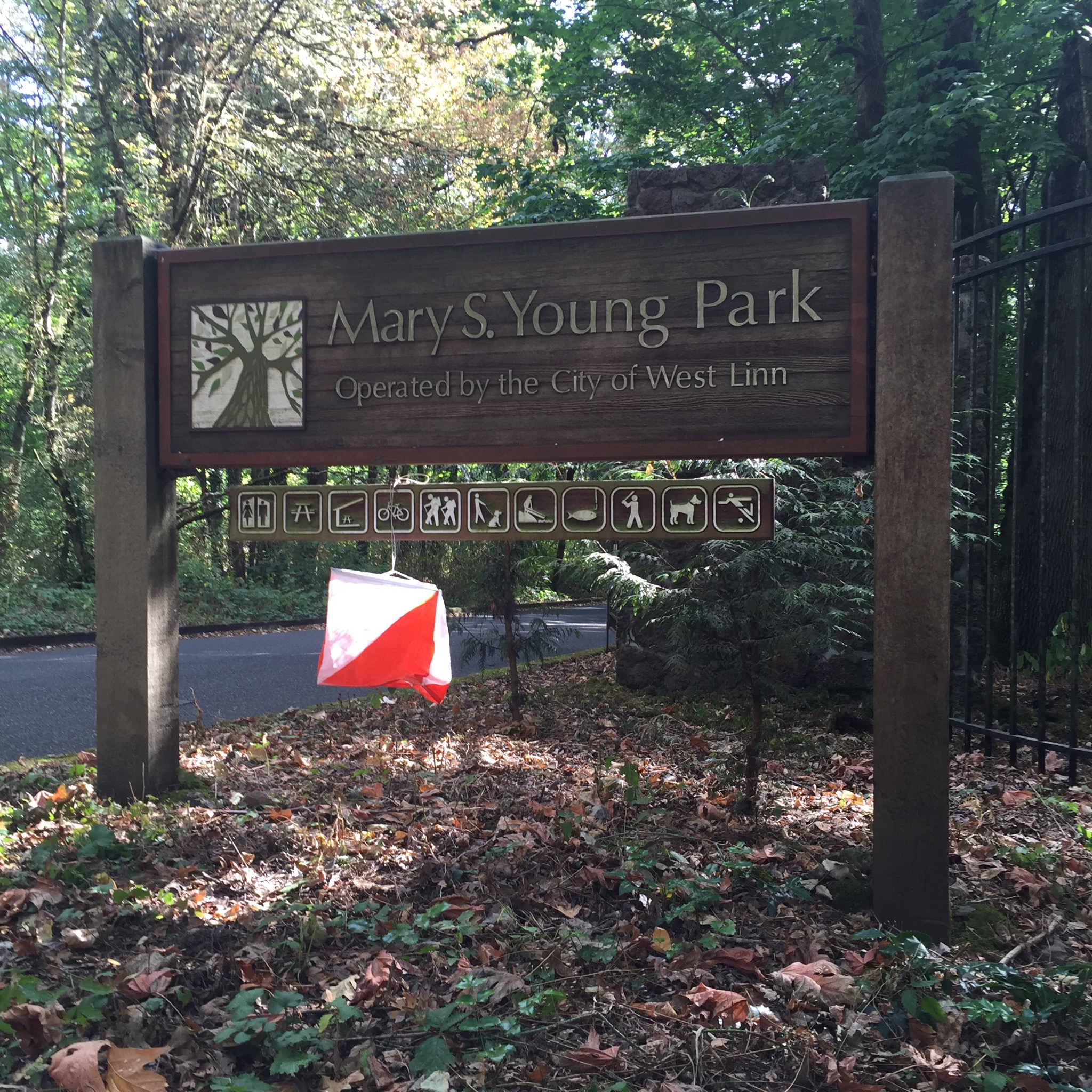
Event overview
If you don't live nearby, Mary S. Young Park is probably the most scenic park you never heard of. The western part of the park features a network of trails winding through a cool shady forest. Near the parking areas, a couple of large open fields offer contour detail, trees, bushes, and other features. The eastern part of the park plunges to the Willamette River on trails that negotiate a dramatically eroded landscape. The river's edge has rock formations, sandy beaches, and islands. All courses will use the trail system; so bring your running shoes. Well, for the longer courses, bring older running shoes.
Times
- Registration 10:30 am - 12:45 pm
- Instruction Clinics 11:00 am - 1:00 pm as needed
- Course starts 11:00 am - 1:00 pm
- Courses close 3:00 pm
All teams must check out through the course finish gate before leaving the park, even if the team does not finish the course or returns after the course closes.
Courses
- White: Beginner (about 2 Km, 8-10 controls, easy, on-trail and near-trail navigation)
- Yellow: Beginner / Intermediate (about 3 Km, 10-12 controls, on-trail and near-trail navigation)
- Orange: Intermediate (about 3.5 Km, elevation gain, 10-12 controls, some off-trail, mostly on-trail navigation)
- Green: Advanced (about 5 Km, 15+ controls, elevation gain, mostly on trail with some off-trail navigation)
Electronic punching (E-punch) will be used on all courses. Rental fee is $1.
Maps
See a map of a previous event here.
Volunteers
All CROC orienteering events are put on by volunteers, and the meet director can almost always used some extra hands. Please keep in mind:
- No prior experience is needed for many of the tasks
- You can help out AND still run your course of choice
- Your entry fee is FREE if you help out with a meet!
Typical ways to assist are: helping with starts and finishes, checking in folks at registration, and picking up control flags after the course closes.
Please contact the meet director at the email address on the bottom of this page if you'd like to volunteer at this event. For more details, see the Volunteer pages.
Results
Results are posted to the Events & Results web page a few days after the event.
Registration and other costs
The event is open to the public. Note: If you join CROC at this event, ($15 individual, $20 family/group annual membership), your event fee is FREE! Ask about this at meet registration. All participants must register and sign the liability waiver before entering the course. Each participant or team receives a course map and a control description sheet.
The Columbia River Orienteering Club event fees are:
- $8 - individual (non-member)
- $12 - group (non-member, going out using one map)
- $6 - individual (club member)
- $10 - group (club member, going out using one map)
- $1 - extra copy of color map
- $1 - compass rental
- $1 - epunch rental
Contact
Meet director: Anndy Wiselogle
Map and Directions
From Portland City Center:
- Get on Macadam South, which runs along the Willamette River on the west bank. (This road is OR 43)
- Proceed South on OR 43 to Lake Oswego, about 6 miles.
- From Lake Oswego, continue south on OR 43 about 2.8 miles to the park.
- Follow the orienteering signs to the main loop parking lot at the east end of the park.

Catherine Creek
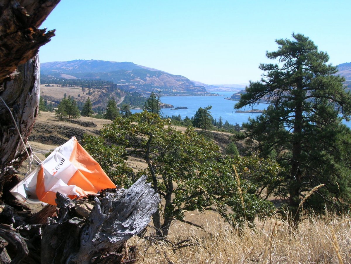
Event overview
Catherine Creek, located in the sunny eastern end of the Columbia River Gorge near Hood River, offers superb orienteering terrain. Along with some ankle twisting rocks and enthusiastic patches of poison oak, you can experience lots of micro terrain features, steep hills, depressions, sparse oak woodlands, and an ability to travel in almost any direction.
Times
Maps will be handed out from 10am until noon. Persons participating will start as they are ready.
Clinics
As with all CROC meets, beginners are welcome. Beginner clinics will be offered as needed.
Registration and other costs
The event is is free and open to the public.
Everyone needs to check in and out at the start and finish for safety reasons.
Course Setter's Notes
Clothing:
Poison oak is present at Catherine Creek. Stream areas may have patches of poison oak which is also found around many trees. We will place controls in places where they are not directly in contact with poison oak. It is best to wear long pants to prevent allergic reactions.
Water: We will have a water stop at a distant control on the longest course, as we anticipate the weather will be hot.
Toilets: The Forest Service sometimes puts a port-a-potty at Catherine Creek during the summer. Best to bring your own TP in case they have run out. Stop in Bingen, WA for a bathroom stop just in case.
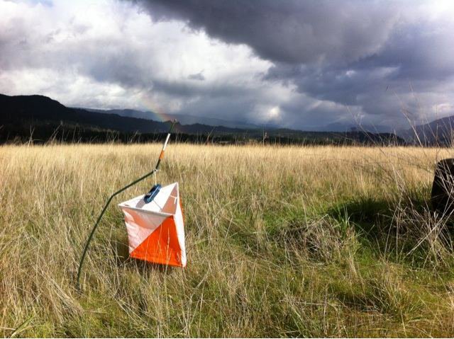
Controls:
Controls will be orange and white orienteering bags with a punch to mark your card.
Beginner Training Short Course: (1.2km) This course will use the developed path area S. of the highway. Map is 1:5,000 with 5m contours. The paved trails pass through an area of rough open land with patches of trees and in the lower section though two areas of thicker forest (there is some poison oak in large bush clumps). Details: Straight line distance is 1.5 km. Altitude gain is 30 meters. There are a total of 7 controls with the longest leg between controls being about 250m and the shortest leg about 75m.
Beginner Longer Course: (2.2km) This course continues beyond the above course for another 1.km following some of the clear, but less developed trails north of the road. Controls are on features designed to give participants a good sample of the basic orienteering symbols and placement of the controls. Total straight line distance is: 2.5 km Altitude gain is 65 meters and there are a total of 12 controls with the longest leg being about 250m and the shortest 75m.
Intermediate/Advanced Training Courses:
These courses will cover the rough open land N. of the Highway, on both sides of Catherine Creek. This is an area with patches of open trees, broken ground and a number of low cliffs. The controls are such that in some cases you will have to choose your trail to go around the cliffs. The large cliffs are impassable and are off limits! There are trails on the maps showing definite game trails that will take you safely through gaps in the cliff areas. Maps are: 1: 10,000 scale with 5m contours. There will be 3 course choices:
• Short Course (Yellow to Orange): About 3.4km, altitude change about 130m, with 12 controls, longest leg about 300m. One water stop is shown on the map.
• Medium Course (Green): About 4.4km, altitude change about 130m, with 15 controls, longest leg about 400m. One water stop is shown on the map.
• Long Course (Red): About 6 km, altitude change about 120m, with 17 controls, longest leg about 400m. One water stop is shown on the map.
Punch Cards: Although this is not an officially timed event, we will place your start time on the punch cards to post informal times for those who wish. Times will be posted on the CROC website.
Post event camping and BBQ potluck
Meet directors Jill and Rick McBee will generously open their home and property to host a Saturday night camp out and barbecue potluck. Please give them an RSVP at the email below if you would like to attend.
Sunday Hood River street Score-O
On Sunday, maps of the Hood River Score-O will be available for a “see Hood River” on your own tour. We will have an informal urban score-O on the hilly streets of Hood River.
Contact:
Meet directors: Jill and Rick McBee
Map and Directions
- Catherine Creek is located 7 miles east of Hood River on the Washington side of the Columbia River, just off Highway 14.
- Take Interstate 84 from Portland to Exit 64 at the town of Hood River.
- Once off the exit, turn left under the freeway and cross the toll bridge (75 cents toll each way).
- On the Washington side of the Columbia River, turn East (that will be to the right) onto highway 14 and follow the road straight through the next small town, which is Bingen.
- Continue on east along Highway 14 for about 5.8 miles and you will see a sign that says “Old Highway 8”. Turn left at this sign and follow the road as it winds past a small lake and then goes upwards along the cliffs above Highway 14.
- In about 1.4 miles you will come to a parking area on the left hand side of the road. The orienteering tent will be there and should be obvious.

Willamette Mission State Park
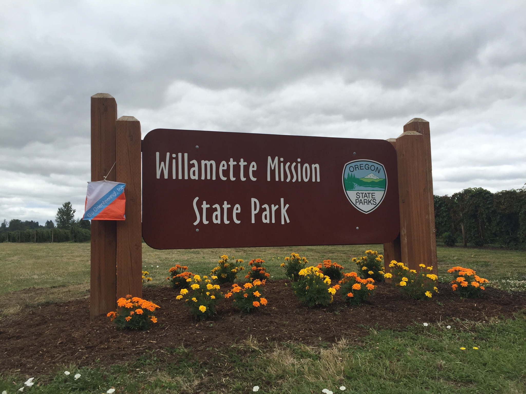
Event overview
Willamette Mission Park is a 1,680-acre state park with many miles of running trails winding along the Willamette River, backwater sloughs, and agricultural fields. The park is very accessible, yet large enough to give participants a feeling of "getting out there." There is a nice mix of paved paths, open farm fields, and wooded "thickets" to explore. The terrain is flat and looks open, but most of the orienteering route choices will include trails due to blackberry thickets or other dense vegetation or cultivated land which may or may not be planted. The advanced course will be designed with the challenge of multiple route choices for most legs, and will be a little longer than typical due to the flat terrain.
Times
- Registration 10:30 am - 12:45 pm
- Instruction Clinics 10:45 am - 12:00 noon as needed
- Course starts for individuals and teams anytime between 11:00 am - 1:00 pm
- All courses close 3:00 pm
All teams must check out through the course finish before leaving the park, even if the team does not finish the course or returns after the course closes.
Courses
- White: Beginner (about 2 Km, 8-10 controls, easy, on-trail and near-trail navigation)
- Yellow: Beginner / Intermediate (about 3 Km, 10-12 controls, easy, on-trail and near-trail navigation)
- Orange: Intermediate (about 4 Km, 12-14 controls, some off-trail, mostly on-trail navigation)
- Green: Advanced (about 5 to 6 Km, 15-20 controls, mostly off trail navigation)
Each participant or team receives a course map and a control description sheet.
Orienteering map from previous event
Volunteers
All CROC orienteering events are put on by volunteers, and the meet director can almost always used some extra hands. Please keep in mind:
- No prior experience is needed for many of the tasks
- You can help out AND still run your course of choice
- Your entry fee is FREE if you help out with a meet!
Typical ways to assist are: helping with starts and finishes, checking in folks at registration, and picking up control flags after the course closes.
Please contact the meet director at the email address on the bottom of this page if you'd like to volunteer at this event. For more details, see the Volunteer pages.
Results
Results are posted to the Events & Results web page a few days after the event.
Registration and other costs
The event is open to the public. Note: If you join CROC at this event, ($15 individual, $20 family/group annual membership), your event fee is FREE! Ask about this at meet registration. All participants must register and sign the liability waiver before entering the course. Each participant or team receives a course map and a control description sheet.
The Columbia River Orienteering Club event fees are:
- $8 - individual (non-member)
- $12 - group (non-member, going out using one map)
- $6 - individual (club member)
- $10 - group (club member, going out using one map)
- $1 - extra copy of color map
- $1 - compass rental
- $1 - epunch rental
These fees do not include any extra daily use fee charged by the park. You must pay these separately. Oregon State parks charges $5 for day use, $30 for a 12 month pass and $50 for a 24 month pass.
Contact
Meet director: Ken and Debbie Wenzel
skiwenzel@hotmail.com
Home Phone 503-297-2958
Ken’s cell 503-729-6571
Debbie’s cell 503-422-1524
Map and Directions
Latitude 45.081032 North
Longitude 123.046056 West
From I-5 Freeway south of Portland, between Woodburn and Salem:
Take Exit 263 Brooklake Road (sign to Silverton, Gervais, and a large Pilot brand gasoline station and truck stop on the west side of the freeway). Go west on Brooklake Road 0.7 mile to the stop light at River Road.
Continue west on Brooklake Road for an additional 1.1 miles to the T junction with Wheatland Ferry Road.
Turn right (north) on Wheatland Road for 2.4 miles to the main gate entrance to Willamette Mission State Park.
Turn left (west) into the park, staying on the straight-ahead main road for 1.6 miles to the side road to the "Walnut Grove" labeled as Mission Lake A and B areas (if you miss the junction and go to the end of the road you are in the "Filbert Grove" parking area.)

Lacamas Park
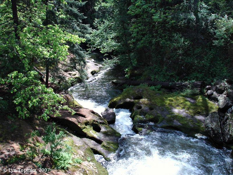
Event overview
Lacamas Park is a large wooded area near Camas, WA. It features a small area of dense trails, a beautiful series of waterfalls, cascades and potholes, and a larger network of fire roads and trails through fairly dense forest.
Times
- Registration 10:30 am - 12:45 pm
- Instruction Clinics 10:45 am - 12:00 noon as needed
- Course starts for individuals and teams anytime between 11:00 am - 1:00 pm
- All courses close 3:00 pm
All teams must check out through the course finish before leaving the park, even if the team does not finish the course or returns after the course closes.
Courses
- Beginner (about 2 Km, 8-10 controls, easy, on-trail and near-trail navigation)
- Adv. Beginner (about 3 Km, 10-12 controls, easy, on-trail and near-trail navigation)
- Intermediate (about 4 Km, 12-14 controls, some off-trail, mostly on-trail navigation)
- Advanced (about 5 to 6 Km, mostly off trail navigation)
Each participant or team receives a course map and a control description sheet.
Volunteers
All CROC orienteering events are put on by volunteers, and the meet director can almost always used some extra hands. Please keep in mind:
- No prior experience is needed for many of the tasks
- You can help out AND still run your course of choice
- Your entry fee is FREE if you help out with a meet!
Typical ways to assist are: helping with starts and finishes, checking in folks at registration, and picking up control flags after the course closes.
Please contact the meet director at the email address on the bottom of this page if you'd like to volunteer at this event. For more details, see the "Get Involved" pages.
Results
Results are posted to the “Events & Results” page a few days after the event.
Registration and other costs
The event is open to the public. Note: If you join CROC at this event, ($15 individual, $20 family/group annual membership), your event fee is FREE! Ask about this at meet registration. All participants must register and sign the liability waiver before entering the course. Each participant or team receives a course map and a control description sheet.
The Columbia River Orienteering Club event fees are:
- $8 - individual (non-member)
- $12 - group (non-member, going out using one map)
- $6 - individual (club member)
- $10 - group (club member, going out using one map)
- $1 - extra copy of color map
- $1 - compass rental
- $1 - epunch rental
Contact
Meet director: Glen Cafferty glen.cafferty@comcast.net
Map and Directions
- From I-5 north in Vancouver WA take exit 1A to merge onto WA-14 E toward Camas
- After 12 miles, take exit 12 for WA-14 toward Camas/Business Loop
- Take a slight right at NW 6th Ave
- After 1.3 miles turn left at NE Garfield St
- Take a left at NE 14th Ave
- Take the second right onto WA-500 W/NE Everett St
- Park is on the right 1 mile ahead

Champoeg State Park

Event overview
Spring time at Champoeg! Along the banks of the Willamette River, this large park has mostly open terrain, runnable oak forest, and a short section of dense trails. There will be four courses from Beginner to Advanced. Instructors will give short instruction clinics for newcomers between 10:45 a.m. and noon. Individuals and teams may start a course any time between 11:00 a.m. and 1:00 p.m.
Times
- Registration 10:30 am - 12:45 pm
- Instruction Clinics 10:45 am - 12:00 noon as needed
- Course starts for individuals and teams anytime between 11:00 am - 1:00 pm
- All courses close 3:00 pm
All teams must check out through the course finish before leaving the park, even if the team does not finish the course or returns after the course closes.
Courses
- White: Beginner (about 2 Km, 8-10 controls, easy, on-trail and near-trail navigation)
- Yellow: Beginner / Intermediate (about 3 Km, 10-12 controls, easy, on-trail and near-trail navigation)
- Orange: Intermediate (about 4 Km, 12-14 controls, some off-trail, mostly on-trail navigation)
- Green: Advanced (about 5 to 6 Km, mostly off trail navigation)
Orienteering map from previous event
See a map of this location here. Opens Google Drive in a new browser tab
Volunteers
All CROC orienteering events are put on by volunteers, and the meet director can almost always used some extra hands. Please keep in mind:
- No prior experience is needed for many of the tasks
- You can help out AND still run your course of choice
- Your entry fee is FREE if you help out with a meet!
Typical ways to assist are: helping with starts and finishes, checking in folks at registration, and picking up control flags after the course closes.
Please contact the meet director at the email address on the bottom of this page if you'd like to volunteer at this event. For more details, see the "Get Involved" pages.
Results
Results are posted to the “Events & Results” page a few days after the event.
Registration and other costs
The event is open to the public. Note: If you join CROC at this event, ($15 individual, $20 family/group annual membership), your event fee is FREE! Ask about this at meet registration. All participants must register and sign the liability waiver before entering the course. Each participant or team receives a course map and a control description sheet.
The Columbia River Orienteering Club event fees are:
- $8 - individual (non-member)
- $12 - group (non-member, going out using one map)
- $6 - individual (club member)
- $10 - group (club member, going out using one map)
- $1 - extra copy of color map
- $1 - compass rental
- $1 - epunch rental
These fees do not include any extra daily use fee charged by the park. You must pay these separately. Oregon State parks charges $5 for day use, $30 for a 12 month pass and $50 for a 24 month pass.
Each participant or team receives a course map and a control description sheet.
Contact
Meet director: Michael Hanson lmhanson4@frontier.com
Map and Directions
- From Interstate 5, take the Donald exit (Exit 278).
- Follow the signs to Champoeg Park: Drive west on Ehlen Road. Go about 3.6 miles.
- Turn right on Case Road. Go about 1.4 miles.
- Turn left on Champoeg Road. Go about 0.9 miles.
- Turn right into the park at the entrance. Follow the orienteering signs to the event start area.
NOTE: There is a self-registration station at the park entrance where you can pay the per-vehicle daily use fee. ($5)

Mt. Tabor

Event overview
Happy spring! It must be time for CROC’s annual FREE orienteering event at Mt. Tabor Park in southeast Portland. We have an event here every year, and it is one of our most popular venues. Mt. Tabor offers hills, water bodies, great urban views and the popular volcano site. Courses will provide fun and challenge for all levels, beginner through advanced.
Note that CROC also has two permanent orienteering courses at Mt. Tabor, if you would like to try this terrain on your own at any time. (Of course, the permanent course control points are different). See the CROC website under "Training" for more details on these permanent courses.
Note: Even if you know the park, please see the map below for the event registration, start and finish location. The easiest access to the event is to enter the park at the NE corner, off of SE 69th and Belmont. The event start is at Picnic Area "B", in the NE corner of the park, near the east tennis courts and playground.

Times
- Registration 10:30 am - 12:45 pm
- Instruction Clinics 10:45 am - 12:00 noon as needed
- Course starts for individuals and teams anytime between 11:00 am - 1:00 pm
- All courses close 3:00 pm
All teams must check out through the course finish before leaving the park, even if the team does not finish the course or returns after the course closes.
Courses
- White: Beginner (about 2 Km, 8-10 controls, easy, on-trail and near-trail navigation)
- Score-O: This course is being offered in place of our traditional advanced beginner (yellow), intermediate (orange), and advanced (green) courses. Unlike regular courses Score-O allows participants to design their own course to see how many controls they can reach, in any order, within a certain time limit, usually 60 and/or 90 minutes.
Orienteering map from previous event
See an orienteering map of this location here. Opens Google Drive in a new browser tab
Volunteers
All CROC orienteering events are put on by volunteers, and the meet director can almost always used some extra hands. Please keep in mind:
- No prior experience is needed for many of the tasks
- You can help out AND still run your course of choice
- Your entry fee is FREE if you help out with a meet!
Typical ways to assist are: helping with starts and finishes, checking in folks at registration, and picking up control flags after the course closes.
Please contact the meet director at the email address on the bottom of this page if you'd like to volunteer at this event. For more details, see the "About" pages
Results
Results are posted to the Results and Events web page a few days after the event.
Registration and other costs
- The event is FREE and open to the public.
- Beginners are welcome at this and all CROC events. Beginner orienteering clinics are taught as needed.
- All participants must register and sign the liability waiver before entering the course.
Each participant or team receives a course map and a control description sheet.
Contact
Meet director: David Rogers and Julie Pohl dnr2jcp at gmail.com