Member training: Compass use for Orienteering
May
4
10:00 AM10:00

Member training: Compass use for Orienteering

  • Compass Use for Orienteering

  • Saturday, May 4, 2024 10:00 a.m. - noon

  • Pier Park in North Portland

  • For CROC members only

    Learn and practice orienting the map, using bearings to locate controls, and judging distance to know where you are on the map. This two-hour workshop is useful for new members and everyone who wants to hone their compass skills. As with other trainings, this is open to CROC members only, and there is no additional fee.

    Bring your compass, or borrow one at the training.

    Register online here before May 2. For questions, email trainer Anndy Wiselogle.

View Event →
Hamilton Island
May
19
10:30 AM10:30

Hamilton Island


ADVANCE ONLINE REGISTRATION IS REQUIRED FOR THIS EVENT.

  • Makes things fast and easy for YOU on event day (no paperwork or payment)

  • Simplifies processing the results

  • Helps meet directors know how many maps to print

  • See who’s attending, maybe plan a carpool


QUICK INFO

  • Online pre-registration required, no event day registration

  • Registration deadline: Friday, May 17, 11:00pm

  • Location: Hamilton Island near Cascade Locks in the Columbia River Gorge - map

  • Courses: Four different courses for all skill levels. Classic point-to-point orienteering format

  • Start: Anytime between 11:00 am and 1:00 pm

  • Event Director: Ken and Debbie Wenzel


EVENT OVERVIEW

Hamilton Island was initially "discovered" for Americans by Lewis and Clark in 1805, and they named it Strawberry Island. That name was eventually changed to Hamilton Island in honor of a Samuel M. Hamilton, a nearby land owner in the mid 1800s. The island stopped being a real island in the 1970s when construction debris for the Bonneville North Power house filled in one of the surrounding waterways.

The terrain is mostly wide open in all directions with scattered copses. There is one large low hill to go around or climb multiple times. There are marshy areas, some thickets, and shorelines. You can enjoy beautiful river gorge views and lots of wildlife.

You may encounter blackberry vines and thistles. Lower leg protection / gaiters are recommended on the more advanced courses.

We use an electronic scoring and timing system known as “e-punch”. Each entry or team needs to have an e-punch stick. If you don't have your own e-punch stick, the rental cost is included in your registration fee. Using e-punch is easy. You can learn how at the event, or read about e-punch here.

CROC thanks our land management partner the US Army Corps of Engineers.


START WINDOWS

For this event we’re using assigned 30 minute start windows between 11 am and 1 pm. This spreads participants over the entire two hour start window instead of a big rush at the beginning, easing the workload on event volunteers.

Please choose your start window during registration. The earlier you register, the better chance you have of a preferred window. If you arrive early for your start window, you may be asked to wait. If you're late, no worries, we’ll allow you to start when we have an opening. It's a guideline, not a firm rule.


NEW TO ORIENTEERING? WELCOME!

Our events are open to both members and non-members, and beginners are welcome.

  • Have a look at our “New to O?” webpage, which covers just about every question you may have.

  • At most events, we offer free beginner clinics (they take about 10 minutes) to teach you everything you need to know. These are typically at half-hour intervals; choose your time slot on the registration page.

  • If you'd like to get reminders about upcoming events, sign up at our newsletter page. (No more than a couple of emails per month, we promise!)

  • Thanks for coming out and trying something new, we think you'll like it!


TIMES

  • Check in and map handout: opens at 10:30 am

  • Beginner clinics: 11:00 am and 11:30 am

  • Course starts: anytime between 11:00 am - 1 pm

  • All courses close: 3:00 pm

    (All teams must check out through the course finish area before leaving, even if the team does not finish the course or returns after the course closes.)


Courses

  • White (beginners and kids) about 2 km, navigationally easy, all on trails

  • Yellow (novice): about 3 km, navigationally easy, mostly trails, with simple route choices

  • Orange (intermediate) about 4 km, navigationally more difficult with route choices

  • Green (advanced): about 6 km, (off trail navigation) most elevation gain with more challenging route choices. Leg protection is recommended.


VOLUNTEERS

All CROC events are put on by volunteers, and the meet director can almost always use some extra hands. Please keep in mind:

  • No prior experience is needed for many of the tasks

  • You can help out AND still run your course of choice

Typical ways to assist are:  helping with starts and finishes, handing out maps, and picking up control flags after the course closes. Typical shifts are one hour.
If you'd like to help, you can choose a task and time shift when you register online. Thanks!


REGISTRATION AND OTHER COSTS

Advance online registration is required. There is no event day registration.

Application deadline: Friday, May 17, 11:00pm

Refund policy: full refund if requested more than 48 hours before the start time of the event. Email us to request a refund and we’ll work it out.

Event Cost

  • $17 base price - individuals

  • $22 base price, teams of 2 or more

    - Subtract $5 if you’re a member or CROC or other O-club (Join CROC)

    - Subtract $5 if you have your own e-punch (Buy your own epunch)


LIVELOX: GPS TRACKING AND ROUTE REVIEWING TOOL

CROC uses Livelox, which is an interactive web based tool that enables you to see your exact route/track on the orienteering map, and compare them with other competitors.

By seeing the routes other people took, where you went, and where things went good or bad for you, you can learn and become a better orienteer.

To use this tool, you need to record a GPX track while you are on the course. This can be done with many phone apps and GPS watches. After the event, you can log into your free account, upload your track, and review your course.

See a link to the Livelox tracks from the Results page.

Questions? Email John Crowther 


Results

Results are posted to the Events & Results web page a few days after the event.


Driving directions and map to event

Latitude longitude coordinates of event: 45.6337, -121.9788

Click for a Google map, or copy/paste these latitude longitude coordinates into Google maps or your smartphone mapping app to get a map and driving directions to the event.

Note:

  • There will NOT be a CROC sign on Hwy 14, as the locals like to (ahem) remove them. 

  • We will be at the baseball field in Cascade Locks, NOT at the parking lot near the river as in the past few years. See directions and map below.

Driving directions from Portland (allow about 1 hour):

  1. Drive east on I 84, take Exit 44 at Cascade Locks.

  2. Cross the Bridge of the Gods into Washington (Toll $2).

  3. Turn left (west) onto Hwy 14 and go approx. 4 miles.

  4. Turn left at the Chevron station in the town of North Bonneville.

  5.  In 200 feet, take a right onto Cascade Dr. Follow the blue signs to the ball field.  In 0.4 miles, take a left onto Portage Drive.  Go to the end of Portage Drive.

View Event →
CROC Board Meeting
Jun
3
7:00 PM19:00

CROC Board Meeting

CROC holds quarterly board meetings. All members may attend.

Meeting dates are generally scheduled for: first Monday of December, March and June, and the second Monday of September, from 7:00 pm to 9:00 pm.

The meeting location may vary. Meetings may be online or in-person.

Please go to About > Contact and email us to find out where the next meeting will be, and to confirm the actual date.

View Event →
Willamette Mission State Park
Jun
8
10:30 AM10:30

Willamette Mission State Park


Online registration link coming here May 18


Advance online registration is required for this event.

  • Makes things fast and easy for YOU on event day (no paperwork or payment)

  • Simplifies processing the results

  • Helps meet directors know how many maps to print

  • See who’s attending, maybe plan a carpool


Quick info

  • Advance online registration required, deadline Thursday, June 6, 11:00pm

  • Courses: Four different courses for all skill levels. Classic point-to-point orienteering format

  • TImes: Map handout opens at 10:30. Start your course anytime between 11:00 am and 1:00 pm

  • Everyone welcome, members and nonmembers

  • Event director: TBA


Event Overview

On the banks of the Willamette River, Willamette Mission is large and mostly flat. There is a mix of runnable open fields and trails through dense forest. Due to enthusiastic stinging nettles in some areas of the park, wearing long pants or running tights is highly recommended on the intermediate and advanced courses.

We use an electronic scoring and timing system known as “e-punch”. Each entry or team needs to have an e-punch stick. If you don't have your own e-punch stick, the rental cost is included in your registration fee. Using e-punch is easy. You can learn how at the event, or read about e-punch here.

CROC thanks our land management partner Oregon State Parks.


NEW TO ORIENTEERING? WELCOME!

Our events are open to both members and non-members. Beginners, families and dogs are welcome.

  • Have a look at our “New to O?” webpage, which covers just about every question you may have.

  • At most events, we offer free beginner clinics (they take about 10 minutes) to teach you everything you need to know. These are typically at half-hour intervals; choose your time slot on the registration page.

  • If you'd like to get reminders about upcoming events, sign up at our newsletter page. (No more than a couple of emails per month, we promise!)

  • Thanks for coming out and trying something new, we think you'll like it!


START WINDOWS

For this event we’re using assigned 30 minute start windows between 11 AM and 1 PM. This spreads participants over the entire two hour start window instead of a big rush at the beginning, encourages social distancing. and eases the workload on event volunteers.

Please choose your start window during registration. The earlier you register, the better chance you have of a preferred window. If you arrive early for your start window, you may be asked to wait. If you're late, no worries, we’ll allow you to start when we have an opening. It's a guideline, not a firm rule.


TIMES

  • 10:00-11:00 a.m.  Intermediate Workshop: Compass Use and Distance Determination; for CROC members only, no fee

  • Beginner clinics: 11:00 am, 11:30 am and 12:00 pm. Choose your preferred time when you register.

  • Course starts: anytime between 11:00 am and 1:00 pm

  • All courses close: 3:00 pm (controls will be picked up)

(All teams must check out through the course finish area before leaving, even if the team does not finish the course or returns after the course closes.)


Courses

  • White:  Beginner (about 3 km, on-trail and near-trail navigation)

  • Yellow:  Beginner / Intermediate (about 4 km, on-trail and near-trail navigation)

  • Orange:  Intermediate (about 6 km, off-trail and on-trail navigation)

  • Green:  Advanced (about 9 km, some trail, mostly off-trail navigation)


REGISTRATION AND OTHER COSTS

Park Fee: Oregon State Parks charges $5 for day use, $30 for a 12 month pass and $50 for a 24 month pass. The day pass fee may be paid at the entrance station before you enter the park.

Event Cost

  • $17 base price - individuals

  • $22 base price - groups of 2 or more

    - Subtract $5 if you’re a member or CROC or other O-club (Join CROC)

    - Subtract $5 if you have your own e-punch (Buy your own epunch)

Online registration link coming here May 18


LIVELOX: GPS TRACKING AND ROUTE REVIEWING TOOL

CROC uses Livelox, which is an interactive web based tool that enables you to see your exact route/track on the orienteering map, and compare them with other competitors.

By seeing the routes other people took, where you went, and where things went good or bad for you, you can learn and become a better orienteer.

To use this tool, you need to record a GPX track while you are on the course. This can be done with many phone apps and GPS watches. After the event, you can log into your free account, upload your track, and review your course.

See a link to the Livelox tracks from the Results page.

Questions? Email John Crowther 


The event date is subject to change! When it's confirmed, we will remove this notice.


VOLUNTEERS

All CROC events are put on by volunteers, and the meet director can almost always use some extra hands. Please keep in mind:

  • No prior experience is needed for many of the tasks

  • You can help out AND still run your course of choice

Typical ways to assist are:  helping with starts and finishes, handing out maps, and picking up control flags after the course closes. Typical shifts are one hour.
If you'd like to help, you can choose a task and time shift when you register online. Thanks!


Results

Results are posted to the Events & Results web page a day or two after the event.


Driving directions and location

Latitude longitude coordinates of the event:

45.0797, -123.0306

Click these coordinates for a Google map link, or copy/paste these coordinates into Google maps or your smartphone mapping app to get a map and driving directions to the event.

Driving directions from Portland:

  • From Portland city center, take I-5 south about 35 miles. Take exit 263, and head west.

  • Go west about 4 miles then take a right on Wheatland Road.

  • Go north on Wheatland Road about 4 miles, and turn left turn into the park.

View Event →
Milo McIver State Park
Jul
13
11:00 AM11:00

Milo McIver State Park


Online registration link coming here June 22


ADVANCE ONLINE REGISTRATION IS REQUIRED FOR THIS EVENT.

  • Makes things fast and easy for YOU on event day (no paperwork or payment)

  • Simplifies processing the results

  • Helps meet directors know how many maps to print

  • See who’s attending, maybe plan a carpool


Quick info

  • Application deadline: Thursday, July 11, 11:00pm

  • Courses: Four different courses for all skill levels. Classic point-to-point orienteering format

  • Times: Map handout opens at 10:30. Start your course anytime between 11:00 am and 1:00 pm.

  • Everyone welcome, members and nonmembers

  • Event director: TBA


EVENT OVERVIEW

Come out and enjoy orienteering on the varied terrain of this large riverside park. McIver State Park is a 1,600+-acre park with many miles of trails winding along the Clackamas River, near Estacada, OR. The park is very accessible, yet large enough to give participants a feeling of "getting out there." There is a nice mix of paved paths, open fields, and wooded areas. The terrain is both flat and hilly. 

We use an electronic scoring and timing system known as “e-punch” Each entry or team needs to have an e-punch stick. If you don't have your own e-punch stick, you can rent one at registration for an additional $5. Using the e-punch is easy. You can learn how at the event, or read about e-punch here.

CROC thanks our land management partner Oregon State Parks.


NEW TO ORIENTEERING? WELCOME!

Our events are open to both members and non-members. Beginners, families and dogs are welcome.

  • Have a look at our “New to O?” webpage, which covers just about every question you may have.

  • At most events, we offer free beginner clinics (they take about 10 minutes) to teach you everything you need to know. These are typically at half-hour intervals; choose your time slot on the registration page.

  • If you'd like to get reminders about upcoming events, sign up at our newsletter page. (No more than a couple of emails per month, we promise!)

  • Thanks for coming out and trying something new, we think you'll like it!


COURSES

  • White: Beginner (about 2 km, 8-10 controls, easy, on-trail and near-trail navigation)

  • Yellow: Beginner/ Intermediate (about 3 km, 10-12 controls, easy, on-trail and near-trail navigation)

  • Orange: Intermediate (about 4 km, 12-14 controls, some off-trail, mostly on-trail navigation)

  • Green: Advanced (about 5 km, 14-16 controls, mostly off-trail navigation)


START WINDOWS

For this event we’re using assigned 30 minute start windows between 11 am and 1 pm. This spreads participants over the entire two hour start window instead of a big rush at the beginning, easing the workload on event volunteers.

Please choose your start window during registration. The earlier you register, the better chance you have of a preferred window. If you arrive early for your start window, you may be asked to wait. If you're late, no worries, we’ll allow you to start when we have an opening. It's a guideline, not a firm rule.


TIMES

  • Check-in and map pick-up 9:45 AM - 12:45 PM

  • Course starts 10:00 am - 1:00 pm

  • Courses close 2:30 pm

  • Choose a start time here if you have not done so while registering

All teams must check out through the course finish gate before leaving the park, even if the team does not finish the course or returns after the course closes.


Registration and other costs 

Park Fee: Oregon State Parks charges $5 for day use, $30 for a 12 month pass and $50 for a 24 month pass. The day pass fee may be paid at the entrance station before you enter the park.

Refund policy: full refund if requested more than 48 hours before the start time of the event. Email us to request a refund and we’ll work it out.

Event Cost

  • $17 base price - individuals

  • $22 base price - groups of 2 or more

    - Subtract $5 for membership in CROC or other O-club Become a CROC member

    - Subtract $5 if you have your own epunch Buy your own epunch


Online registration link coming here June 22


 VOLUNTEERS

All CROC orienteering events are put on by volunteers, and the meet director can almost always used some extra helpers. Please keep in mind:

  • No prior experience is needed for many of the tasks

  • You can help out AND still run your course of choice

Typical ways to assist are: helping with starts and finishes, checking in folks at registration, and picking up control flags after the course closes.
Please contact the event director at the email on the top of this page if you'd like to volunteer at this event. For more details, see the Get Involved pages.


RESULTS

Times will be posted to the Events & Results page a few days after the event.


Map and Directions to Event

Latitude longitude coordinates of event:  45.2994, -122.3837

Copy and paste these latitude longitude coordinates (in decimal degree format) into Google maps or your smart phone to get a map and driving directions to the event.

  1. From Portland City Center, go to Clackamas on I-205.

  2. Take Hwy 224 east to Estacada.

  3. At the east end of town, take a right onto Hwy 221, Woodburn-Estacada Hwy. (This will be a bridge over the Clackamas River.)

  4. In 1 mile, turn right onto S Hayden Road.

  5. In 1.2 miles, turn right onto S Springwater Road.

  6. In 0.7 miles turn right onto S Entrance Road to the park.

View Event →
Champoeg State Park
Aug
3
11:00 AM11:00

Champoeg State Park


Online registration link coming here July 13


Advance online registration is required for this event.

  • Makes things fast and easy for YOU on event day (no paperwork or payment)

  • Simplifies processing the results

  • Helps meet directors know how many maps to print

  • See who’s attending, maybe plan a carpool


Quick info

  • Advance online registration required, deadline Thursday, Aug 1, 11:00pm

  • Courses: Four different courses for all skill levels. Classic point-to-point orienteering format

  • Times: Map handout opens at 10:30. Start your course anytime between 11:00 am and 1:00 pm.

  • Everyone welcome, members and nonmembers

  • Event director: TBA


Event Overview

On the banks of the Willamette River, Champoeg State Park is large and mostly flat. An interesting variety of terrain should make for some fun orienteering! Due to enthusiastic stinging nettles in parts of the course, wearing long pants or running tights is highly recommended on the intermediate and advanced courses.

We use an electronic scoring and timing system known as “e-punch”. Each entry or team needs to have an e-punch stick. If you don't have your own e-punch stick, the rental cost is included in your registration fee. Using e-punch is easy. You can learn how at the event, or read about e-punch here.

CROC thanks our land management partner Oregon State Parks.


NEW TO ORIENTEERING? WELCOME!

Our events are open to both members and non-members. Beginners, families and dogs are welcome.

  • Have a look at our “New to O?” webpage, which covers just about every question you may have.

  • At most events, we offer free beginner clinics (they take about 10 minutes) to teach you everything you need to know. These are typically at half-hour intervals; choose your time slot on the registration page.

  • If you'd like to get reminders about upcoming events, sign up at our newsletter page. (No more than a couple of emails per month, we promise!)

  • Thanks for coming out and trying something new, we think you'll like it!


START WINDOWS

For this event we’re using assigned 30 minute start windows between 11 am and 1 pm. This spreads participants over the entire two hour start window instead of a big rush at the beginning, easing the workload on event volunteers.

Please choose your start window during registration. The earlier you register, the better chance you have of a preferred window. If you arrive early for your start window, you may be asked to wait. If you're late, no worries, we’ll allow you to start when we have an opening. It's a guideline, not a firm rule.


TIMES

  • Beginner clinics: 11:00 am and 11:30 am. Choose your preferred time when you register.

  • Course starts: anytime between 11:00 am and 1:00 pm

  • All courses close: 3:00 pm (controls will be picked up)

(All teams must check out through the course finish area before leaving, even if the team does not finish the course or returns after the course closes.)


Courses

  • White:  Beginner (about 3 km, on-trail and near-trail navigation)

  • Yellow:  Beginner / Intermediate (about 3-4 km, on-trail and near-trail navigation)

  • Orange:  Intermediate (about 4 km, off-trail and on-trail navigation)

  • Green:  Advanced (about 5 km, some trail, mostly off-trail navigation)


REGISTRATION AND OTHER COSTS

Park Fee: Oregon State Parks charges $5 for day use, $30 for a 12 month pass and $50 for a 24 month pass. The day pass fee may be paid at the entrance station before you enter the park.

Event Cost

  • $17 base price - individuals

  • $22 base price - groups of 2 or more

    - Subtract $5 for membership in CROC or other orienteering club

    - Subtract $5 if you have your own e-stick

Become a CROC member   -   Buy your own epunch


Online registration link coming here July 13


VOLUNTEERS

All CROC events are put on by volunteers, and the meet director can almost always use some extra hands. Please keep in mind:

  • No prior experience is needed for many of the tasks

  • You can help out AND still run your course of choice; most tasks take 1 hour or less

Typical ways to assist are:  helping with starts and finishes, handing out maps, and picking up control flags after the course closes. Typical shifts are one hour.
If you'd like to help, you can choose a task and time shift when you register online. Thanks!


Results

Results are posted to the Events & Results web page a day or two after the event.


Driving directions and location

Latitude longitude coordinates of the event: 45.2482, -122.8940

Click these coordinates for a Google map link, or copy/paste these coordinates into Google maps or your smartphone mapping app to get a map and driving directions to the event.

  1. From Interstate 5, take the Donald exit (Exit 278).

  2. Follow the signs to Champoeg Park: Drive west on Ehlen Road. Go about 3.6 miles.

  3. Turn right on Case Road. Go about 1.4 miles.

  4. Turn left on Champoeg Road. Go about 0.9 miles.

  5. Turn right into the park at the entrance. Follow the orienteering signs to the event start area.

View Event →
CROC Board Meeting
Sep
9
7:00 PM19:00

CROC Board Meeting

CROC holds quarterly board meetings. All members may attend.

Meeting dates are generally scheduled for: first Monday of December, March and June, and the second Monday of September, from 7:00 pm to 9:00 pm.

The meeting location may vary. Meetings may be online or in-person.

Please go to About > Contact and email us to find out where the next meeting will be, and to confirm the actual date.

View Event →
CROC Board Meeting
Dec
2
7:00 PM19:00

CROC Board Meeting

CROC holds quarterly board meetings. All members may attend.

Meeting dates are generally scheduled for: first Monday of December, March and June, and the second Monday of September, from 7:00 pm to 9:00 pm.

The meeting location may vary. Meetings may be online or in-person.

Please go to About > Contact and email us to find out where the next meeting will be, and to confirm the actual date.

View Event →

Lacamas Park
Apr
20
11:00 AM11:00

Lacamas Park


Advance online registration is required for this event

  • Makes things fast and easy for YOU on event day (no paperwork or payment)

  • Simplifies processing the results

  • Helps meet directors know how many maps to print

  • See who’s attending, maybe plan a carpool


Quick info

  • Courses: Fice different courses for all skill levels. Classic point-to-point orienteering format.

  • TImes: Map handout opens at 10:30. Start your course anytime between 11:00 am and 1:00 pm

  • Everyone welcome, members and nonmembers

  • Event director: Mike Holliday and Mike Reid


EVENT OVERVIEW

Welcome to the Lacamas Lake Park orientering meet! Lacamas Park is a large wooded area near Camas, WA. The park is hilly, with a complex network of canyons and spurs. Cliffs and rock outcrops are abundant.

There is an extensive trail network. Open rocky areas showcase wildflowers; however most of the vegetation is lush, and trail running skills will come in handy. Route choices for all courses are primarily on trail.

Note that there is poison oak in the park. Long pants and/or gaiters are recommended for the advanced courses.

We use an electronic scoring and timing system known as e-punch. Each entry or team needs to have an e-punch stick. If you don't have your own e-punch stick, the rental cost is included in your registration fee. Using e-punch is easy. You can learn how at the event, or read about e-punch here.

CROC thanks our land management partner Lacamas Park.


NEW TO ORIENTEERING? WELCOME!

  • Our events are open to both members and non-members. Beginners, families and dogs are welcome.

  • Have a look at our “New to O?” webpage, which covers just about every question you may have.

  • At most events, we offer free beginner clinics (they take about 10 minutes) to teach you everything you need to know. These are typically at half-hour intervals; choose your time slot on the registration page.

  • If you'd like to get reminders about upcoming events, sign up at our newsletter page. (No more than a couple of emails per month, we promise!)

  • Thanks for coming out and trying something new, we think you'll like it!


START WINDOWS

For this event we’re using assigned 30 minute start windows between 11 AM and 1 PM. This spreads participants over the entire two hour start window instead of a big rush at the beginning, encourages social distancing. and eases the workload on event volunteers.

Please choose your start window during registration. The earlier you register, the better chance you have of a preferred window. If you arrive early for your start window, you may be asked to wait. If you're late, no worries, we’ll allow you to start when we have an opening. It's a guideline, not a firm rule.


Intermediate Workshop for CROC Members:

Matching Map to Terrain: Map Symbols and Keeping in Touch with the Map

This no-cost workshop for CROC members will train people to understand the map symbols and to navigate through an intermediate course. We’ll work together as a group and do a “walk-about” observing features in the park. We’ll be done by 11:00 am with plenty of time for you to do a course.

See more here, and register for the training here.


TIMES

  • Member training, 10 AM to 11 AM, see above.

  • Beginner clinics: 11:00 am and 11:30 am. Choose your preferred time when you register.

  • Course starts: start windows between 11:00 am and 1:00 pm

  • All courses close: 3:00 pm (controls will be picked up)

(All teams must check out through the course finish area before leaving, even if the team does not finish the course or returns after the course closes.)


COURSES

  • White:  Beginner (about 1.6 km, 12 controls, on-trail and near-trail navigation)

  • Yellow:  Beginner / Intermediate (about 2.3 km, 12 controls, on-trail and near-trail navigation)

  • Orange:  Intermediate (about 3.5 km, 12 controls, 105 m climb)

  • Brown: Short Advanced (about 3.6 km, 11 controls, 75 m climb)

  • Green:  Long Advanced (about 5.1 km, 17 controls, 125 m climb)


Course Setter's Notes (Amy Winston)

The thick vegetation in the park requires course route choices to be primarily on trails. The Park has closed a trail to the lower falls to replace a damaged footbridge. The courses have been designed to avoid the trail closure and still provide plenty of orienteering challenge and fun. There is some climb and some steep slopes on the Orange, Brown and Green courses, but the climb is not excessive. 

Here is the link to the Livelox GPS track visualization tool  https://www.livelox.com/Events/Show/125100/CROC-Lacamas-April-2024 for Lacamas. It will go live at 4:00 PM on the event day. Everyone who can record a GPS track on their personal device is encouraged to upload their track (see below for more information).


REGISTRATION AND OTHER COSTS

Event Cost

  • $17 base price - individuals

  • $22 base price - groups of 2 or more

    - Subtract $5 if you’re a member or CROC or other O-club (Join CROC)

    - Subtract $5 if you have your own e-punch (Buy your own epunch)


LIVELOX: GPS TRACKING AND ROUTE REVIEWING TOOL

CROC uses Livelox, which is an interactive web based tool that enables you to see your exact route/track on the orienteering map, and compare them with other competitors.

By seeing the routes other people took, where you went, and where things went good or bad for you, you can learn and become a better orienteer.

To use this tool, you need to record a GPX track while you are on the course. This can be done with many phone apps and GPS watches. After the event, you can log into your free account, upload your track, and review your course.

See a link to the Livelox tracks from the Results page.

Questions? Email John Crowther 


VOLUNTEERS

All CROC events are put on by volunteers, and the meet director can almost always use some extra hands. Please keep in mind:

  • No prior experience is needed for many of the tasks

  • You can help out AND still run your course of choice

Typical ways to assist are:  helping with starts and finishes, handing out maps, and picking up control flags after the course closes. Typical shifts are one hour.
If you'd like to help, you can choose a task and time shift when you register online. Thanks!


RESULTS

Results are posted to the Events & Results web page a day or two after the event.


DRIVING DIRECTIONS AND LOCATION

The park area is north of Camas, WA; on the east side of Washington SR 500/SE Everett  Rd. PLEASE PARK IN THE OVERFLOW PARKING LOT. This lot is reached by driving over the bridge between Round Lake and Lacamas Lake, turning right on 35th Ave, then left into the large gravel lot. Start is across street. Restrooms - walk south across the pedestrian bridge to the restroom building.  See map below.

Look for the orange and white “sandwich board signs when you get close.

Note: There is a new TRAFFIC CIRCLE near the park entrance, please use caution.

Latitude longitude coordinates of the event:

45.6055, -122.4058

Copy/paste these latitude longitude coordinates into Google maps or your smartphone mapping app to get a map and driving directions to the event.

View Event →
Member Training: Matching Map to Terrain: Map Symbols and Keeping in Touch with the Map
Apr
20
10:00 AM10:00

Member Training: Matching Map to Terrain: Map Symbols and Keeping in Touch with the Map

Matching Map to Terrain: Map Symbols and Keeping in Touch with the Map

  • April 20, 2024 10:00-110:00 a.m. before course meet

  • Lacamas Lake Park near Camas, Washington

  • For CROC members only

In this workshop we’ll learn the orienteering map symbols, including contour lines and terrain features, and how to use them to navigate to your destination. We’ll do a walk-about through the terrain and be back by 11:00 with plenty of time to do a course. This is good for new members and people who want to strengthen their map-reading skills.

This training is for CROC members only; there is no cost. Register here by April 18 and we’ll send you the exact starting point. For questions and suggestions contact trainer Anndy.

View Event →
Stub Stewart State Park
Mar
30
11:00 AM11:00

Stub Stewart State Park


Advance online registration is required for this event.

  • Makes things fast and easy for YOU on event day (no paperwork or payment)

  • Simplifies processing the results

  • Helps meet directors know how many maps to print

  • See who’s attending, maybe plan a carpool


Quick info

  • Advance online registration required, deadline Thursday, March 28, 11:00pm

  • Courses: Seven different courses for all skill levels. Classic point-to-point orienteering format

  • Times: Map handout opens at 10:30. Start your course anytime between 11:00 am and 1:00 pm. All courses close at 3 pm.

  • Everyone welcome, members, nonmembers, families, pets, and youth groups

  • Event director: Mike Holliday and Marsha Holliday


Event Overview

The navigational and physical challenges for this event are higher than our typical local CROC meets. Choose your course with this in mind, and start early, especially for the advanced courses. More details below.

In the nearby coast range, Stub Stewart State Park is hilly and very forested.

We use an electronic scoring and timing system known as “e-punch”. Each entry or team needs to have an e-punch stick. If you don't have your own e-punch stick, the rental cost is included in your registration fee. Using e-punch is easy. You can learn how at the event, or read about e-punch here.

CROC thanks our land management partner Oregon State Parks.


Courses

Course  Distance / Climb / Climb%

  • White:  Beginner  1.8 km  /  45m  / 2.5%

  • Yellow:  Beginner / Intermediate  2.6 km  /  85m  / 3.3%

  • Orange:  Intermediate  3.7 km /  140m  / 3.8%

  • Brown: Advanced Short   3.3 km /  120m  / 3.6%

  • Green:  Advanced Medium   4.3 km  / 180m  / 4.2%

  • Red: Advanced Long     5.6 km /  235m  / 4.2%

  • Blue: Advanced Very Long    7.2 km  / 310m  / 4.3%

Note: We recommend that anyone running an advanced course of any length start before noon. All courses close at 3:00 pm and control pick-up will begin.

The map scale is 1:10,000 and has 5 meter contours.


Course Setter’s Notes (by tony Pinkham)

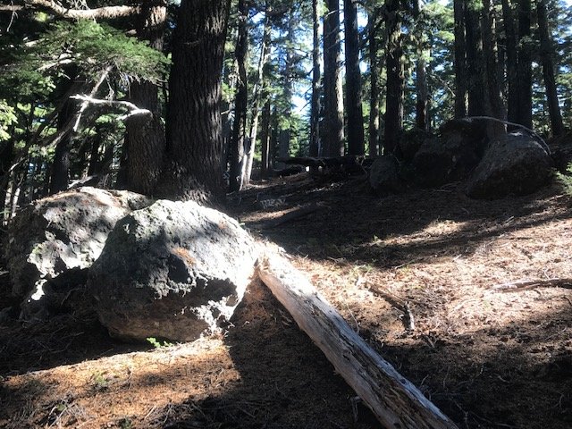
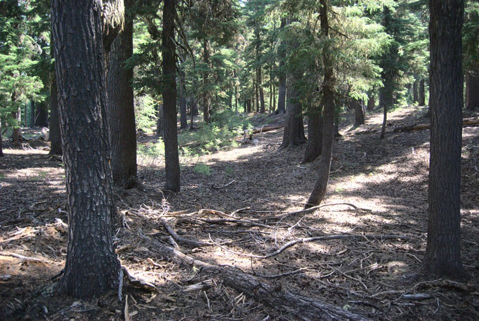
This venue is a very hilly, forest park with lots of vegetation and stumps from past logging operations. The longer courses have substantial amounts of off-trail navigation often through areas with vegetation or debris from past forest thinning operations. Areas with vegetation are shown with different shades of green on your map; lighter green areas are easier to go through and darker green areas are typically best avoided as they are often impassable. Undergrowth areas are shown with parallel green lines; you can go through the areas with widely spaced green lines, but you should probably avoid the areas with tightly spaced green lines. Fortunately, much of the vegetation is still low to the ground from winter dormancy and snow pack, so it is somewhat easier to go through the vegetation in the early spring compared to the summer.

All courses go through or close to the Hares Canyon Horse Campground, which is closed to horse campers but open for us to use. The advanced courses will also go through the East Dairy Creek Campground which is closed to campers but open for us to use The West Dairy Creek Campground is open to campers so closed for our use and is shown as out-of-bounds on your map.

The eastern portion of this park is closed for forest thinning operations. The trails leading into that area are marked as closed. Do not use any closed trails.

Parking is in two lots. When we fill up the Hilltop parking by the check in area, then everyone else has to drive further up the road to the Clayhill parking lot and walk 3/4 mile along the road back to the Hilltop area. No parking is allowed on the road side. There is a day use parking fee of $5--if you need a day use parking pass, one can be purchased at either the ranger office shortly after entering the park or at a kiosk located by the restrooms at the Hilltop parking area.

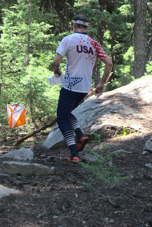
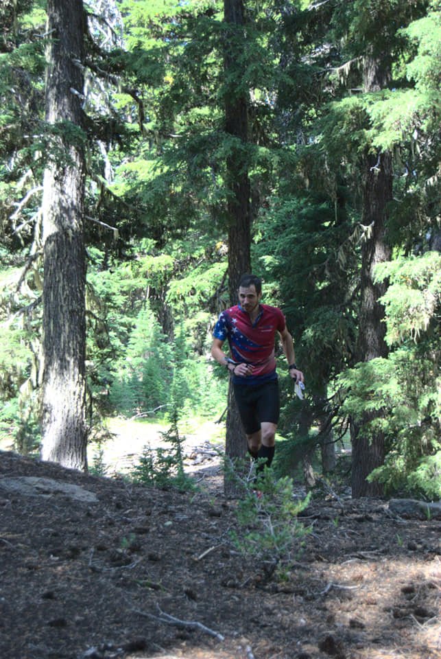
The red and blue courses are very physical so they were designed on the shorter than normal. Anyone doing one of the advanced courses will navigate significant distances off trail. If you are doing the green, red, or blue course and prefer shorter off-trail routes up hills instead of longer trail routes, we recommend wearing shoes with studs.

Because of the heavy vegetation; we recommend that you wear the following for doing intermediate and advanced courses:

  • Eye protection (glasses or safety glasses)

  • Long pants and long sleeves

  • Gaiters

If you encounter pools of mud on the trail, please go around the mud. The park prefers that we not make the mud pools worse by walking or running through them.

Some of the other park users might be horseback riders. Their horses have very sensitive hearing and are easily startled by people stepping on branches. To keep from startling the horses, do the following:

  • If encountering horseback riders on trails, step aside to let them pass you. 

  • If you are passing horseback riders, call out to them and let them know that you need to pass. Listen for and follow any instructions given by the horseback riders.

  • If you are off trail with horseback riders in sight, call out to the horseback riders to let them know that you are a human (not a bear) in the woods. Often it helps to keep talking until they are out of the area.

Fortunately, this event is scheduled when there are expected to be few horseback riders (the Hares Canyon horse campground is closed in March), so there will probably not be many horseback riders on the trails.

The courses close at 3 pm and we begin picking up controls at that time. 

  • If you often take more than 2 hours to do your course, please start between 11 am and noon to be sure that you finish well BEFORE 3 pm.

  • If you realize that you cannot finish your course by 3 pm, immediately go to the finish as quickly as possible (BEFORE 3pm). Controls will be picked up at 3 pm so you cannot punch at controls after the closing time. Also, anyone not back by 3 pm is assumed to be hurt so we have to organize search parties to look for them. 

  • Everybody must punch in at the finish and download their times even if they do not finish their course. This is how we make sure that everyone returns safely.


NEW TO ORIENTEERING? WELCOME!

Our events are open to both members and non-members. Beginners, families and dogs are welcome.

  • Have a look at our “New to O?” webpage, which covers just about every question you may have.

  • At most events, we offer free beginner clinics (they take about 10 minutes) to teach you everything you need to know. These are typically at half-hour intervals; choose your time slot on the registration page.

  • If you'd like to get reminders about upcoming events, sign up at our newsletter page. (No more than a couple of emails per month, we promise!)

  • Thanks for coming out and trying something new, we think you'll like it!


START WINDOWS

For this event we’re using assigned 30 minute start windows between 11 am and 1 pm. This spreads participants over the entire two hour start window instead of a big rush at the beginning, easing the workload on event volunteers.

Again, if you are doing an advanced course, please try to start before 12 noon.

Please choose your start window during registration. The earlier you register, the better chance you have of a preferred window. If you arrive early for your start window, you may be asked to wait. If you're late, no worries, we’ll allow you to start when we have an opening. It's a guideline, not a firm rule.


TIMES

  • Beginner clinics: 11:00 am and 11:30 am. Choose your preferred time when you register.

  • Course starts: anytime between 11:00 am and 1:00 pm

  • All courses close: 3:00 pm (controls will be picked up)

(All teams must check out through the course finish area before leaving, even if the team does not finish the course or returns after the course closes.)


REGISTRATION AND OTHER COSTS

Park Fee: Oregon State Parks charges $5 for day use, $30 for a 12 month pass and $50 for a 24 month pass. The day pass fee may be paid at either the welcome center (one mile after entering the park) or at the "iron ranger" fee box in each parking lot (exact change required.)

Event Cost

  • $17 base price - individuals

  • $22 base price - groups of 2 or more

    - Subtract $5 if you’re a member or CROC or other O-club (Join CROC)

    - Subtract $5 if you have your own e-punch (Buy your own epunch)


Livelox: GPS tracking and route reviewing tool

CROC uses Livelox, which is an interactive web based tool that enables you to see your exact route/track on the orienteering map, and compare them with other competitors.

By seeing the routes other people took, where you went, and where things went good or bad for you, you can learn and become a better orienteer.

To use this tool, you need to record a GPX track while you are on the course. This can be done with many phone apps and GPS watches. After the event, you can log into your free account, upload your track, and review your course.

See a link to the Livelox tracks from the Results page.

Questions? Email John Crowther 


VOLUNTEERS

All CROC events are put on by volunteers, and the meet director can almost always use some extra hands. Please keep in mind:

  • No prior experience is needed for many of the tasks

  • You can help out AND still run your course of choice

Typical ways to assist are:  helping with starts and finishes, handing out maps, and picking up control flags after the course closes. Typical shifts are one hour.
If you'd like to help, you can choose a task and time shift when you register online. Thanks!


Results

Results are posted to the Events & Results web page a day or two after the event.


Driving directions and location

Latitude longitude coordinates of the event: 45.7414, -123.1864

Click these coordinates for a Google map link, or copy/paste these coordinates into Google maps or your smartphone mapping app to get a map and driving directions to the event.

Take Oregon Highway 26 23.8 miles from the intersection of Oregon Highway 217 in Beaverton to Oregon Highway 47 N (see the signs for Vernonia/Clatskanie).

  1. Turn right onto OR-47 N and go 4.1 miles to the entrance to Stub Stewart State Park.

  2. Turn right into the state park and go about 0.5 miles to the Welcome Center where you can purchase a day, 12-month, or 24-month parking pass for your car. If you already have a parking pass, continue to the next step.

  3. Continue another .6 miles to the Hilltop Day Use parking area and park your car.
    Note: If the Hilltop parking area is filled, drive .5 miles further to the Clayhill Horse Staging parking area (park along the side of that area and leave the center area open for horse trailers).

View Event →
Member Training: Using Distance and Elevation - Navigating and Visualizing
Mar
16
10:00 AM10:00

Member Training: Using Distance and Elevation - Navigating and Visualizing

  • March 16, 2024 10:00 a.m. - noon

  • Mt. Tabor Park in southeast Portland

  • For CROC members only

We’ll learn and practice how far on the map means how far on the ground, uphill and downhill. Then we’ll practice estimating visually how steep and how far away something is. This is valuable in the field on a course leg: if you pass the rock about 15 meters away, are you on the best line of travel? Mt. Tabor offers a variety of elevation differences and distances, so we have lots of opportunities.

This training is for CROC members only; there is no cost. Register here by March 14, and we’ll send you the exact starting point. For questions and suggestions contact trainer Anndy.

View Event →
Multnomah Village Urban Night-O - RESCHEDULED
Mar
9
5:00 PM17:00

Multnomah Village Urban Night-O - RESCHEDULED


this event was canceled in January due to severe winter weather. We rescheduled to March 9.


ADVANCE ONLINE REGISTRATION IS REQUIRED FOR THIS EVENT.

  • Makes things fast and easy for YOU on event day (no paperwork or payment)

  • Simplifies processing the results

  • Helps meet directors know how many maps to print

  • See who’s attending, maybe plan a carpool


Quick info

  • Registration deadline: Thursday, March 7, 11:00pm

  • Location: Lucky Lab Pub, Multnomah Village, SW Portland 7675 SW Capitol Hwy, Portland, 97219

  • Times: Pub opens at 5:00. Map handout starts at 5:30. Plan your route, mass start at 6:00 sharp. Course closes at 7:30 pm.

  • Course: Score O format. Find as many checkpoints as you can, in any order, within 90 minutes

  • Cost: $12 individuals, $17 teams, ($5 discount for club members)

  • Event Director: John Godino


Event overview

Come out to Multnomah Village for CROC's annual urban night orienteering! Run or stroll the back streets, alleys, and trails of this SW Portland neighborhood on a night-time urban navigation adventure. Both individuals and teams are welcome. We've been doing this event for about 15 years, it's always a lot of fun!

You will have about 45 minutes of twilight, then the rest of your time on course will be in the dark.

Unlike traditional orienteering courses where you find orange and white flags set the day of the event, this course uses permanent objects such as fire hydrants, yard art, and signs. You'll get a map with about 30 marked checkpoints, and an answer sheet. When you find the checkpoint, you need to answer a multiple choice question correctly, such as: "What's the animal painted on the side of the garage?  a) elephant b) walrus c) panda".  Answer the question, and move on to the next control.  

  • This is a good event to do as a team as well as individually, so feel free to bring a friend. Beginners, families, and dogs are welcome. Maximum team size is six people.

  • We're starting at dusk, so you’ll have some twilight before it gets fully dark.

  • Be very careful crossing busy streets! Always give cars the right-of-way, they can’t see you.

  • Feel free to stay and have a beverage / food at the Lucky Lab pub after the event; we have the upstairs event space reserved.


Event Rules

  • Mass start at 6:00 pm sharp. Pub upstairs opens at five, please arrive early to register and plan your route.

  • You have 90 minutes to find as many checkpoints as you can in any order you like and then return to the finish.

  • You do NOT have to find all the checkpoints.

  • You get one point for each correct answer. (The are also 3 point bonus checkpoints, so plan a route that visits some of those.)

  • 1 point is deducted for each wrong answer (no guessing) and for each minute over the time limit (don't be late!)

  • If you’re on a team, stay together - no splitting up.

  • No GPS enabled devices (phones) are allowed for navigation assistance.

  • Participants under age 18 must be accompanied by a responsible adult.


What to bring

  1. A quality flashlight or headlamp with fresh batteries, one for each person on your team. Please keep your light on at all times during the event to increase your visibility.

  2. Clothing appropriate for the weather. Reflective / high visibility clothing is highly recommended.

  3. A watch/phone to be sure you don't take longer than 90 minutes on the course.

  4. A highlighter pen is handy for marking your intended route, hint hint.


NEW TO ORIENTEERING? WELCOME!

  • Our events are open to both members and non-members. Beginners, families and dogs are welcome.

  • We are not offering beginner clinics at this event, so take a close look at the “Event Overview”, and “Event Rules” sections above for all the details.

  • No compass is needed, just decent map reading skills.

  • If you'd like to get reminders about upcoming events, sign up at our newsletter page. (No more than a couple of emails per month, we promise!)

  • Thanks for coming out and trying something new, we think you'll like it!


REGISTRATIOn

Advance online registration is required. There is no event day registration.

Application deadline: Thurs, March 7, 11:00pm

Refund policy: full refund if requested more than 48 hours before the start time of the event. Email us to request a refund and we’ll work it out.

Event Cost

  • $12 base price - individuals

  • $17 base price, teams of 2 or more. (Maximum team size is six people.)

    - Subtract $5 if you’re a member or CROC or other orienteering club (Join CROC)


Results

Results will be posted on the Events & Results page a few days after the event.


Practice/Training

CROC has a permanent training course established in this area.  If you try it before the night-O, you may have an unfair advantage, hint hint!  See complete details here.

Here’s an example of the permanent course map. The map we use for competitive night O looks a lot like this one.

Multnomah Village permanent orienteering course map example


Map of event location

View Event →
CROC Board Meeting
Mar
4
7:00 PM19:00

CROC Board Meeting

CROC holds quarterly board meetings. All members may attend.

Meeting dates are generally scheduled for: first Monday of December, March and June, and the second Monday of September, from 7:00 pm to 9:00 pm.

The meeting location may vary. Meetings may be online or in-person.

Please go to About > Contact and email us to find out where the next meeting will be, and to confirm the actual date.

View Event →
Member training - Corridor-O
Feb
24
10:00 AM10:00

Member training - Corridor-O

  • Corridor-O

  • February 24, 2024 10:00 a.m. - noon

  • Gabriel Park in southwest Portland

  • For CROC members only

This training helps you focus on the map details where you are. The only part of the map that shows is a corridor with the controls. Your challenge is to use the corridors to navigate to the control sites without seeing the big picture. Corridor-Orienteering is a good exercise for intermediate and advanced orienteers.

Start any time between 10:00 and 11:00 a.m.; course is open until noon. 

This training is for CROC members only; there is no cost. Register here by February 22 and we’ll send you the exact starting point. For questions and suggestions contact trainer Anndy.

View Event →
Mt. Sylvania Urban-O, SW Portland
Feb
10
11:00 AM11:00

Mt. Sylvania Urban-O, SW Portland

MtSylvania_map_sample

ADVANCE ONLINE REGISTRATION IS REQUIRED FOR THIS EVENT.

  • Makes things fast and easy for YOU on event day (no paperwork or payment).

  • Simplifies processing the results.

  • Helps meet directors know how many maps to print.

  • See who’s attending, maybe plan a carpool.


Quick info

  • Courses: Three different courses / time limits for all skill levels. Score-O format; find as many controls as possible in any order within the time limit.

  • TImes: Check in begins at 10:30 and the beginner clinics occur at 11:00 and 11:30. Start your course anytime between 11:00 AM and 1:00 PM. Courses close at 4:00 PM.

  • Event center: shelter located in the south corner of Westlake Park.

  • Everyone welcome, members and nonmembers

  • Event director: Tony Pinkham


EVENT OVERVIEW

The new Mt. Sylvania map covers 7.5 square kilometers of a hilly and relatively flat residential area in Lake Oswego and Portland. In addition to navigating streets, you'll be able to include plenty of walkways and trails that connect neighborhoods and provide shortcuts. Half of the area is relatively flat and the other half is hilly leading to the steep inclines that go up Mt. Sylvania, where you can get some impressive views of Tualatin Valley and Mt. Hood.

We will have three courses using the same course map. The courses have maximum times of 1 hour, 2 hours, or 3 hours. You specify your preferred course time limit when you finish. If you finish past the time allowed for your course, you lose a point for each minute or fraction of a minute that you are late. It pays not to be late.

Unlike traditional orienteering courses where you find orange and white flags set the day of the event, this course uses permanent objects such as fire hydrants, yard art, and signs. You'll get a map with marked checkpoints, and an answer sheet. When you find the checkpoint, you need to answer a multiple choice question correctly, such as: "What's the animal painted on the side of the garage?  a) elephant b) walrus c) panda".  Answer the question, and move on to the next control.  

You get to decide whether you are a competitor or recreational map hiker. Competitors get their times and scores published. Recreational map hikers get credit for doing the course without mention of points or times. Stay off of private property (shown as olive green on your maps) at all times. Public schools with open gates can be accessed.

Note:

  • You can go as individuals or teams. We strongly recommend that teams have no more than six people (four or fewer is best).

  • Competitive teams must stay together at all times (no splitting up to find controls).

  • Everybody has to check into the finish by 4:00 PM so that we know that everyone has returned safely.

  • We distribute a maximum of four maps per team (one per team member up to four).

  • After registration closes, team compositions cannot change (that is, teams cannot be split into smaller teams; that would require a registration change). 

The start and finish will be located at the shelter located in the southern corner of Westlake Park. The shelter includes a restroom and drinking water. When you check in, if your registration is complete, we will hand you (and your team) a Q&A sheet and your map(s). You get up to 20 minutes to look at your map and plot your course. When you are ready to start your course, go to the starts and ask for a start time. One competitor or team can start every minute. Your start time happens as soon as that minute occurs.

If possible, we will post preliminary results at the event.


NEW TO ORIENTEERING? WELCOME!

Our events are open to both members and non-members, and beginners are welcome.

  • Have a look at our “New to O?” webpage, which covers just about every question you may have.

  • You can compete as an individual or as a team. Maximum team size is six people.

  • At most events, we offer free beginner clinics (about 10 minutes) to teach you everything you need to know. These are typically at 30 minute intervals. If you'd like to attend, choose a time slot when you register.

  • If you'd like to get reminders about upcoming events, sign up at our newsletter page. (No more than a couple of emails per month, we promise!)

  • Thanks for coming out and trying something new, we think you'll like it!


Courses

All courses use the same map. They differ only by the amount of time that you spend looking for controls.

  • 60 minutes:  Probably the easiest course because it is shorter and uses flatter areas close to the start/finish.

  • 120 minutes:  More challenging because you are bound to venture into some hilly areas.

  • 180 minutes:  Very challenging as you'll probably be covering a large area with lots of hill climbing.


TIMES

  • Beginner clinics: 11:00 am and 11:30 am. Choose your preferred time when you register.

  • Course starts: start windows between 11:00 am and 1:00 pm.

  • All courses close: 4:00 pm. If you do a 3-hour course, consider starting by 12:30 PM so that you are sure to be done by 4:00 PM even if you are late

(All teams must check out through the course finish area before leaving, even if you or your team does not finish the course or returns after the course closes. This way we know that everyone has returned safely.)


REGISTRATION AND OTHER COSTS

Advance online registration is required. There is no event day registration.

Application deadline: Thursday, February 8, 11:00pm

Event Cost

  • $12 base price for individuals

  • $17 base price for teams of 2 or more (maximum team size is 6)

- Subtract $5 for membership in CROC or other O-club - Become a CROC member


VOLUNTEERS

All CROC events are put on by volunteers, and the meet director can almost always use some extra hands. Please keep in mind:

  • No prior experience is needed for many of the tasks

  • You can help out AND still run your course of choice

Typical ways to assist are: helping with starts and finishes, checking in folks at registration, helping with results, and cleaning up after the course closes. Typical shifts are 60 to 90 minutes long.
If you'd like to help, please choose a volunteer slot when you register online.


RESULTS

We hope to post final results on the Events & Results web page within a day or two after the event.


MAP AND DIRECTIONS

45.4242, -122.7266

Copy/paste these latitude longitude coordinates into Google maps or your smartphone mapping app to get a map and driving directions to the event.

Check in, starts, and finishes will be run at the shelter in the southern corner of Westlake Park. Parking is in the nearby parking lot at 14165 Bunick Dr., Lake Oswego, OR.

Try a Google maps search for “Westlake Park, Lake Oswego”

To get to Westlake Park Park by car:

  1. Take Interstate 5 to exit 292 Kruse Way in Lake Oswego.

  2. Go east (toward Lake Oswego) for 0.7 miles to Westlake Drive.

  3. Turn left onto Westlake Drive and go 0.1 miles to Parkview Drive.

  4. Turn right onto Parkview Drive and go 0.3 miles to Bunick Drive.

  5. Turn left onto Bunick Drive and go 0.1 miles to the park and its parking lot.

Look for the orange and white “sandwich" board signs when you get close.

To get to Westlake Park by bus, take the 78 bus to Kerr and Touchstone. Walk 0.1 miles south to Botticelli, turn right and walk 0.6 miles to Westlake park.

View Event →
Member training: Complex Orienteering Dilemmas, and How To Solve Them
Jan
10
6:30 PM18:30

Member training: Complex Orienteering Dilemmas, and How To Solve Them

  • Wednesday, January 10, 2024 6:30-8:00 p.m.

  • Taborspace in southeast Portland

  • For CROC members only

Advanced orienteering courses can really challenge you. How do you navigate in vague terrain, or in an area of complex contours? What do you do when you do get lost, that is, you lose contact with the map? Join CROC member and US National Team member Ali Crocker for a discussion and suggestions to improve your navigation through various challenging terrains.

Once you register we’ll send you the specific location.

This training is for CROC members only; there is no cost. Register here by January 9. For questions and suggestions contact trainer Anndy.

View Event →
2023 CROC Holiday Lights
Dec
18
to Dec 31

2023 CROC Holiday Lights


ADVANCE ONLINE REGISTRATION IS REQUIRED FOR THIS EVENT.

  • Only CROC members can register for this free event but they can include family or friends on their team.

  • Participants must sign event waiver to complete their online registration.


Quick info

  • Enjoy a FREE orienteering event featuring holiday decorations in Beaverton.

  • Score-O format: visit the controls in any order you want. Choose between 60, 120, and 180 minutes on the map.

  • Use the MapRun smartphone app to “punch” each control (no Q&A sheet).

  • Look at your map and plot your course before you start.

  • This course uses about 35% of the Sexton Mountain map covering flats and hills.

  • There are no volunteers at this event--you do your course on your own whenever you like.

    • Daylight runners can see some lit decorations if they start after 3 PM.

    • Night runners get the best view of lit decorations, but must be extra careful when crossing streets.

    • No beginner clinics. Team captains can give their own clinics if needed to team members.

  • Dress for cold and wear reflective clothing. Flashlight or headlamp is recommended for evening participants. Smartphone is required if you are using the MapRun app.

  • Control sites have decorations but not all decorated houses are control sites. Many houses were decorated after the course was set.

  • Control point values are equal to the tens digit in the control number (control 34 is worth 30 points; control 101 is worth 100 points).

  • You can do this event alone or as a team. Teams are recommended for safety and for maximizing enjoyment.


EVENT OVERVIEW

Happy Holidays and thank you for your CROC membership!!! This event is our thanks for your helping make CROC the wonderful club that it is. This is a FREE event for CROC members, who can have friends and family team up with them.

Your map shows where there are lit holiday decorations, and it lists the address numbers for those sites in the control descriptions. Instead of having to answer questions about each control site, the MapRun app on your smartphone will sound a chime to give you credit for each control found. You get 8 hours to find as many controls as possible in any order, which is more than enough time to find all the controls. You don't have to find all of the controls--just do what is fun for you.

Dress warmly, wear reflective clothing, bring a flashlight, and fully charge your phone for this event. After you register and sign the event waiver, you will receive a MapRun passcode for this event and a PDF file of the event map. Print the color map and bring it with you (if you don't have a printer, print the map at an Office Max, FedEx, or Staples store for less than $0.70). To protect the map from rain or sweaty hands, we recommend a gallon plastic bag or map case. Consider using a smartphone holder for your arm or belt, so your hands are free and your phone is safely held while still being able to receive GPS signals.

The start and finish locations are located very close to the start and finish used at the Sexton Mountain event in November.

  • Park on SW Rigert Road by the Westside trail in Hart Meadows Park.

  • The start is about 20 meters north of the road on the paved trail by the NW corner of the power pylons.

  • The finish is located on the other side of the road on the paved trail by the NE corner of the tennis courts.

These locations are unlit at night but they are close to the road and were chosen so that MapRun would not accidentally start or finish your course when you drove up to this location or ran by on the road. After you start your course, stay at least 10 meters away from the NE corner of the tennis courts until you are ready to finish your course (if you get too close to the tennis courts, MapRun will think that you are finishing your course).

As always, stay off of private property (shown as light olive green on your maps). Public schools with open gates can be accessed when the schools are not in session. If you go through an unlocked, closed gate, then be sure to close the gate after you go through it.

Results will be posted on the MapRun event page and updated as each person finishes the course. CROC will provide results for anyone doing the course by December 31.

If you know of another area with lots of interesting holiday decorations, let Tony Pinkham (runnerinwoods@gmail.com) know about that area and maybe it will be used for our 2024 holiday lights event.


TO SET UP THE MapRun APP ON YOUR PHONE

  • Install the MapRun app onto your phone (you must be within range of WIFI or phone mobile service):

    1. Go to the Apple Store or Play Store and install the MapRun app (version 7 is recommended).

    2. Use your phone settings to be sure that its location function is turned on.

  • Setup the 2023 CROC Holiday Lights event on your phone (must be within range of WiFi or phone mobile service):

  1. Be sure that your smartphone volume is turned on to a high setting.

  2. Open the MapRun app.

  3. Using the MapRun home screen, press either the Events Near Me button or the Select Event button.

  4. Find and select the 2023 CROC Holiday Lights event by selecting a country (USA), state (Oregon), region (Portland Metro), and county (Washington).

  5. You may be asked to make a user profile in MapRun, with your name, email, and some other contact info.

  6. If you tap “Go to Start”, you may be asked for a four digit passcode, Enter the code sent to you after you fully registered for this event.

  7. The home screen will reappear with 2023 CROC Holiday Lights listed below the Select Event button.

  8. Print a copy of the event map (the PDF file sent to you after you registered for this event).


To run your course:

To start your course:

  1. Use the Goto Start button on the MapRun home screen to show you directions to the start. Use that map to move the red dot (you) to the purple triangle (start). When you reach the start location (NW corner of the power pylon in Hart Meadows park by SW Rigert Road), MapRun will sound a chime and your clock has started for your course. Use the map that you printed to find each control.

  2. When you are asked for a passcode, enter the code sent to you after you registered.

  3. When you arrive within 5 meters of each control (the location is the same as the address listed for that control in the control descriptions), MapRun will sound a chime and the screen control circle will change from purple to green. If the chime doesn't occur, you might have to walk up and down the sidewalk in front of that house or possibly in the street.

To finish your course:

  1. When you are ready to finish your course, go back to the start area, but go across the street to the NE corner of the tennis courts.

  2. When you reach the NE corner of the tennis courts, MapRun will sound another chime and the screen will indicate that you have finished your course. Your results will be listed with the results for everyone else by the MapRun app.


TIMES

  • You can do this course any time and day until December 31, 2023. After December 31, when most of the decorations disappear, the course will be closed for results, but you can still do the course without results on the CROC website while using the MapRun app.


REGISTRATION

Advance online registration is required. There is no event day registration and there are no event fees. This is a free event for CROC members.

Registration deadline: 11 PM on Friday, December 29, 2023.

Registration requirements: 

  • CROC membership for the person registering (team captain)

  • Signing the event waiver (everybody on a team). Anyone who joins a team without signing a waiver is NOT part of this event.

  • Adhering to waiver provisions--this is an unsupervised event, which means that you are fully responsible for your behavior and safety.

Registration confirmation:

  • The registering person receives a MapRun passcode and a PDF map file for printing.

  • If you don't receive this confirmation or have questions, contact Tony Pinkham at runnerinwoods@gmail.com or call by phone (8 AM to 10 PM) at 650-793-8764.


RESULTS

Timed results will be posted on the MapRun website, which is updated with each person or team that finishes. CROC will publish results after December 31.


MAP AND DIRECTIONS

45.4602, -122.8411

Copy/paste these latitude longitude coordinates into Google maps or your smartphone mapping app to get a map and driving directions to the event.

Starts and finishes occur at Hart Meadows park. Parking is on SW Rigert Rd. where it goes through Hart Meadows park.

Try a Google maps search for “Hart Meadows park”

To get to Hart Meadows Park by car:

  1. Take Highway 217 to SW Allen Blvd (exit 2B).

  2. Go west on SW Allen for 1.7 miles to SW Murray Blvd.

  3. Turn left onto SW Murray Blvd. and go 0.8 miles to SW Hart Rd.

  4. Turn right onto SW Hart Rd. and go 0.5 miles to SW 155th Ave.

  5. Turn left onto SW 155th Ave. and go 0.3 miles to SW Rigert Rd.

  6. Turn right onto SW Rigert Rd. and go 0.2 miles to Hart Meadows park.

  7. Park on the street.

The start is located on the paved walkway that goes by the NW corner of a power pylon about 20 meters north of SW Rigert Road.

The finish is located on the paved walkway that goes by the NE corner of the tennis courts about 20 meters south of SW Rigert Road.

View Event →
"Ho-Ho-O" Warm Clothing Drive, Memorial Park Wilsonville
Dec
9
11:00 AM11:00

"Ho-Ho-O" Warm Clothing Drive, Memorial Park Wilsonville


ADVANCE ONLINE REGISTRATION IS REQUIRED FOR THIS EVENT.

  • Makes things fast and easy for YOU on event day (no paperwork or payment)

  • Simplifies processing the results

  • Helps meet directors know how many maps to print

  • See who’s attending, maybe plan a carpool


QUICK INFO

  • Registration deadline: Thurs, Dec 7, 11:00pm

  • FREE with warm clothing donation

  • Location: Memorial Park, Wilsonville

  • Course: 60 minute score-O; find up to 20 controls in any order you like within 1 hour

  • Times: start anytime between 11 AM and 1 PM

  • Event Director: John Godino

  • Note: the event start/finish area is in the NW corner of the park at the covered picnic area.

Memorial Park start finish area.jpg

EVENT OVERVIEW

Join CROC's annual warm clothing drive and keep warm yourself with a brisk winter orienteering meet at Memorial Park in Wilsonville, on the banks of the Willamette River. Your entry is FREE with a donation of a jacket, sweater, blanket, sleeping bag or similar item. Clothing will be donated to a local charity (Mainspring) after the event.

Even though there is no cost with a donation, we’d still like you to pre-register online at the link above.

This score-o format is very beginner friendly, and new folks are welcome at this and all CROC events. Free beginner clinics will be offered as needed to get you started with confidence.

There are blackberries. Long pants / tights / lower leg protection is highly recommended.

CROC thanks our recreation partner Wilsonville Parks.


Special demonstration of radio orienteering

Are you curious about how radio orienteering works? We will have a demonstration at this event.

The program includes the introduction of the sport disciplines (includes classic ardf, radio orienteering & sprint) with demonstration of the equipment and techniques. We will probably have a short course available of two or three controls if you want to try it.

This training will begin at around 12:30 pm, which will hopefully give participants one hour to run their course and then check out the Radio-O.


NEW TO ORIENTEERING? WELCOME!

Our events are open to both members and non-members. Beginners, families and dogs are welcome.

  • Have a look at our “New to O?” webpage, which covers just about every question you may have.

  • You can compete as an individual or as a team. Maximum team size is six people.

  • At most events, we offer free beginner clinics (they take about 10 minutes) to teach you everything you need to know. These are typically at half-hour intervals; choose your time slot on the registration page.

  • If you'd like to get reminders about upcoming events, sign up at our newsletter page. (No more than a couple of emails per month, we promise!)

  • Thanks for coming out and trying something new, we think you'll like it!


COURSES

Event format: 60 minute score-O. There will be about 20 controls. You have 60 minutes to find as many controls as you can in any order you like. Points will be deducted for every minute you’re late. Bringing a watch to keep track of your time is highly recommended!

We use an electronic scoring and timing system known as “e-punch” Each entry or team needs to have an e-punch stick. If you don't have your own e-punch stick, we’ll give you one for free with your clothing donation. Using the e-punch is easy. You can learn how at the event, or read about e-punch here.


TIMES

  • Beginner clinics 11:00 am and 11:30

  • Course starts: anytime between 11:00 am - 1:00 pm

  • Course closes: 2:00 pm

All teams must check out through the course finish gate before leaving the park, even if the team does not finish the course or returns after the course closes.


ORIENTEERING MAP OF THIS LOCATION FROM A PREVIOUS EVENT

See a map here.  Opens Google Drive in a new browser tab


VOLUNTEERS

All CROC events are put on by volunteers, and the meet director can almost always use some extra hands. Please keep in mind:

  • No prior experience is needed for many of the tasks

  • You can help out AND still run your course of choice

Typical ways to assist are:  helping with starts and finishes, checking in folks at registration, and picking up control flags after the course closes. Typical shifts are about one hour long.
If you'd like to help, you can choose a task and time shift when you register online. Thanks!


RESULTS

Results will be posted to the Events & Results page a few days after the event.


 REGISTRATION AND OTHER COSTS

Bring a warm clothing donation for FREE entry. Participants must pre-register and sign the liability waiver before entering the course. 

If you do NOT donate clothing, costs are:

  • $10 - individuals

  • $20 - groups of 2 or more. (Maximum team size is six people.)


MAP AND DIRECTIONS

45.3024, -122.7598

Latitude longitude coordinates of the event site. Copy and paste these into a mapping app on your phone or Google maps to get a map and driving directions to this location.


From Portland City Center:

  • I-5 south to Wilsonville

  • Left under the freeway onto Wilsonville Road.

  • Go about 1/2 mile, turn left on Memorial Drive, then an immediate left to enter the park. We’ll be at the picnic shelter.

View Event →
CROC Board Meeting
Dec
4
7:00 PM19:00

CROC Board Meeting

CROC holds quarterly board meetings. All members may attend.

Meeting dates are generally scheduled for: first Monday of December, March and June, and the second Monday of September, from 7:00 pm to 9:00 pm.

The meeting location may vary. Meetings may be online or in-person.

Please go to About > Contact and email us to find out where the next meeting will be, and to confirm the actual date.

View Event →
Sexton Mountain Urban Score-O
Nov
25
11:00 AM11:00

Sexton Mountain Urban Score-O

Sexton Mountain map example


ADVANCE ONLINE REGISTRATION IS REQUIRED FOR THIS EVENT.

  • Makes things fast and easy for YOU on event day (no paperwork or payment)

  • Simplifies processing the results

  • Helps meet directors know how many maps to print

  • See who’s attending, maybe plan a carpool


Quick info

  • Courses: Four different courses for all skill levels. Score-O format; find as many controls as possible in any order within the time limit.

  • TImes: Check in begins at 10:30 and the beginner clinics occur at 11:00 and 11:30. Start your course anytime between 11:00 AM and 1:00 PM. Courses close at 4:30 PM.

  • Everyone welcome, members and nonmembers

  • Event director/Course Setter: Tony Pinkham


EVENT OVERVIEW

Need to run or walk off a few calories from your Thanksgiving feast? Here's your chance! The newly expanded Sexton Mountain map of Beaverton offers over 8 square kilometers of hilly residential neighborhoods with lots of streets going in non standard directions and lots of walkways through green spaces and connecting neighborhoods. Anyone wanting to minimize their hilly experiences can do the short course, which lets you stay close to the start/finish where the hills are not so steep. Anyone needed to burn calories can do a longer course with lots of hills to meet your demanding needs. This event happens rain or shine (if it snows, you can use your XC rock skis).

Each control on your map has an identifying number. The first digit of the control number shows the point value of that control (for example, control 31 is worth 3 points and control 51 is worth 5 points). To show that you found a control, you answer the question for that control on a Question & Answer (Q&A) sheet that you carry with your map. Answer the question correctly (the questions are easy), you get the points for that control. Answer it incorrectly, we assume you guessed and you lose the number of points for that control. Don't guess.

We will have four courses using the same course map. The courses have maximum times of 1 hour, 2 hours, 3 hours, and 4 hours. You specify your preferred course time limit when you finish. If you finish past the time allowed for your course, you lose a point for each minute or fraction of a minute that you are late. It pays not to be late.

You get to decide whether you are a competitor or recreational map hiker. Competitors get their times and scores published. Recreational map hikers get honorary mention for doing the course without mention of points or times. Competitors and recreational map hikers can go as individuals or teams. Competitive teams must stay together at all times (no splitting up to find controls). Everybody has to check into the finish by 5:00 PM so that we know that everyone has returned safely.

Stay off of private property (shown as olive green on your maps) at all times. Public schools with open gates can be accessed.

When you arrive for this event, go to the check in station to receive your Q&A sheet and then go to either the beginner clinics (if you are new to orienteering) or to starts (if you are ready to orienteer). When you are ready for a start time, show your Q&A sheet to the starter to get a start time. When your start time occurs (this happens each minute or each two minutes), pick up your map and begin your course (one map per person on your team). When you finish or quit your course, bring your Q&A sheet to the finish station and hand it in. Your finish time occurs when you turn in your Q&A sheet. Both the starts and finishes occur next to each other.

If possible, we will post our results at the event. In the event of inclement weather, results will be posted a day after the event.


NEW TO ORIENTEERING? WELCOME!

Our events are open to both members and non-members, and beginners are welcome.

  • Have a look at our “New to O?” webpage, which covers just about every question you may have.

  • You can compete as an individual or as a team. Maximum team size is six people.

  • At most events, we offer free beginner clinics (about 10 minutes) to teach you everything you need to know. These are typically at 30 minute intervals. If you'd like to attend, choose a time slot when you register.

  • If you'd like to get reminders about upcoming events, sign up at our newsletter page. (No more than a couple of emails per month, we promise!)

  • Thanks for coming out and trying something new, we think you'll like it!


Courses

All courses use the same map. They differ only by the amount of time that you spend looking for controls.

  • 60 minutes:  Probably the easiest course because it is shorter and uses flatter areas close to the start/finish.

  • 120 minutes:  More challenging because you are bound to venture into some steep hills.

  • 180 minutes:  Challenging as you'll probably visit all of the steep hills in your quest to find them all.

  • 240 minutes:  Very challenging as you'll probably visit all the steep hills and new areas of the map.


TIMES

  • Beginner clinics: 11:00 am and 11:30 am. Choose your preferred time when you register.

  • Course starts: start windows between 11:00 am and 1:00 pm.

  • All courses close: 5:00 pm. If you do a 4-hour course, consider starting by 12:30 PM so that you are sure to be done by 5:00 PM even if you are late

(All teams must check out through the course finish area before leaving, even if you or your team does not finish the course or returns after the course closes. This way we know that everyone has returned safely.)


REGISTRATION AND OTHER COSTS

Advance online registration is required. There is no event day registration.

Application deadline: Thursday, February 9, 11:00pm

Event Cost

  • $12 base price - individuals

  • $17 base price - teams of 2 or more (maximum team size is 6)

- Subtract $5 for membership in CROC or other O-club - Become a CROC member


VOLUNTEERS

All CROC events are put on by volunteers, and the meet director can almost always use some extra hands. Please keep in mind:

  • No prior experience is needed for many of the tasks

  • You can help out AND still run your course of choice

Typical ways to assist are: helping with starts and finishes, checking in folks at registration, helping with results, and picking up control streamers after the course closes. Typical shifts are 60 to 90 minutes long.
If you'd like to help, please choose a volunteer slot when you register online.


RESULTS

We hope to post results on the Events & Results web page within a day or two after the event.


MAP AND DIRECTIONS

45.4602, -122.8411

Copy/paste these latitude longitude coordinates into Google maps or your smartphone mapping app to get a map and driving directions to the event.


Check in, starts, and finishes will be run at Hart Meadows park. Parking is on SW Rigert Rd. where it goes through Hart Meadows park.

Try a Google maps search for “Hart Meadows tennis courts”

To get to Hart Meadows Park bu car:

  1. Take Highway 217 to SW Allen Blvd (exit 2B).

  2. Go west on SW Allen for 1.7 miles to SW Murray Blvd.

  3. Turn left onto SW Murray Blvd. and go 0.8 miles to SW Hart Rd.

  4. Turn right onto SW Hart Rd. and go 0.5 miles to SW 155th Ave.

  5. Turn left onto SW 155th Ave. and go 0.3 miles to SW Rigert Rd.

  6. Turn right onto SW Rigert Rd. and go 0.2 miles to Hart Meadows park.

  7. Park on the street.

Look for the orange and white “sandwich board signs when you get close.

To get to Hart Meadows Park by bus, take the 88 bus from the Beaverton Transit Center and get off at Hart Meadows Park (the stop after the SW 152nd Ave on Hart Rd).

 
View Event →
CROC Annual Member Appreciation party
Nov
18
3:00 PM15:00

CROC Annual Member Appreciation party

  • 7675 SW Capitol HwyPortland 97219 (map) (map)
  • Google Calendar ICS

EVENT OVERVIEW

At the Lucky Lab Multnomah Village, CROC recognizes all of our great members and volunteers for making another fantastic O-year!  Join us for a free sprint-O event, pizza, salad, and (no host) beverages.  

As part of the Annual End of Year CROC festivities, we're having a sprint-O in a nearby Gabriel Park just before the start of the party.  Stop off at the park, try your hand at the short sprint course, then head right over to the nearby Lucky Lab pub in Multnomah Village for free salad and pizza, yummy beverages, and sharing tales with your fellow CROCers.


HIGHLIGHTS  

  1. Look at maps from major events from around the country

  2. Join in the coming year's event planning; new meet directors and course setters are welcome!

  3. Did we mention free pizza and salad?


TIMES

  • Sprint at Gabriel Park: start anytime from from 3:00pm to 3:30 pm

  • Party: 4:00 to 6:00 pm at the Lucky Lab


SPRINT DETAILS

  • Map handout from 3:00pm to 3:30pm

  • The start location is the parking lot next to the Gabriel Park playground, basketball courts and baseball fields in the NE corner of the park. Turn off of SW Vermont St. onto SW 42nd for parking.

  • No need to RSVP, plenty of maps will be printed

  • Depending on weather, you might want to bring a change of clothes and shoes for the party which immediately follows the sprint

Then, join us at the Lucky Lab for food and celebration!


CONTACT

John Godino 

View Event →
Member training - Three Parks! Three Courses!
Nov
11
10:00 AM10:00

Member training - Three Parks! Three Courses!

  • Three Parks! Three Courses!

  • Saturday, November 11, 2023

  • Three parks in southeast Portland

  • For CROC members only

This training event consists of three short courses at three different urban parks. This gives you THREE chances to practice skills and techniques. The courses will be set with small garden flags at Creston, Kenilworth and Laurelhurst parks in southeast Portland. Courses will be available 10:00 a.m. until 4:00 pm. on Saturday, November 11. There won’t be trainers on site.

You’ll have a suggested skill to practice on each course. And you can practice fast starts at all three locations: Where am I, which way is north, and where do I go? The average course length will be ~1.6 k. You can do them in any order, and can do as many as you want. If you want to keep track of your times for the courses, we’ll post them.

This training is for CROC members only; there is no cost. Register here by November 9, and we’ll email you the maps (or by November 7 if you want us to US mail the maps to you). For questions and suggestions contact trainer Virginia Church or training coordinator Anndy Wiselogle.

View Event →
CROC Corn Maze @ Sauvie Island Pumpkin Patch
Oct
21
7:30 AM07:30

CROC Corn Maze @ Sauvie Island Pumpkin Patch


Time to renew your membership

September and October are membership renewal months at CROC; thanks for continuing your support of orienteering! Renew your membership here.


ADVANCE ONLINE REGISTRATION IS REQUIRED FOR THIS EVENT.

  • Makes things fast and easy for YOU on event day (no paperwork or payment)

  • Simplifies processing the results

  • Helps meet directors know how many maps to print

  • See who’s attending, maybe plan a carpool


Quick info

  • Date: Sat Oct 21 - Note the EARLY mass start time of 8:00!

  • Location: Sauvie Island Pumpkin Patch - big thanks to them for hosting!

  • Courses: Mass start, score-O format (find controls in any order you want within a time limit)

  • Meet director: Brian Hauck


Event Overview

Come on out and try CROC corn maze orienteering at the Pumpkin Patch on Sauvie Island! It’s probably the smallest scale map we’ve ever used, but DANG there’s a lot of route options! It's all the fun of a corn maze but with an extra competitive edge. Family and beginner friendly, as always.

Driving time from Portland city center is about 30 minutes.

  • #1 rule: Stay ONLY on existing paths in the maze and do NOT cut through standing corn.

  • This event starts MUCH earlier than our usual meets, so we can be finished with the course by the time the corn maze opens for business.

  • MASS START time of 8:00am. Aim to arrive by 7:30 or so to have time to get ready.

This event will have a map exchange. Complete the main course to find 20 controls in any order you like. If you want some more excitement, you can go back in and try to find some more. Either way, you need to be finished by 9 am, or you lose one point for each minute you're late.


Corn maze orienteering tips

  • Using a highlighter pen to mark your route on the map can be helpful, hint hint.

  • A compass can be useful - it’s very easy to get turned around and lose your reference to North.

  • The map scale will be approximately 1:1200, a much larger scale (more “zoomed in”) than a normal orienteering map. Controls will accordingly be very close together, some just a few seconds apart, so don’t overrun your objective.

  • The orienteering skills of thumbing the map where you move your thumb along to indicate the “you are here” position), and orienting the map (by rotating it to match the terrain in front of you) will be very useful. Read about these two important skills in more detail on our “Beginner’s Guide” page.

  • Please bring: a change of clothes/shoes. Corn mazes can get muddy!


Times

  • Map handout - 7:00-7:45  (Yes, it's early! )

  • Instructions - 7:50am

  • Mass Start - 8:00am

  • Course Closes - 9:00am


Costs - (prices include the $8 entrance fee into the Pumpkin Patch maze)

  • $25 base price - individuals

  • $30 base price - groups of 2 or more

    - Subtract $5 for membership in CROC or other O-club


Directions and map to event site

45.6415, -122.7895

Latitude longitude coordinates of the event site. Copy and paste these into a mapping app on your phone or Google maps to get a map and driving directions to this location.

Driving time from Portland city center is about 30 minutes.

16511 NW Gillihan Rd, Portland, OR 97231

From Portland City center:

  1. Drive west on Highway 30 about 9.7 miles.

  2. Take a right turn and cross the bridge across Sauvie Island.

  3. Take an immediate left, circle under the bridge, and go about 2.3 miles on NW Gillihan Rd to the Pumpkin Patch.

View Event →
Member training: map contours
Oct
15
10:00 AM10:00

Member training: map contours

Map Contours: Practice

  • NEW DATE: SUNDAY, October 15, 2023 10:00 a.m. - noon

  • Mt. Tabor Park in southeast Portland

  • For CROC members only

Here’s an opportunity to practice reading contour lines…since there will be no paths or roads on the map. Mt. Tabor Park may be familiar, but can you navigate without those linear features? Navigate through this course using only the contour lines and the vegetation marks. 

This training is for CROC members only; there is no cost. Register here by October 12, and we’ll send you the meeting location. For questions and suggestions contact trainer Anndy.

View Event →
Deschutes Pyr-O-Clastic 2023
Sep
29
to Oct 1

Deschutes Pyr-O-Clastic 2023

CROC presents Deschutes Pyr-o-clastic (Unplugged), a new take on a Classic map

Instead of our biannual daze, we are offering a set of high quality races in the style of an NRE. Unplugged because it’s not a true NRE.

This is the 20th anniversary of our Dutchman Flat map and we are designing courses for all ages and abilities.

CROC thanks our recreation partner, the US Forest Service.


At a Glance

  • 2 events in 2 days

  • NRE style:
    Courses and results according to the standard Orienteering USA competition classes
    Assigned start times

  • SPORTident epunch timing

  • Results and splits posted same day

  • Camping offered at Tumalo State Park

  • All courses on the Dutchman Flat map, one of the best on the US West Coast


Some photos from past events at Dutchman Flat . . .


Registration Information

Registration opened on July 20, 2023 and will remain open until September 25, 11:00 pm, unless we hit the capacity limit of 150 participants.

The registration menu includes:

  • Event fees: per day or both days

  • Optional Saturday evening barbecue dinner (at Riverbend Park in Bend)

  • Optional camping at Tumalo State Park (now full, but see below for other camping options.)

  • Waiver form

  • Optional epunch / SI card rental

participation limits

Participation is limited to 150 people, as required by our Special Use Permit. Register early to avoid the cut off.

Prices

  • Single Event Day: $25

  • Both Events: $40

  • Courses are half price for Juniors under age 20

  • $5 per day surcharge for late registration after August 31

  • Children up to age 13 on the white or yellow courses can individually do their course with a parent or guardian shadowing them.

  • BBQ Dinner: $24

  • Camping per night: $20 per tent per night, sharing one standard campsite with two tents. This includes additional parking fees, if needed. Do not pay additional fees at the park, we’ll cover it.

  • Are you coming with an RV or want to have the whole site to yourself? Please see the notes below under Accommodations or use the contact form below to ask us about it.

Refunds

Please register if you plan to come.

Refund requests will be considered on a case by case basis if your plans change due to personal health circumstances. If you do not feel 100% healthy, please stay home and request a refund.

Please note that we share the risk of event degradation or cancellation due to adverse environmental conditions such as wildfire, smoke, heavy rain, etc. and these are not a basis to request a refund. There is a past history of excellent conditions on our selected event dates.

If a refund is granted,

For courses

  • 100% if requested by 5 pm on the day before the course

  • No Refund after that

For banquet and camping

  • 100% if requested on or before September 23

  • No Refund after that


Events

All event information is subject to change. Please refer to the official Event Bulletin for detailed information such as driving directions.

The orange, brown, green, red, and blue courses will have assigned start times. If you are doing one of those courses and miss your start time, another start time will be assigned at the start location for an available opening. If you are doing a white or yellow course, your start time will be assigned at the starts.

Advanced courses require advanced map and compass navigation skills. They are designed to have long off-trail routes. Please be aware of the safety bearing (south) as this map has unbounded forest land on the other 3 sides.

Juniors up to 13 years of age can have a parent or guardian shadow them as they do their white or yellow course."

Assigned start times 10 am - noon on both days


Fri Sept 29

  • Model Area - park in Todd Creek Horse Camp parking lot, pick up a map in the parking lot (look for a box with an orienteering control flag), and explore the area to see how the map works with the terrain. No physical controls will be on site but you can use the UsynligO phone app to find a few control features in the area.

  • Coordinates for the Model Area parking: 44.0173, -121.6941

Sat Sept 30

  • Dutchman Flat (upper), all OUSA competitive gender/age classes and recreational classes

  • Event: Classic Distance

  • Parking: Mt Bachelor ski area, West Village parking lot, 20 miles from Bend and up to 30 minutes from the event center. (Parking area coordinates: 44.0048, -121.6788)

  • Walk to check in: 10 minutes

  • Walk to start: 30–45 minutes

Sun Oct 1

  • Dutchman Flat (lower) all OUSA age classes

  • Event: Middle Distance

  • Parking: Mt Bachelor ski area, West Village parking lot, 20 miles from Bend

  • Walk to check in: 10 minutes

  • Walk to start: 15 minutes


EMBARGOED AREA

Participants must stay out of the embargoed areas shown on the following map until the event occurs in each of those areas.


Hydration

Water will be provided each day at the Event Center and at one or more water controls on the course. Participants may of course carry their own water.


Contingency Plans

Specific plans will be described in the coming weeks for the following potential environmental hazards:

Specific mitigations in these conditions may include

  • Changing all start times to 1 hour earlier or 1 hour later

  • Closure of the longest courses

  • Cancellation of the day’s event

Such mitigations will be communicated by e-mail to registered participants as early as possible and no later than 7 am on event day. Please check your Spam or Promotions folder as this email will be sent by MailChimp.


Accommodations

Tent Camping

We have reserved a number of regular campsites at Tumalo State Park, lat long coordinates: 44.1284, -121.3315. (Copy/paste these into Google maps or mapping app to get driving directions.) We will not be camping in the group campsite this year. (Sept 18 update: Camping at Tumalo Is now full. See other camping options below.)

You can reserve tent camping with your Deschutes Pyr-O-Clastic registration. We will assign two tents per standard campsite because developed campsites close to the city of Bend are in short supply. We think you will find this still gives plenty of space to enjoy outdoor living and campground amenities including showers while communing with fellow orienteers.

If you are coming to Deschutes Pyr-O-Clastic with an RV or just want to have a whole site, you can reserve your own at Tumalo State Park for the event dates. There were 14 sites available as of July 19.

Other Camping

  • Sisters Creekside Campground has reservable sites in a pleasant setting close to the town of Sisters.

  • Pringle Falls Campground in La Pine has reservable sites along the Deschutes River.

  • La Pine State Park typically has RV and tent sites and is the same distance from Dutchman Flat as is the Tumalo State Park campground.

  • Skull Hollow Campground about 9 miles from Terrebonne has non-reservable sites but is not likely to fill up. It is pleasant but can be hot during the day. No water.

  • Public showers may be available at Juniper Swim & Fitness Center

    800 NE 6th St. Bend, OR 97701 , Tel. (541) 389-7665, call to confirm

  • Up in the mountains, there are several walk-in, low-cost, high-scenery, Forest Service campgrounds located on Century Drive west of Bend (near the Dutchman Flat event). These are first-come, first-served, not reservable (no water)

  • Dispersed camping is allowed in the national forests, but you need to camp outside the Dutchman Flat embargoed area.

Other Lodging

  • There are numerous motel/condo/B & B options in Bend


Social and Other Activities

Saturday September 30 - Barbecue Dinner

  • Riverbend Park in Bend (coordinates 44.0430, -121.3206)

  • Sign up via the registration links above

  • Bring your own lawn blanket and/or chairs if convenient

  • Dinner options from Parrilla Grill will be emailed to attendees (four dinner choices, each with options, for teens/adults and two for children).

Bend!

Between events, you can enjoy the outdoor playground of central Oregon

  • Must-see near Bend is the High Desert Museum and Lava Butte's trails through the flows

  • Explore great mountain biking and hiking trails in or near the Three Sisters wilderness or high desert

  • Rock climb at world-class Smith Rock, 30 minutes north of Bend

  • Great mountain biking at Phil’s Trails and other nearby trailheads

  • Cool off at some nearby back-country lakes

  • If it’s hot you can go tubing on the Deschutes River from Riverbend Park to Drake Park

  • Head 2.5 hours south to Crater Lake National Park

The City of Bend offers a wide range of accommodations, great restaurants, and many craft breweries (3rd highest number per capita in USA)


Contact

Please use this contact form to reach the Deschutes Pyr-O-Clastic 2023 planning team

View Event →
Member Training: Phone Orienteering
Sep
17
10:00 AM10:00

Member Training: Phone Orienteering

  • Mary S. Young Park in West Linn

  • Sunday, September 17, 2023 10:00 a.m. start

  • For CROC members only

“Phone Orienteering” is a fun exercise that promises you will learn something. Here’s how it works: You and a partner are connected over your mobile phones. You get the map, and while comfortably sipping your iced tea, you direct your partner where to go to locate the half dozen controls on the map. When they complete the loop, then you switch roles, and your partner directs you over the phone to the other half dozen controls.

Required: a charged mobile phone

This workshop is for CROC members only; and there is no fee.

Phone-O starts at 10:00 a.m. sharp, so we can form teams and get started. Maps will be given out at the training, and people will be paired by orienteering speed.

Phone O is offered at no cost for members of CROC. Register by September 14  by using the on-line waiver.  For questions and suggestions, contact training coordinator Anndy Wiselogle. Once you register, we’ll send you the exact start location.

View Event →
Catherine Creek
Sep
9
11:00 AM11:00

Catherine Creek


TIME TO RENEW YOUR MEMBERSHIP

September and October are membership renewal months at CROC; thanks for continuing your support of orienteering! Renew your membership here.


Advance online registration is required for this event.

  • Makes things fast and easy for YOU on event day (no paperwork or payment)

  • Simplifies processing the results

  • Helps meet directors know how many maps to print

  • See who’s attending, maybe plan a carpool


Quick info

  • Advance online registration required, deadline Thursday, Sept 7, 11:00pm

  • Courses: Five different courses for all skill levels. Classic point-to-point orienteering format

  • TImes: Map handout opens at 10:30. Start your course anytime between 11:00 am and 1:00 pm

  • Everyone welcome, members and nonmembers

  • Carpool: If you need a ride, request one here and we’ll see if we can connect you with a driver

  • Event directors: Jill and Rick McBee


Event Overview

Catherine Creek offers up incomparable Columbia Gorge scenery. The terrain is open and the features are varied and intricate, adding up to some fun orienteering at all levels.

See detailed course setter’s notes here.

Gaiters or similar lower leg coverings are recommended to repel evil grass seeds. Poison oak is in the area, another reason to wear long pants.

We use an electronic scoring and timing system known as “e-punch”. Each entry or team needs to have an e-punch stick. If you don't have your own e-punch stick, the rental cost is included in your registration fee. Using e-punch is easy. You can learn how at the event, or read about e-punch here.

CROC thanks our land management partner the US Forest Service.


NEW TO ORIENTEERING? WELCOME!

Our events are open to both members and non-members. Beginners, families and dogs are welcome.

  • Have a look at our “New to O?” webpage, which covers just about every question you may have.

  • At most events, we offer free beginner clinics (they take about 10 minutes) to teach you everything you need to know. These are typically at half-hour intervals; choose your time slot on the registration page.

  • If you'd like to get reminders about upcoming events, sign up at our newsletter page. (No more than a couple of emails per month, we promise!)

  • Thanks for coming out and trying something new, we think you'll like it!


START WINDOWS

For this event we’re using assigned 30 minute start windows between 11 AM and 1 PM. This spreads participants over the entire two hour start window instead of a big rush at the beginning, easing the workload on event volunteers.

Please choose your start window during registration. The earlier you register, the better chance you have of a preferred window. If you arrive early for your start window, you may be asked to wait. If you're late, no worries, we’ll allow you to start when we have an opening. It's a guideline, not a firm rule.


TIMES

  • Map handout begins: 10:30

  • Beginner clinics: 11:00 am and 11:30 am. Choose your preferred time when you register.

  • Course starts: anytime between 11:00 am and 1:00 pm

  • All courses close: 3:00 pm (controls will be picked up)

(All teams must check out through the course finish area before leaving, even if the team does not finish the course or returns after the course closes.)


Courses

  • White: Beginner (about 1.1 km, climb 30 meters, on-trail and near-trail navigation)

  • Yellow: Beginner / Intermediate (about 2.2 km, climb 50 meters, on-trail and near-trail navigation)

  • Orange: Intermediate (about 3.2 km, climb 65 meters, off-trail and on-trail navigation)

  • Brown: Advanced, short (about 4.5 km, climb 90 meters, some trail, mostly off-trail navigation)

  • Green: Advanced, long (about 6.3 km, climb 125 meters, some trail, mostly off-trail navigation)


REGISTRATION AND OTHER COSTS

Event Cost

  • $17 base price - individuals

  • $22 base price - groups of 2 or more

    - Subtract $5 for membership in CROC or other orienteering club

    - Subtract $5 if you have your own e-stick

Become a CROC member   -   Buy your own epunch


VOLUNTEERS

All CROC events are put on by volunteers, and the meet director can almost always use some extra hands. Please keep in mind:

  • No prior experience is needed for many of the tasks

  • You can help out AND still run your course of choice

Typical ways to assist are:  helping with starts and finishes, handing out maps, and picking up control flags after the course closes. Typical shifts are one hour.
If you'd like to help, you can choose a task and time shift when you register online. Thanks!


Results

Results are posted to the Events & Results web page a day or two after the event.


Driving directions and location

45.7105, -121.3620

Latitude longitude coordinates of the event location. Copy paste these into Google maps or a smartphone mapping app to get a map and directions to the event.

  • From Portland, go east on I-84 to Hood River. Cross the bridge to the Washington side, and turn right on WA 14.

  • Go about 5.8 miles, and then turn left on old Highway 8. Drive about 1.5 more miles and look for the orienteering signs by the parking area. NOTE: there are no services near the event. Bingen is the nearest town.

View Event →
Champoeg State Park
Aug
12
11:00 AM11:00

Champoeg State Park


Advance online registration is required for this event.

  • Makes things fast and easy for YOU on event day (no paperwork or payment)

  • Simplifies processing the results

  • Helps meet directors know how many maps to print

  • See who’s attending, maybe plan a carpool


Quick info

  • Advance online registration required, deadline Thursday, Aug 10, 11:00pm

  • Courses: Four different courses for all skill levels. Classic point-to-point orienteering format

  • Times: Map handout opens at 10:30. Start your course anytime between 11:00 am and 1:00 pm.

  • Everyone welcome, members and nonmembers

  • Event director: Adrianna Stone


Event Overview

On the banks of the Willamette River, Champoeg State Park is large and mostly flat. An interesting variety of terrain should make for some fun orienteering! Due to enthusiastic stinging nettles in parts of the course, wearing long pants or running tights is highly recommended on the intermediate and advanced courses.

We use an electronic scoring and timing system known as “e-punch”. Each entry or team needs to have an e-punch stick. If you don't have your own e-punch stick, the rental cost is included in your registration fee. Using e-punch is easy. You can learn how at the event, or read about e-punch here.

CROC thanks our land management partner Oregon State Parks.


NEW TO ORIENTEERING? WELCOME!

Our events are open to both members and non-members. Beginners, families and dogs are welcome.

  • Have a look at our “New to O?” webpage, which covers just about every question you may have.

  • At most events, we offer free beginner clinics (they take about 10 minutes) to teach you everything you need to know. These are typically at half-hour intervals; choose your time slot on the registration page.

  • If you'd like to get reminders about upcoming events, sign up at our newsletter page. (No more than a couple of emails per month, we promise!)

  • Thanks for coming out and trying something new, we think you'll like it!


START WINDOWS

For this event we’re using assigned 30 minute start windows between 11 AM and 1 PM. This spreads participants over the entire two hour start window instead of a big rush at the beginning, easing the workload on event volunteers.

Please choose your start window during registration. The earlier you register, the better chance you have of a preferred window. If you arrive early for your start window, you may be asked to wait. If you're late, no worries, we’ll allow you to start when we have an opening. It's a guideline, not a firm rule.


TIMES

  • Beginner clinics: 11:00 am and 11:30 am. Choose your preferred time when you register.

  • Course starts: anytime between 11:00 am and 1:00 pm

  • All courses close: 3:00 pm (controls will be picked up)

(All teams must check out through the course finish area before leaving, even if the team does not finish the course or returns after the course closes.)


Courses

  • White:  Beginner (about 3 km, on-trail and near-trail navigation)

  • Yellow:  Beginner / Intermediate (about 3-4 km, on-trail and near-trail navigation)

  • Orange:  Intermediate (about 4 km, off-trail and on-trail navigation)

  • Green:  Advanced (about 5 km, some trail, mostly off-trail navigation)


REGISTRATION AND OTHER COSTS

Park Fee: Oregon State Parks charges $5 for day use, $30 for a 12 month pass and $50 for a 24 month pass. The day pass fee may be paid at the entrance station before you enter the park.

Event Cost

  • $17 base price - individuals

  • $22 base price - groups of 2 or more

    - Subtract $5 for membership in CROC or other orienteering club

    - Subtract $5 if you have your own e-stick

Become a CROC member   -   Buy your own epunch


VOLUNTEERS

All CROC events are put on by volunteers, and the meet director can almost always use some extra hands. Please keep in mind:

  • No prior experience is needed for many of the tasks

  • You can help out AND still run your course of choice; most tasks take 1 hour or less

Typical ways to assist are:  helping with starts and finishes, handing out maps, and picking up control flags after the course closes. Typical shifts are one hour.
If you'd like to help, you can choose a task and time shift when you register online. Thanks!


Results

Results are posted to the Events & Results web page a day or two after the event.


Driving directions and location

Latitude longitude coordinates of the event: 45.2482, -122.8940

Click these coordinates for a Google map link, or copy/paste these coordinates into Google maps or your smartphone mapping app to get a map and driving directions to the event.

  1. From Interstate 5, take the Donald exit (Exit 278).

  2. Follow the signs to Champoeg Park: Drive west on Ehlen Road. Go about 3.6 miles.

  3. Turn right on Case Road. Go about 1.4 miles.

  4. Turn left on Champoeg Road. Go about 0.9 miles.

  5. Turn right into the park at the entrance. Follow the orienteering signs to the event start area.

View Event →
Five Techniques for Intermediate and Advanced Orienteers
Aug
12
10:00 AM10:00

Five Techniques for Intermediate and Advanced Orienteers

  • Saturday, August 12, 2023

  • 10:00 - 11:00 a.m.

  • Champoeg Park  (before the meet)

  • For CROC members only

Orienteers have lots of tools and techniques to efficiently get to the control sites, and this workshop will explain five of the most popular techniques for intermediate and advanced orienteers. We’ll see collecting features, attack points, handrails, aiming off, and catching features on demonstration maps to explain the concepts. This is a “classroom” training meaning we’ll be sitting around a picnic table reading maps, and not traveling through the terrain. We will be outdoors. There will be a map exercise to explore best routes on several legs. 

This workshop is for people who have completed at least a Yellow (novice) level course. If you have done a course with a leg that stumped you, bring the map and we’ll put our heads together to find a good route.

This training is at Champoeg Park before the CROC meet, so you have the opportunity to apply these newly learned skills.

The training is a benefit to CROC members, and there is no charge.

Register online here before August 10. For questions, email trainer Anndy Wiselogle.

View Event →
Short Course:  Reed Canyon
Jul
12
6:30 PM18:30

Short Course:  Reed Canyon

  • Short Course:  Reed Canyon

  • Wednesday, July 12, 2023

  • 6:30-7:00 p.m.

  • For CROC members only

The Training Committee offers four Wednesday evening Short Courses for a little practice and exercise on a Wednesday summer evening. Start between 6:30 and 7:00 p.m. and finish by 8:00. There is no cost, no e-punch timing, no results, just fun.

At Reed Canyon we’ll have a three-map relay. You or your team will get maps of three short courses, with a bit of navigating from the end of one course to the start of the next one. You’ll get to explore the Reed campus, sports fields, and the pretty nature preserve (Crystal Creek Springs) which bisects the campus.


The total length of the three courses is about 3.3 K, with some climbing.

This training is for CROC members only; there is no cost. Register here by July 10. For questions and suggestions contact trainer Virginia Church or training coordinator Anndy.

View Event →
Memorial Park, Wilsonville
Jul
8
11:00 AM11:00

Memorial Park, Wilsonville


ADVANCE ONLINE REGISTRATION IS REQUIREd

  • Makes things fast and easy for YOU on event day (no paperwork or payment)

  • Simplifies processing the results

  • Helps meet directors know how many maps to print

  • See who’s attending, maybe plan a carpool


QUICK INFO

  • Registration deadline: Thurs, July 6, 11:00pm

  • Location: Memorial Park, Wilsonville. The start area is in the picnic shelter at the very north west end of the park.

  • Courses: Four different courses for all skill levels. Classic point-to-point orienteering format

  • Start: Anytime between 11:00 am and 1:00 pm

  • Event Director: Virginia Church and Anndy Wiselogle

CROC

EVENT OVERVIEW

On the banks of the Willamette River, Memorial Park has a wide variety of terrain in a fairly small area. It's relatively flat, making this a good course for those new to the sport.

We use an electronic scoring and timing system known as “e-punch”. Each entry or team needs to have an e-punch stick. If you don't have your own e-punch stick, the rental cost is included in your registration fee. Using e-punch is easy. You can learn how at the event, or read about e-punch here.

CROC thanks our recreation partner Wilsonville Parks.


NEW TO ORIENTEERING? WELCOME!

Our events are open to both members and non-members. Beginners, families and dogs are welcome.

  • Have a look at our “New to O?” webpage, which covers just about every question you may have.

  • At most events, we offer free beginner clinics (they take about 10 minutes) to teach you everything you need to know. These are typically at half-hour intervals; choose your time slot on the registration page.

  • If you'd like to get reminders about upcoming events, sign up at our newsletter page. (No more than a couple of emails per month, we promise!)

  • Thanks for coming out and trying something new, we think you'll like it!


START WINDOWS

For this event we’re using assigned 30 minute start windows between 11 AM and 1 PM. This spreads participants over the entire two hour start window instead of a big rush at the beginning, easing the workload on event volunteers.

Please choose your start window during registration. The earlier you register, the better chance you have of a preferred window. If you arrive early for your start window, you may be asked to wait. If you're late, no worries, we’ll allow you to start when we have an opening. It's a guideline, not a firm rule.


COURSES

  • White (beginners and kids) about 2 km, navigationally easy, all on trails

  • Yellow (novice): about 3 km, navigationally easy, mostly trails, with simple route choices

  • Orange (intermediate): about 4 km navigationally more difficult with route choices

  • Green (advanced): about 5 km, (off trail navigation) most elevation gain with more challenging route choices. Leg protection is recommended.


TIMES

  • Beginner clinics 11:00 am and 11:30

  • Course starts: anytime between 11:00 am - 1:00 pm

  • Course closes: 3:00 pm

All teams must check out through the course finish gate before leaving the park, even if the team does not finish the course or returns after the course closes.


VOLUNTEERS

All CROC events are put on by volunteers, and the meet director can almost always use some extra hands. Please keep in mind:

  • No prior experience is needed for many of the tasks

  • You can help out AND still run your course of choice

Typical ways to assist are:  helping with starts and finishes, checking in folks at registration, and picking up control flags after the course closes. Typical shifts are about one hour long.
If you'd like to help, you can choose a task and time shift when you register online. Thanks!


RESULTS

Results will be posted to the Events & Results page a few days after the event.


Advance online registration is required. There is no event day registration.

Application deadline: Thurs, July 6, 11:00pm

Refund policy: full refund if requested more than 48 hours before the start time of the event. Email us to request a refund and we’ll work it out.

Event Cost

  • $17 base price - individuals

  • $22 base price, teams of 2 or more

    - Subtract $5 if you’re a member or CROC or other O-club (Join CROC)

    - Subtract $5 if you have your own e-punch (Buy your own epunch)


MAP AND DIRECTIONS

45.3024, -122.7598

Latitude longitude coordinates of the event site. Copy and paste these into a mapping app on your phone or Google maps to get a map and driving directions to this location.


From Portland City Center:

  • I-5 south to Wilsonville

  • Left under the freeway onto Wilsonville Road.

  • Go about 1/2 mile, turn left on Memorial Drive, then an immediate left to enter the park. We’ll be at the picnic shelter.

View Event →
Short Course:  Council Crest
Jul
5
6:30 PM18:30

Short Course:  Council Crest

  • Short Course:  Council Crest

  • Wednesday, July 5, 2023

  • 6:30-8:00 p.m.

  • For CROC members only

The Training Committee offers four Wednesday evening Short Courses for a little practice and exercise on a Wednesday summer evening. Start between 6:30 and 7:00 p.m. and finish by 8:00. There is no cost, no e-punch timing, no results, just fun.

Join us for a fun short course at Portland’s iconic Council Crest Park. The course will take a loop around the park trails and include spectacular views of four volcanic mountains. 

This training is for CROC members only; there is no cost. Register here by July 3. For questions and suggestions contact trainer Brian Hauck or training coordinator Anndy.

View Event →
Short Course:  Sellwood Riverfront Park
Jun
28
6:30 PM18:30

Short Course:  Sellwood Riverfront Park

  • Short Course:  Sellwood Riverfront Park

  • Wednesday, June 28, 2023

  • 6:30-8:00 p.m.

  • For CROC members only

The Training Committee offers four Wednesday evening Short Courses for a little practice and exercise on a Wednesday summer evening. Start between 6:30 and 7:00 p.m. and finish by 8:00. There is no cost, no e-punch timing, no results, just fun.

Sellwood Riverfront Park in southeast Portland has breezes off the water, shade trees, and lots of sun as well. This 3.2 k course can be done individually or in pairs as a “Leap Frog” exercise: partners go together taking turns navigating. When you’re not navigating, you’re planning your next leg.

This training is for CROC members only; there is no cost. Register here by June 26. For questions and suggestions contact trainer Anndy.

View Event →
Four days of O near Spokane WA
Jun
22
to Jun 25

Four days of O near Spokane WA

Our friends at Eastern Washington Orienteering Club (EWOC) and Cascade Orienteering Club (COC) are planning a four day event in late June. The latter two days will be a National Ranking Event (NRE). See all the details at their website below.

Details on the EWOC June 22-23 events in Spokane at Riverside State Park

Details on the COC June 24-25 events at Fiske State Park

View Event →