Try orienteering whenever you want at our permanent courses.
CROC has several permanent orienteering courses set up in the Portland area so you can try orienteering whenever you like, rather than just when we decide to have a meet.

These courses are FREE, available year round, and open to anyone.
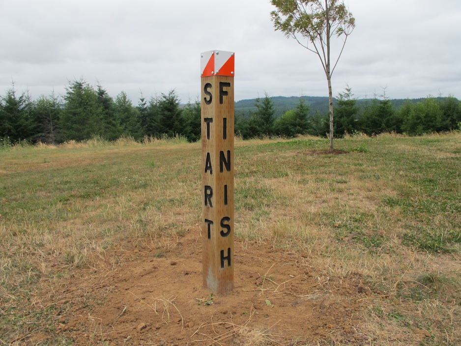
A permanent orienteering course, also known as a TRIM course, is one that has a post (or some other sort of permanent object) marking control locations instead of the standard box-kite type markers used for one-day meets.
These courses may be used for either competition, a modest stroll to practice your map reading, or as an excellent opportunity for individuals, families, and school, scout, civic and military groups to practice navigation skills.
Visiting orienteers from outside the area are welcome to try these courses and sample the Portland terrain.
Please note that these beginner-friendly courses require very little in the way of compass skills, and are about 95% map reading.
See the links below for complete details, printable maps and control descriptions for our permanent courses.
Stub Stewart State Park - Located in the Oregon coast range about 45 minutes from Portland city center, Stub Stuart offers a dense network of trails, old logging tracks, and overnight camping. Stub has a beginner and advanced/beginner course. NOTE: this course has been REMOVED as of 2023. We plan to replace it with a phone app orienteering soon.
Multnomah Village Urban-O - The Multnomah Village neighborhood in southwest Portland has a variety of twisty small streets, connecting pathways and staircases, and beautiful Gabriel Park to offer a variety of urban orienteering challenges.
Mt. Tabor Park #1 - Located in Southeast Portland, this extinct core of a volcano offers one of the classic views of the city in addition to a dense network of hilly trails and a good variety of vegetation.
Mt. Tabor Park #2 - Mt. Tabor, one of our most popular venues, now has a second permanent course. This one is based on the botany marker posts placed by Friends of Mt Tabor.
Council Crest Urban-O #1 - The Portland Heights / Council Crest neighborhood features the highest point in the city, lots of hills, secluded streets, secret staircases, and some of the nicest houses in town.
Council Crest Urban-O #2 - The Council Crest neighborhood offers so much good terrain for urban orienteering, we made an entirely new course with 50 new control points.
Hoyt Arboretum - The beautiful Hoyt Arboretum has some good hills and a dense trail network, a good area for the intermediate / advanced orienteer.
Gabriel Park - New for 2015, this SW Portland park has a nice blend of cool cedar forest, open fields, and decent hills.
Camp Currie - This privately owned youth camp in Camas WA has a short course on a 1:4000 scale map with set posts as control markers. Note - This map is ONLY for use by youth groups staying at the camp or by special permission. (This was an Eagle Scout project.)