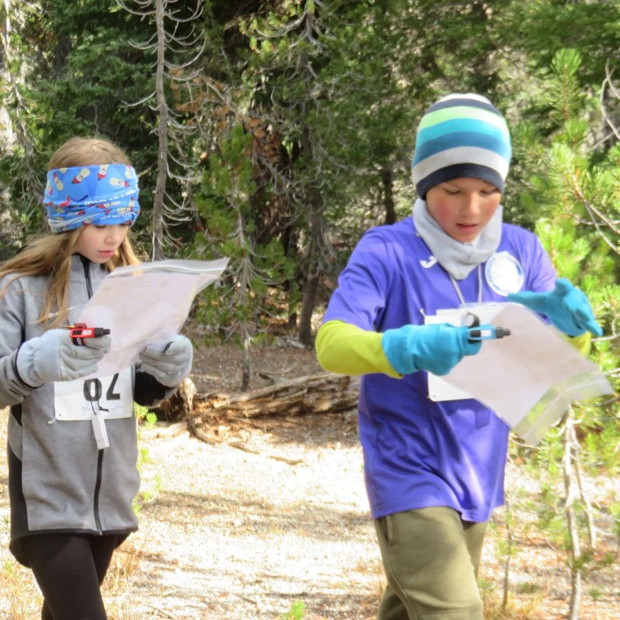
Upcoming (and past) orienteering events
Tahoe 4 day
Our friends at the Bay Area Orienteering Club are hosting a four-day event in the Lake Tahoe area.
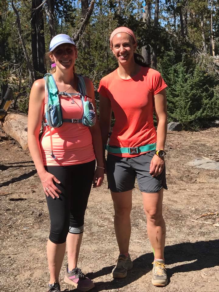
Deschutes Daze (Registration OPEN)
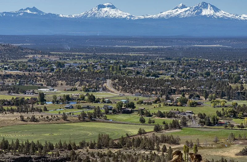
CROC is hosting a four day Central Oregon orienteering festival near Bend, Aug 6-9.
This will also be the 2026 Western States Orienteering Championships!
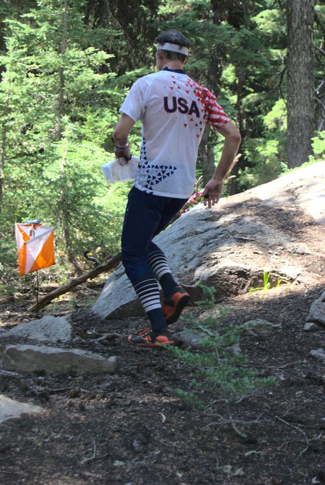
Air Quality Impact from Wildfires (Last updated 7/28/26)
We are working on a contingency plan for the Friday Orchards event. The next update will be posted 7/29.
We know many participants are keeping an eye on the current smoke conditions in Central Oregon. The health and safety of our participants, volunteers, organizers, and spectators is our top priority.
We are moving forward with Deschutes Daze with adjustments as required.
In this update you will find information on our expectations for the events, the current situation including permits, and our criteria for event decisions if there is smoke:
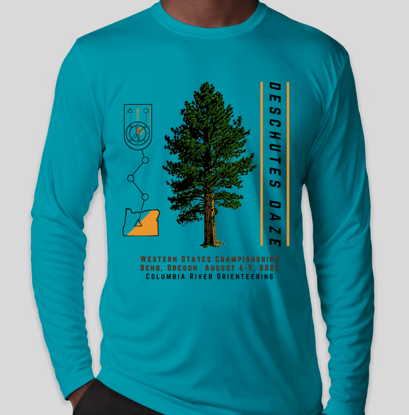
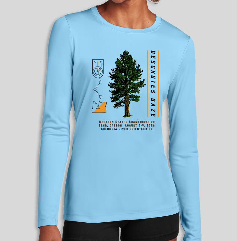
Deschutes Daze!
Enjoy the return of our popular Deschutes Daze festival, last held in 2021, this time featuring courses for all ability levels, a regional championship, a National Ranking Event, and a new map.
One National Ranking Event with standard OUSA Competitive and Open Classes
Western States Championship spans three days
For competitive and recreational participants
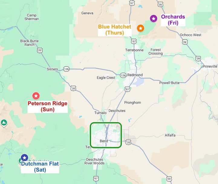
Venues
Thursday August 6: Crooked River National Grasslands, Day 1, on a new map (Blue Hatchet)
Friday August 7: Crooked River National Grasslands, Day 2, with the event center at a new location on our existing map (Orchard)
Saturday August 8: NRE competition at Dutchman Flat near Mt. Bachelor
Sunday August 9: Peterson Ridge south of Sisters, Oregon on a map we first used in 2021, newly improved.
The first two days feature high desert open terrain including juniper woodlands, sparse sagebrush, and dry meadows. The scents of juniper and sage will welcome you to two days of adventure in this special place. Race start elevation at 3000’ on Day 1 and 3500’ on Day 2. Day 1 (Blue Hatchet) is on a new map by Rex Winterbottom (terraloco).
The third day of racing is on the Dutchman Flat map, created in 2003 by Valentin Vladimirov and updated many times including this year. The courses include areas of fast-running forest with little undergrowth under a dark canopy of massive firs. Alpine meadows and a clear running creek also traverse the course area. Nordic ski and snowshoe trails add interesting navigational handrails. The race start elevation is 6400’ with 800 m walk from parking.
The fourth day at Peterson Ridge brings us to the classic Cascades east slope environment. Open forest with huge ponderosa pines, a giant’s volcanic rock garden with cliffs and monoliths, and arid scrubland with aromatic sage and snowbrush. Elevation 3800’
The climate in Central Oregon in July is typically warm and dry. Average high temperatures are around 27°C (80°F), cooler at Dutchman Flat. There is a risk of excessive heat. The probability of rain is very low.
Click the image below to open a Google map of the event locations.
Registration Information
Use the registration form to sign up for
Orienteering courses
Camping at Tumalo State Park
T-Shirt
Saturday Evening Banquet in the Park
Day-of-event volunteer opportunities
Note: registrations will be limited at 150. It is possible that registration will close early when we reach this capacity limit.
Early registration fees will be available until the end of May. Regular registration fees begin on June 1 and prices go up on July 13. Registration will close on August 2, or sooner if we hit the 150 participant limit.
| Race | Adult | Group up to 4 |
Junior age 20 and under | |
|---|---|---|---|---|
| Early registration ends 5/31 |
Day 1, 2, 4 Day 3 NRE Package |
20 40 90 |
20 + 8/addl n/a n/a |
12 22 50 |
| Regular registration ends 7/12 |
Day 1, 2, 4 Day 3 NRE Package |
25 45 110 |
25 + 8/addl n/a n/a |
15 25 60 |
| Late registration ends 8/2 |
Day 1, 2, 4 Day 3 NRE Package |
35 55 145 |
35 + 8/addl n/a n/a |
20 30 75 |
Refunds
Refund requests will be considered if your plans change or if you are not feeling well. Please contact the registrar.
For courses
100% if requested at least one week before the event
(or if you are staying home due to illness or injury)100% if unable to attend due to unhealthy smoke levels or if events are cancelled
For banquet and camping
100% if requested on or before July 25
No Refund after that
The T-shirt is not refundable but we can mail it to you.


Events
All event information in this table is subject to change. Please refer to the official Event Bulletin for detailed information such as driving directions.
All events will have assigned start times. Start times on Day 1 are between noon and 2:00pm; start times for Days 2, 3, 4 are between 10:00am and noon.
| Date | Venue | Event | Venue Location | Walk to Check-In |
Walk to Start |
|---|---|---|---|---|---|
| Thursday August 6 |
CRNG White, Yellow, Orange, Brown, Green, Red |
WSC Point-to-point |
About 15 miles SE of Madras 35 mile drive from Bend |
1 - 10 min | 1 min |
| Friday August 7 |
CRNG White, Yellow, Orange, Brown, Green, Red |
WSC Point-to-point |
About 15 miles SE of Madras 35 mile drive from Bend |
5 min | 10 min |
| Saturday August 8 |
Dutchman Flat Standard OUSA competitive classes/courses |
WSC NRE Classic Distance |
Park at the Mt. Bachelor Ski Area West Village parking lot 20 miles SW of Bend |
10 min | 10 min |
| Sunday August 9 |
Peterson Ridge Beginner, Intermediate, Short Adv, Medium Adv, Long Adv |
Point-to-point | About 10 miles south of Sisters which is 20 miles NW of Bend |
1 min | 1 min |
NRE = National Ranking Event, results sent to OUSA for your national ranking
WSC = Western States Championship event, results combined to determine the 2026 Western States Champions
Western States Championships
Deschutes Daze is the Western States Championships for 2026!
Residence in a western state and OUSA membership makes you eligible to compete, earn awards and bask in glory as Western States Champion.
Rankings for Western States Championships are based on your two best times for the events on Thursday, Friday, and Saturday. That means if you compete on all 3 days you get to drop your worst result. For each event and class: The winner receives 1000 points and everyone else receives points based on their percent behind the winner’s time.
The competition classes for Western States Championships are similar to the standard OUSA competition classes, with some classes combined.
EventReg will offer all the classes you are allowed to register in based on your age and sex. Most participants will select the age-numbered class closest to their actual age. This may be a different age-number for Thursday (CRNG Blue Hatchet) and Friday (CRNG Orchard) than for Saturday (Dutchman Flat NRE), but they are compatible for computing the combined score if they appear on the same row in the table linked above.
Unusual participants who are “running up”, for example a 55 year-old man running in the M-21+ class on Saturday, should pick the corresponding class for the other days to make their scores combinable.
Course-color classes, such as F-Brown or M-Orange, are not competitive for the Western States Championship. Groups must register on a Course-color class.
Confused? Use the contact form below and we’ll answer any questions.
Accommodations
Tumalo State Park Group Camp
We have reserved both group campsites at Tumalo State Park (already full), lat long coordinates: 44.1284, -121.3315. (Copy/paste these into Google maps or mapping app to get driving directions.) Just 6 miles from Bend.
This is a full service campground with well maintained showers. The group camp is set apart from the other campsites, shaded by tall ponderosas. The restroom building has electrical outlets. There is water next to the tent sites.
You can sign up for tent camping in the group campsite with your Deschutes Daze registration. Each reservation is for one tent (single, couple, or family) with one car, for 3 nights (Thursday through Sunday). There are 20 spaces, of which 2 may be occupied by a small camper such as a Sprinter van.
Other Camping
Sisters Creekside Campground has reservable sites in a pleasant setting in the town of Sisters.
Pringle Falls Campground in La Pine has reservable sites along the Deschutes River.
Skull Hollow Campground about 9 miles from Terrebonne has non-reservable sites but is not likely to fill up. It is pleasant but hot during the day. No water
Haystack Reservoir Campground about 13 miles from Terrebonne has reservable and non-reservable sites. It is pleasant but hot during the day. Swimming allowed if no cyanobacteria advisory. No water
Public showers may be available at Juniper Swim & Fitness Center
800 NE 6th St. Bend, OR 97701 , Tel. (541) 389-7665, call to confirm
Up in the mountains, there are several walk-in, low-cost, high-scenery, Forest Service campgrounds located on Century Drive west of Bend (near the Dutchman Flat event). These are first-come, first-served, not reservable (no water)
Dispersed camping is allowed in the national forests, for example on the road to Dutchman Flat or around our new Peterson Ridge map south of Sisters (no water)
Other Lodging
There are numerous hotel/vacation rental/B & B options in Bend
Banquet and Award Ceremony
The social event of the summer will take place on Saturday. We will have food from Parilla Grill, serving wraps, street tacos, and salad, including vegetarian and vegan options.
The banquet will be at Miller’s Landing Park in Bend. Food will be served buffet-style. Soft drinks and water will be provided. We are working on a permit for BYO beer/wine.
The evening will include social time and the presentation of the Western States Championships awards.
Saturday August 8 - arrive as early as 5:00 pm - dinner served 6 pm
Sign up for food via the registration link above
Adults (age 13 and up): $22
Kids (ages 6-13): $11
Bring your own lawn blanket and/or chairs if convenient, as we’ll be sitting on the grass next to the river.
T-Shirt
Two styles are offered via the registration link above. Please follow these links for detailed descriptions and size charts.
Note on sizing: The unisex style runs large by 1/2 size. Consider picking the smaller if you are between sizes. The women's style is true to size.
Wildfire
The event director will be monitoring local fire-prevention and fire-response agencies to assess potential risk. We will be proactive to be aware of any nearby fires and postpone the event if there is a risk of an evacuation alert.
The Event Director is subscribed to the Deschutes County emergency alerts so that we will know about any problems as they arise. It is unlikely for any new fire to develop quickly enough for the venue to become subject to an evacuation alert during the event, but if that does happen we will focus on getting everyone out of the area as quickly as possible.
Smoke from Wildfires
For smoke in the air, we will follow the US Environmental Protection Agency air quality index (AQI) guidelines to determine if we can use volunteers in the area or hold competition.
Contact
Please use this contact form to reach the Deschutes Daze 2026 planning team

Member Training: Control Picking
Member Training: Control Picking
August 22, 2026
10:00 am - noon
Laurelhurst Park in SE Portland
For CROC members only
Control picking is an exercise to practice quick changes in direction as you enter and leave a control. Laurelhurst Park is a small urban park with a lot of people - don’t get distracted! Start between 10:00 and 11:00 am; finish by noon.
This training is for CROC members only; there is no cost. Register here by August 20 and we’ll send you the exact starting point. For questions and suggestions contact trainer Anndy.

CROC Board Meeting
CROC holds quarterly board meetings. All members may attend.
Meeting dates are generally scheduled for: first Monday of December, March and June, and the second Monday of September, from 7:00 pm to 9:00 pm.
The meeting location may vary. Meetings may be online or in-person.
Please go to About > Contact and email us to find out where the next meeting will be, and to confirm the actual date.

Billy Bob Classic (cancelled)
This event is cancelled.
We hope to reschedule in late summer 2027.

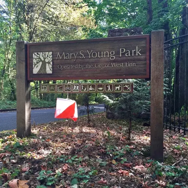
Mary S. Young State Park
The permit for this event is pending.
Advance online registration is required for this event.
Register before Wed Oct 14 end of day (11:59pm)
Online registration link coming here approx 1 month before event date
Quick Info
Courses: Classic point to point orienteering format. Detailed course information will be posted closer to the event date.
Times: Map handout opens at 10:30am. Start your course anytime between 11:00am and 1:00pm. All courses close at 3pm.
Everyone welcome: members, nonmembers, families, pets, and youth groups.
Courses set by: TBA
Event director: TBA
Event overview
Mary S. Young Park may be the most scenic park you never heard of. The western part of the park features a network of trails winding through a cool shady forest. Near the parking areas, a couple of large open fields offer contour detail, trees, bushes, and other features. The eastern part of the park plunges to the Willamette River on trails that negotiate a dramatically eroded landscape. The river's edge has rock formations, sandy beaches, and islands. All courses will use the trail system; so bring your running shoes. Well, for the longer courses, bring older running shoes.
We use an electronic scoring and timing system known as “e-punch” Each entry or team needs to have an e-punch stick. If you don't have your own e-punch stick, you can rent one at registration for an additional $5. Using the e-punch is easy. You can learn how at the event, or read about e-punch here.
CROC thanks our land management partner City of West Linn Parks.
Courses
Course details will be added here closer to the event date.
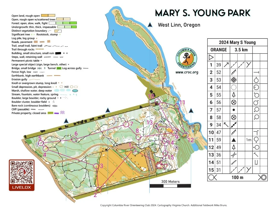
Map example
Here's an example of a map from this venue. (See all maps from previous events here.)
New to Orienteering? Welcome!
Our events are open to both members and non-members. Beginners, families and dogs are welcome.
Have a look at our “New to O?” webpage, which covers just about every question you may have.
At most events, we offer free beginner clinics (they take about 10 minutes) to teach you everything you need to know. These are typically at half-hour intervals; choose your time slot on the registration page.
If you'd like to get reminders about upcoming events, sign up at our newsletter page. (No more than a couple of emails per month, we promise!)
Thanks for coming out and trying something new, we think you'll like it!
Times
Check-in and map pick-up: 10:30 am - 1:00 pm
Beginner clinics: Usually 11:00 am and 11:30 am
Course starts: 11:00 am - 1:00 pm
All courses close: 3:00 pm (controls will be picked up)
All participants must punch in at the finish and download their times even if they do not finish their course, or if they return after the course closes. This is how we make sure that everyone returns safely.
Registration and other costs
Event Cost
$17 base price - individuals
$22 base price - groups of 2 or more
- Subtract $5 if you’re a member or CROC or other O-club (Join CROC)
- Subtract $5 if you have your own e-punch (Buy your own epunch)
Online registration link coming here approx 1 month before event date
Livelox - GPS tracking and route review tool
CROC uses Livelox. This is an interactive web based tool that enables you to see your exact route/track on the orienteering map, and compare them with other competitors after your event.
To use this tool, you need to record a GPX track while you are on the course. You can do this with various watch and phone based apps.
Volunteers
All CROC orienteering events are put on by volunteers, and the meet director can almost always used some extra helpers. Please keep in mind:
No prior experience is needed for many of the tasks
You can help out AND still run your course of choice
Typical ways to assist are: helping with starts, checking in folks at registration, and picking up control flags after the course closes.
If you'd like to help you can choose a task and a time shift when you register online. Thanks!
Results
Times are posted to the Events & Results page a few days after the event.
Map and Driving Directions
45.3804, -122.6278
Latitude longitude coordinates of the event site. Copy and paste these into a mapping app on your phone or Google maps to get a map and driving directions to this location.
From Portland City Center:
Get on Macadam South, which runs along the Willamette River on the west bank. (This road is OR 43)
Go south on OR 43 to Lake Oswego, about 6 miles.
From Lake Oswego, continue south on OR 43 about 2.8 miles to the park.
Follow the orienteering signs to the main loop parking lot at the east end of the park.
CROC Board Meeting
CROC holds quarterly board meetings. All members may attend.
Meeting dates are generally scheduled for: first Monday of December, March and June, and the second Monday of September, from 7:00 pm to 9:00 pm.
The meeting location may vary. Meetings may be online or in-person.
Please go to About > Contact and email us to find out where the next meeting will be, and to confirm the actual date.
Short Course Series: Gabriel Park
MemberTraining: Short Course Series: Gabriel Park
Wednesday, July 22, 2026
6:30-8:00 p.m.
Gabriel Park in SW Portland
For CROC members only
The last of this year’s Short Courseswill be at Gabriel Park.
Short Courses offer CROC members the opportunity to practice orienteering at Portland area parks on Wednesday evenings, while the sun’s out. These Short Courses are free for members, they’re marked by small cones or flags, and there are no results (leave your e-stick at home). Start between 6:30 and 7:00 p.m. and finish by 8:00 p.m. These practices are a great way to have some fun and get a little exercise on a summer night.
Gabriel Park offers everything from trails in the woods to a skate park, a community garden, a swimming pool and hills. There’s a play area for young children, and one for dogs.
This training is for CROC members only; there is no cost. Register here by July 20 and we’ll send you the exact starting point. For questions and suggestions contact trainer Alison Stone or training coordinator Anndy Wiselogle.
Short Course Series: Council Crest
Short Course Series: Council Crest
Wednesday, July 15, 2026
6:30-8:00 p.m.
Council Crest Park in SW Portland
For CROC members only
In July CROC offers club members the opportunity to practice orienteering at Portland area parks on Wednesday evenings, while the sun’s out. These Short Courses are free for members, they’re marked by small cones or flags, and there are no results (leave your e-stick at home). Start between 6:30 and 7:00 p.m. and finish by 8:00 p.m. These practices are a great way to have some fun and get a little exercise on a summer night.
Come out and enjoy a wonderful evening at one of Portland's highest parks. It will be an easy 2K sprint around the park. Map handout will be between 6:30 and 7:00 PM. Bring a picnic, hang out and watch the sunset for the finish of the day.
This training is for CROC members only; there is no cost. Register here by Monday, July 13 and we’ll send you the exact starting point. For questions and suggestions contact trainer Ken Wenzel or training coordinator Anndy Wiselogle.
The next Short Courses is:
July 22: Gabriel Park in southwest Portland

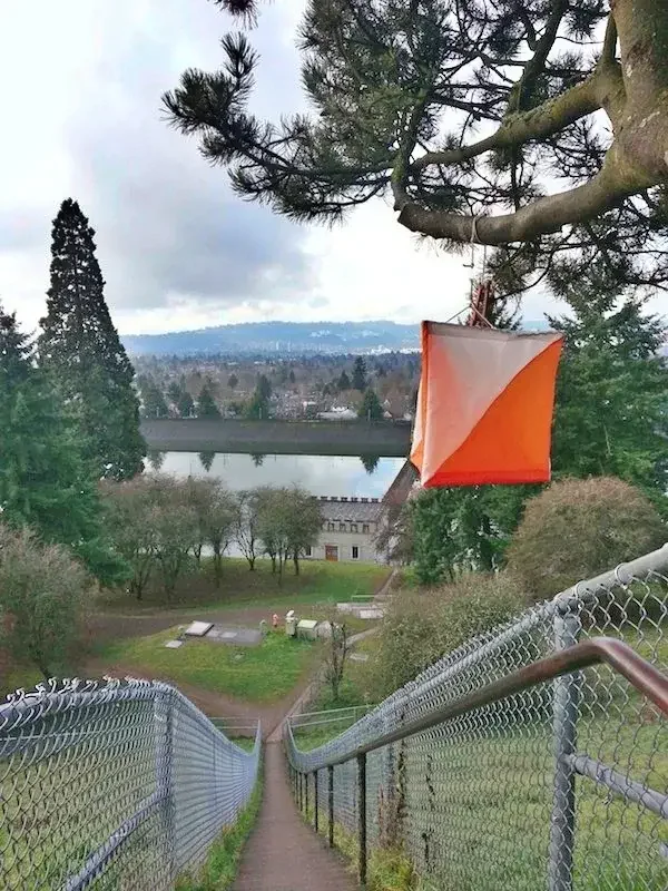
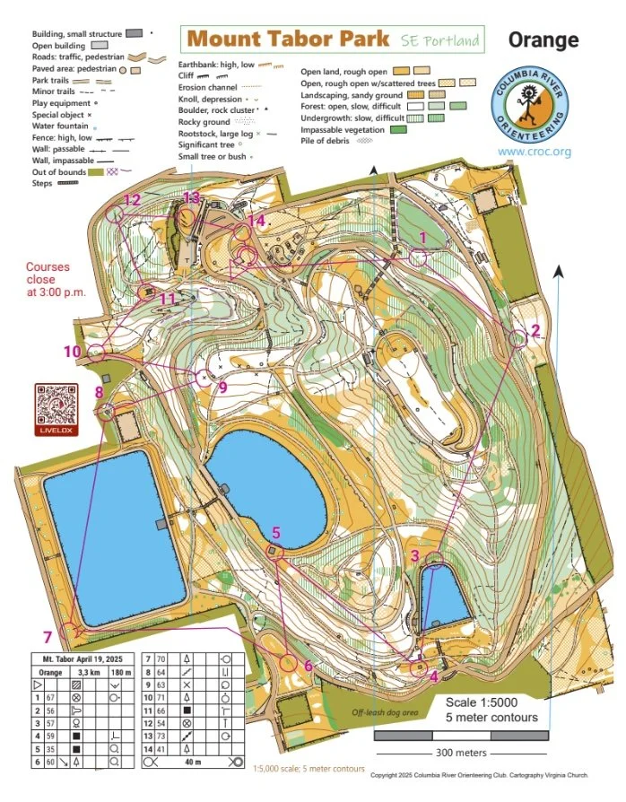
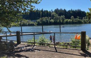
Mt. Tabor Classic (Registration OPEN)
Advance online registration is required for this event.
Register before Wed July 8 end of day (11:59pm)
Quick Info
Courses: Classic point to point orienteering format. Five different courses for all skill levels.
Times: Check-in opens at 10:30am. Start your course between 11:00am and 1:00pm. All courses close at 3pm.
Everyone welcome: members, nonmembers, families, pets, and youth groups.
Courses set by: Anndy Wiselogle (beginner) and Andy Heydon (advanced)
Event director: Josh Kramer (events@croc.org)
Event Overview
Columbia River Orienteering Club returns to Mount Tabor Park almost every year, and it remains one of our most popular venues. The area offers challenging hills, reservoirs, sweeping city views, and the unique terrain of an extinct urban volcano.
A small parking area is available near the event center, but it will likely fill quickly. Additional parking is available along the road east of the event center in the areas marked in purple on the map below.
We use an electronic timing and scoring system called “e-punch.” Each participant or team will need an e-punch stick. If you do not have your own, one can be rented at registration for a small additional fee. E-punch is easy to learn — staff can help you at the event, or you can read more about it online before you arrive.
CROC also maintains two permanent orienteering courses at Mt. Tabor, available for free year-round if you would like to explore the terrain on your own. (Please note that the permanent course control points differ from those used for this event.) Visit the CROC website under "Get Better > Permanent Courses" for more information.
CROC thanks our land management partner Portland Parks and Recreation.

Courses
White: Beginner (12 controls, 1.8 km, 30 m climb)
Yellow: Beginner / Intermediate (13 controls, 2.6 km, 55 m climb)
Orange: Intermediate (14 controls, 3.1 km, 90 m climb)
Brown: Advanced Short (14 controls, 3.8 km, 145 m climb)
Green: Advanced Medium (18 controls, 4.8 km, 210 m climb)
All courses will run shorter in distance than normal due to elevation changes. Be prepared for some potentially steep climbs - especially on the advanced courses!
The start will be a short walk from the event center, up a flight of stairs to the SE Reservoir Loop Drive. Please use caution when walking along the main roads and be aware of any cars.
Crocodiles Hangout
For kids, Crocodiles Hangout will take place from 12:30 to 1:30. In addition to snacks and flying rings, we will have an activity: a "Fly" course for kids to practice orienteering on their own*. This will have a beginner level of difficulty, length 0.5 km, with 6 controls. There is no separate registration needed for this if you are already registered for a regular course. Meet at the picnic table just north of the playground, across the street from the event center.
*As with all our youth activities, we have a number of ways to balance independence with supervision, depending on how each kid wants to experience the course - just ask and we'll figure out the right approach for your family.
Map example
Here's an example of a map from this venue. (See all maps from previous events here.)
New to Orientering? Welcome!
Our events are open to both members and non-members. Beginners, families and dogs are welcome.
Have a look at our “New to O?” webpage, which covers just about every question you may have.
At most events, we offer free beginner clinics (they take about 10 minutes) to teach you everything you need to know. These are typically at 11 and 11:30. Choose which one you like during registration
If you'd like to get reminders about upcoming events, sign up at our newsletter page. (No more than a couple of emails per month, we promise!)
Thanks for coming out and trying something new, we think you'll like it!
Times
Check-in: 10:30 am - 1:00 pm
Beginner clinics: Usually 11:00 am and 11:30 am
Course starts: 11:00 am - 1:00 pm
Crocodiles Hangout 12:30 pm - 1:30 pm
All courses close: 3:00 pm (controls will be picked up)
All participants must punch in at the finish and download their times even if they do not finish their course, or if they return after the course closes. This is how we make sure that everyone returns safely.
Registration and other costs
Event Cost
$17 base price - individuals
$22 base price, teams of 2 or more
- Subtract $5 if you’re a member or CROC or other O-club (Join CROC)
- Subtract $5 if you have your own e-punch (Buy your own epunch)
Volunteers
All CROC events are put on by volunteers, and the meet director can almost always use some extra hands. Please keep in mind:
No prior experience is needed for many of the tasks
You can help out AND still run your course of choice
Typical ways to assist are: helping with starts and finishes, handing out maps, and picking up control flags after the course closes. Typical shifts are one hour long.
If you'd like to help, you can choose a task and time shift when you register online. Thanks!
Results
Results are posted to the Events & Results web page a few days after the event.
Directions and map to event
45.5150, -122.5960
Latitude longitude coordinates of the event site. Copy and paste these into a mapping app on your phone or Google maps to get a map and driving directions to this location.
The Event Center is East of the Mt. Tabor Picnic A, near the main parking area by the visitor center and the playground. The Park is currently renovating the shelter, so please respect all areas that are blocked off. Look for CROC signs as you approach the picnic area.
Here’s an interactive Google map of the event location.
Short Course Series: Sellwood Riverfront Park
Short Course Series: Sellwood Riverfront Park
Wednesday, July 8, 2026
6:30-8:00 p.m.
Sellwood Riverfront Park in SE Portland
For CROC members only
In July CROC offers club members the opportunity to practice orienteering at Portland area parks on Wednesday evenings, while the sun’s out. These Short Courses are free for members, they’re marked by small cones or flags, and there are no results (leave your e-stick at home). Start between 6:30 and 7:00 p.m. and finish by 8:00 p.m. These practices are a great way to have some fun and get a little exercise on a summer night.
Along the Willamette River, with a hawk enjoying the updrafts, Sellwood Riverfront Park is mostly flat, with the exception of climbing the butte (20 meters). It’s an urban park, with a ball field, climbing structure and a dog park. The course includes relatively medium-length legs and some control picking. The length is about 2.5 kilometers.
This training is for CROC members only; there is no cost. Register here by July 6 and we’ll send you the exact starting point. For questions and suggestions contact trainer Anndy Wiselogle.

Pacific NW Orienteering Festival Registration closes 5/31
Orienteering adventures at eight different venues. Hosted by:
Cascade Orienteering Club
Eastern Washington Orienteering Club
Mt. Hood Orienteering Club

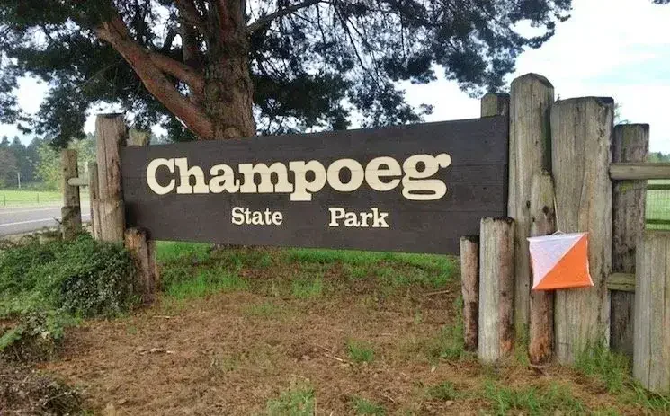
Champoeg State Park Classic
Advance online registration is required for this event.
Register before Wed June 3 end of day (11:59pm)
Quick Info
Courses: Classic point to point orienteering format. date. Five different courses for all skill levels.
Check-in opens at 10:30 am. Start your course between 11:00 am and 1:00 pm. All courses close at 3 pm.
Everyone welcome: members, nonmembers, families, pets, and youth groups.
Courses set by: Debbie Wenzel (beginner) and Virginia Church (advanced)
Event director: Mike Holliday and Kelly Whitty
Event Overview
On the banks of the Willamette River, Champoeg State Heritage Area is large and mostly flat, with a variety of vegetation and water features. Wildlife is abundant in this park (check out the bluebirds!). To protect some of this wildlife, certain areas are closed, and our courses will cover some new areas.
The start location is the Pioneer Memorial Pavilion at the west end of the park. If anyone has considered trying one of the longer orienteering courses, the extensive trail system and flatness make this park a good place to challenge yourself!
Poison oak is part of the plant community at Champoeg. While courses are designed to avoid it, long pants are a good idea.
We use an electronic scoring and timing system known as “e-punch”. Each entry or team needs to have an e-punch stick. If you don't have your own e-punch stick, the rental cost is included in your registration fee. Using e-punch is easy. You can learn how at the event, or read about e-punch here. For this event, AIR+ is enabled for optional contactless control punching with your Sportident SIAC card.
CROC thanks our land management partner Oregon State Parks.
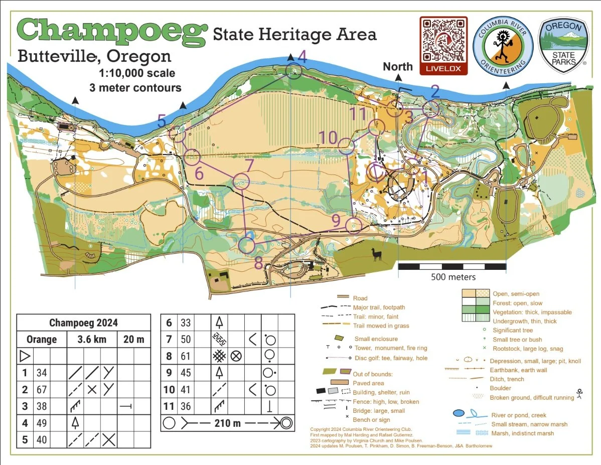
Courses (final)
White (Beginner) 1.8 km, 10m climb, 14 controls, 1:7500 scale
Yellow (Beginner / Intermediate) 3.9 km, 15m climb, 14 controls, 1:7500 scale
Orange (Intermediate) 4.3 km, 10m climb, 12 controls, 1:7500 scale
Brown (Advanced Short) 4.4 km, 10m climb, 12 controls, 1:7500 scale
Green (Advanced Medium) 5.6 km, 10m climb, 14 controls,, 1:10000 scale
All courses have near zero climb. Advanced courses have a lower navigational and physical challenge than average due to the nature of the venue. Vegetation fight is minimal.
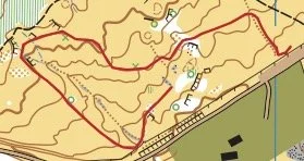
Map example
Here's an example of a map from this venue. (See all maps from previous events here.)
New to Orienteering? Welcome!
Our events are open to both members and non-members. Beginners, families and dogs are welcome.
Have a look at our “New to O?” webpage, which covers just about every question you may have.
At most events, we offer free beginner clinics (they take about 10 minutes) to teach you everything you need to know. These are typically at half-hour intervals; choose your time slot on the registration page.
If you'd like to get reminders about upcoming events, sign up at our newsletter page. (No more than a couple of emails per month, we promise!)
Thanks for coming out and trying something new, we think you'll like it!
Times
Check-in: 10:30 am - 1:00 pm
Beginner clinics: Usually 11:00 am and 11:30 am
Course starts: 11:00 am - 1:00 pm
All courses close: 3:00 pm (controls will be picked up)
All participants must punch in at the finish and download their times even if they do not finish their course, or if they return after the course closes. This is how we make sure that everyone returns safely.
Registration and other costs
Park Fee: Oregon State Parks charges $10 for day use, and $60 for a 12 month pass. The day pass fee may be paid at either the welcome center (one mile after entering the park) or at the "iron ranger" fee box in each parking lot (exact change required.)
Event Cost
$17 base price - individuals
$22 base price - groups of 2 or more
- Subtract $5 if you’re a member or CROC or other O-club (Join CROC)
- Subtract $5 if you have your own e-punch or if you buy one during registration. (Buy your own epunch)
Livelox: GPS tracking and route reviewing tool
CROC uses Livelox, which is an interactive web based tool that enables you to see your exact route/track on the orienteering map, and compare them with other competitors.
Volunteers
All CROC events are put on by volunteers, and the meet director can almost always use some extra hands. Please keep in mind:
No prior experience is needed for many of the tasks
You can help out AND still run your course of choice
Typical ways to assist are: helping with starts and finishes, handing out maps, and picking up control flags after the course closes. Typical shifts are one hour. If you'd like to help, you can choose a task and time shift when you register online. Thanks!
Results
Results are posted to the Events & Results web page a day or two after the event.
Driving directions and location
Latitude longitude coordinates of the event: 45.25532, -122.90483. (Parking at Riverside Day Use area). Copy/paste these latitude longitude coordinates into Google maps or your smartphone mapping app to get a map and driving directions to the event.
Member Training - Line-O
Member Training - Line-O
June 6, 2026
10:00-11:00 a.m.
Champoeg State Park near Donald
For CROC members only
The Line-O exercise invites you to practice fine map reading skills as an orienteer. There’s a meandering red line on the map. Your mission is to follow the line in the terrain, and note how many markers you find along the route. Extra challenge: Mark on your map where each marker is.
The workshop starts at 10:00 am at Champoeg Park, and you’ll have time to finish in order to do a course at the Champoeg meet.
This training is for CROC members only; there is no cost. Register here by June 3 and we’ll send you the exact starting point. For questions and suggestions contact trainer Anndy.
CROC Board Meeting
CROC holds quarterly board meetings. All members may attend.
Meeting dates are generally scheduled for: first Monday of December, March and June, and the second Monday of September, from 7:00 pm to 9:00 pm.
The meeting location may vary. Meetings may be online or in-person.
Please go to About > Contact and email us to find out where the next meeting will be, and to confirm the actual date.
Hamilton Island Classic

Advance online registration is required for this event.
Register before Wed May 6 end of day (11:59pm)
Quick Info
Courses: Classic point to point orienteering format. (Course details are below)
Times: Check-in opens at 10:30am. Start your course between 11:00am and 1:00pm. All courses close at 3pm.
Everyone welcome: members, nonmembers, families, pets, and youth groups.
This is the 3rd in our 2026 Classic Series competition! Take the best 5 of 7 races throughout the season and see how you compare to others in your category! More information on the 2026 Classic Series page.
Courses set by: Sam Scheiss and Julie Pohl
Event director: Amy Winston
Event Overview
Hamilton Island was initially "discovered" for Americans by Lewis and Clark in 1805, and they named it Strawberry Island. That name was eventually changed to Hamilton Island in honor of a Samuel M. Hamilton, a nearby land owner in the mid 1800s. The island stopped being a real island in the 1970s when construction debris for the Bonneville North Power house filled in one of the surrounding waterways.
The terrain is mostly wide open in all directions with scattered copses. There is one large low hill to go around or climb multiple times. There are marshy areas, some thickets, and shorelines. You can enjoy beautiful river gorge views and lots of wildlife.
You may encounter blackberry vines and thistles. The areas covered by blackberries have been updated somewhat, although mowing may change their configuration or have added a trail or two through patches. Lower leg protection / gaiters are recommended on the more advanced courses.
We use an electronic scoring and timing system known as “e-punch”. Each entry or team needs to have an e-punch stick. If you don't have your own e-punch stick, the rental cost is included in your registration fee. Using e-punch is easy. You can learn how at the event, or read about e-punch here.
CROC thanks our land management partner the US Army Corps of Engineers.
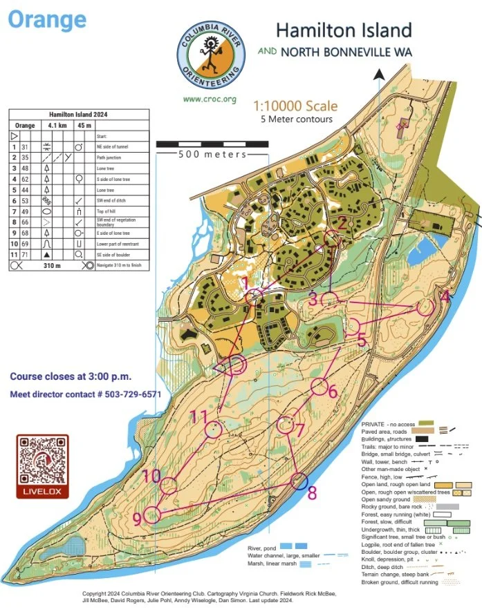
Courses
White: Beginner (2.9 km, on-trail navigation)
Yellow: Beginner/Intermediate ( 3.3 km, on-trail and near trail navigation)
Orange: Intermediate (6.3 km, off-trail, moderate navigational challenge)
Brown: Short Advanced (5.0 km, off-trail, high navigational challenge)
Green: Advanced (8.1 km. off-trail, high navigational challenge)
Map example
Here's an example of a map from this venue. (See all maps from previous events here.)
New to Orientering? Welcome!
Our events are open to both members and non-members. Beginners, families and dogs are welcome.
Have a look at our “New to O?” webpage, which covers just about every question you may have.
At most events, we offer free beginner clinics (they take about 10 minutes) to teach you everything you need to know. These are typically at half-hour intervals; choose your time slot on the registration page.
If you'd like to get reminders about upcoming events, sign up at our newsletter page. (No more than a couple of emails per month, we promise!)
Thanks for coming out and trying something new, we think you'll like it!
Times
Check-in: 10:30 am - 1:00 pm
Beginner clinics: Usually 11:00 am and 11:30 am
Course starts: 11:00 am - 1:00 pm
All courses close: 3:00 pm (controls will be picked up)
All participants must punch in at the finish and download their times even if they do not finish their course, or if they return after the course closes. This is how we make sure that everyone returns safely.
Registration and other costs
Event Cost
$17 base price - individuals
$22 base price - groups of 2 or more
- Subtract $5 if you’re a member or CROC or other O-club (Join CROC)
- Subtract $5 if you have your own e-punch (Buy your own epunch)
Livelox: GPS tracking and route reviewing tool
CROC uses Livelox, which is an interactive web based tool that enables you to see your exact route/track on the orienteering map, and compare them with other competitors.
Volunteers
All CROC events are put on by volunteers, and the meet director can almost always use some extra hands. Please keep in mind:
No prior experience is needed for many of the tasks
You can help out AND still run your course of choice
Typical ways to assist are: helping with starts and finishes, handing out maps, and picking up control flags after the course closes. Typical shifts are one hour.
If you'd like to help, you can choose a task and time shift when you register online. Thanks!
Results
Results are posted to the Events & Results web page a few days after the event.
Driving directions and map to event
Latitude longitude coordinates of event: 45.6337, -121.9788
Click for a Google map, or copy/paste these latitude longitude coordinates into Google maps or your smartphone mapping app to get a map and driving directions to the event.
Note:
There will NOT be a CROC sign on Highway 14, as the locals like to (ahem) remove them.
The event center is at the baseball field in North Bonneville, NOT at the parking lot near the river as in the past few years. See directions and map below.
Driving directions from Portland (allow about 1 hour):
Drive east on I 84, take Exit 44 at Cascade Locks.
Cross the Bridge of the Gods into Washington (Toll $2).
Turn left (west) onto Hwy 14 and go approx. 4 miles.
Turn left at the Chevron station in the town of North Bonneville.
In 200 feet, take a right onto Cascade Dr. Follow the blue signs to the ball field. In 0.4 miles, take a left onto Portage Drive. Go to the end of Portage Drive.
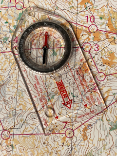
Member Training: Compass use for Orienteering
Compass Use for Orienteering
May 9, 2026
10:00 - 11:00 a.m.
Hamilton Island, North Bonneville, Washington
For CROC members only
Learn and practice orienting the map, using bearings to locate controls, and judging distance to know where you are on the map. Several practice exercises will help you hone these skills. This workshop is useful for new members and everyone who wants to improve their compass skills. As with other trainings, this is open to CROC members only, and there is no additional fee.
Bring your compass, or borrow one at the training.
This training is for CROC members only; there is no cost. Register here by May 6 and we’ll send you the exact starting point. For questions and suggestions contact trainer Anndy.
Member Training: Reading Terrain Contours
Member Training: Reading Terrain Contours
Sunday, April 26, 2026
10:00 am - noon
Mt. Tabor Park in southeast Portland
For CROC members only
Join us for a fun training activity at Mt. Tabor on April 26th (for CROC members only).
Reading the terrain and matching what you see against the map is an important skill for improving your orienteering. This training starts with some explanation of common terrain features one finds on orienteering maps (hills, valleys, reentrants, spurs, saddles, depressions, narrow streams, etc.) and follows it up with a fun exercise on our Mt. Tabor map — or rather, on a modified version of our Mt. Tabor map: we have removed everything but the terrain contours from map!
All the trails and trees and stumps and vegetation are still there in real life, but they aren’t there on your map so you can’t use them to orient yourself while looking for the controls. The only thing you’ll be able to use to navigate is the terrain itself! This terrain-only experience will heighten your awareness of the land forms that underlie all the other things on the map and will help you orient yourself better when you return to a full map.
This training is for CROC members only; there is no cost. Register here by April 24 and we’ll send you the exact starting point. For questions and suggestions contact trainer Bjorn Freeman-Benson or training coordinator Anndy Wiselogle.

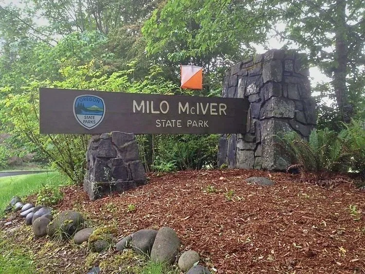
Milo McIver State Park
Quick Info
Courses: Classic point to point orienteering format. Five different courses for all skill levels.
Times: Check-in opens at 10:30. Start your course between 11:00am and 1:00 pm. All courses close at 3 pm.
NEW: Maps for Orange, Brown and Green courses will be handed out at the start instead of at check-in. Making route decisions on the fly is a challenging and fun element of orienteering that we want to be part of our events.
Everyone welcome: members, nonmembers, families, pets, and youth groups.
Courses set by: Becky Bruns and Mark Sandifer
Event director: Bjorn Freeman-Benson
Event overview
Come out and enjoy orienteering on the varied terrain of this large riverside park. McIver State Park is a 1,600+-acre park with many miles of trails winding along the Clackamas River, near Estacada, OR. The park is very accessible, yet large enough to give participants a feeling of "getting out there." There is a nice mix of paved paths, open fields, and wooded areas. The terrain is both flat and hilly.
We use an electronic scoring and timing system known as “e-punch” Each entry or team needs to have an e-punch stick. If you don't have your own e-punch stick, you can rent one at registration for an additional $5. Using the e-punch is easy. You can learn how at the event, or read about e-punch here.
CROC thanks our land management partner Oregon State Parks.
New to Orienteering? Welcome!
Our events are open to both members and non-members. Beginners, families and dogs are welcome.
Have a look at our “New to O?” webpage, which covers just about every question you may have.
At most events, we offer free beginner clinics (they take about 10 minutes) to teach you everything you need to know. These are typically at half-hour intervals; choose your time slot on the registration page.
If you'd like to get reminders about upcoming events, sign up at our newsletter page. (No more than a couple of emails per month, we promise!)
Thanks for coming out and trying something new, we think you'll like it!
Courses
White: Beginner (2.2 km, on trail navigation)
Yellow: Beginner / Intermediate (3.0 km, on-trail and near-trail navigation)
Orange: Intermediate (3.8 km, off-trail, moderate navigational challenge)
Brown: Short Advanced (4.2 km, 10 off-trail, high navigational challenge)
Green: Advanced (5.5 km, off-trail, high navigational challenge)
Times
Check-in and map pick-up: 10:30 am - 1:00 pm
Beginner clinics: Usually 11:00 am and 11:30 am
Course starts: 11:00 am - 1:00 pm
All courses close: 3:00 pm (controls will be picked up)
All participants must punch in at the finish and download their times even if they do not finish their course, or if they return after the course closes. This is how we make sure everyone returns safely.
Registration and other costs
Park Fee: Oregon State Parks charges $10 for day use, and $60 for a 12 month pass. The day use fee may be paid at the park entrance.
Event Cost
$17 base price - individuals
$22 base price - groups of 2 or more
- Subtract $5 if you’re a member or CROC or other O-club (Join CROC)
- Subtract $5 if you have your own e-punch (Buy your own epunch)
Livelox: GPS tracking and route reviewing tool
CROC uses Livelox, which is an interactive web based tool that enables you to see your exact route/track on the orienteering map, and compare them with other competitors.
Volunteers
All CROC orienteering events are put on by volunteers, and the meet director can almost always used some extra helpers. Please keep in mind:
No prior experience is needed for many of the tasks
You can help out AND still run your course of choice
Typical ways to assist are: helping with starts, checking in folks at registration, and picking up control flags after the course closes.
If you'd like to help you can choose a task and a time shift when you register online. Thanks!
Results
Times will be posted to the Events & Results page a few days after the event.
Map and directions to event
Latitude longitude coordinates of event: 45.3091, -122.3783
Copy and paste these coordinates (in decimal degree format) into Google maps or your smart phone to get a map and driving directions to the event.
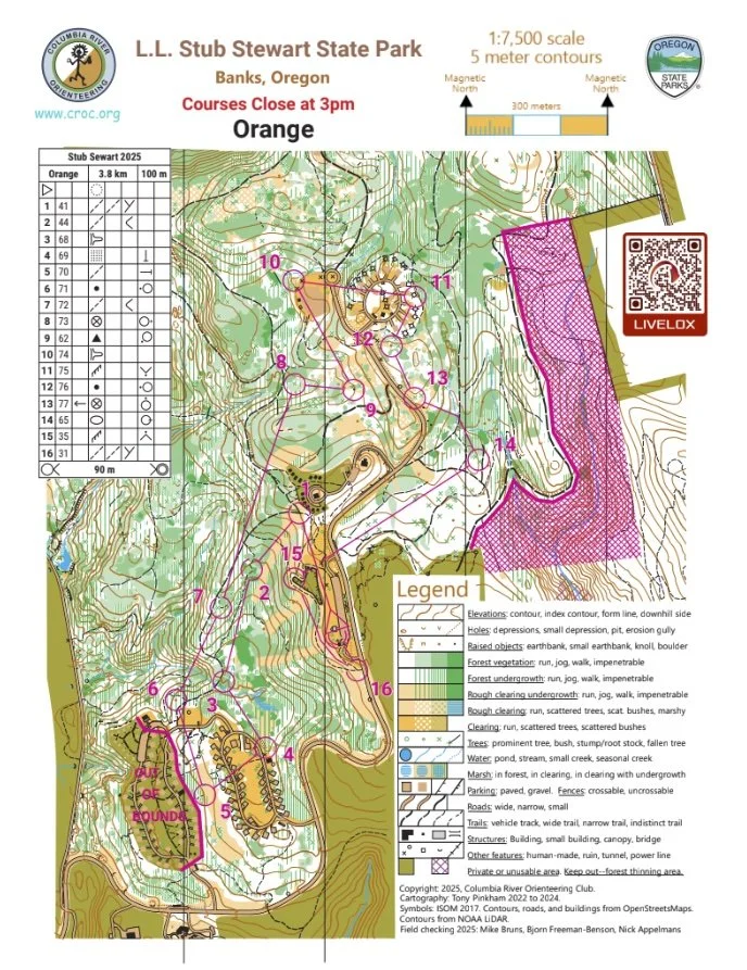
Stub Stewart State Park Classic

Advance online registration is required for this event.
Register before Wed Mar 25, end of day (11:59pm)
Quick info
Courses: Classic point to point orienteering format. Five different courses for all skill levels.
Times: Check-in opens at 10:30. Start your course between 11:00am and 1:00 pm. All courses close at 3 pm.
Intermediate Member Training: Offered before the meet on the topic of Five Techniques for Intermediate and Advanced Orienteers.
NEW: CROCodiles Hangouts at 1pm for all the kids!
NEW: Maps for Orange, Brown and Green courses will be handed out at the start instead of at check-in. Making route decisions on the fly is a challenging and fun element of orienteering that we want to be part of our events.
This is the first of our 2026 Classic Series competition! Take the best 5 of 7 races throughout the season and see how you compare to others in your category!
Event director: Sarah Vitak
Event Overview
Stub Stewart State Park is hilly, very forested and rugged terrain. The physical challenge for this event is higher than our typical local CROC meets. All courses, including White and Yellow are shorter in length but include more climb and steepness than usual. All courses include climbing over or around fallen logs. It’s a great adventure! So, choose your course with this in mind.
We use an electronic scoring and timing system known as “e-punch”. Each entry or team needs to have an e-punch stick. If you don't have your own e-punch stick, the rental cost is included in your registration fee. Using e-punch is easy. You can learn how at the event, or read about e-punch here.
CROC thanks our land management partner Oregon State Parks and Aaron Raines, our incredibly supportive Stub Stewart Park Manager.
Courses
White: Beginner 1.8 km, 10 controls, 40m climb
Yellow: Beginner / Intermediate 2.6 km, 11 controls, 85m climb
Orange: Intermediate 3.8 km, 16 controls, 130m climb
Brown: Advanced Short 3.0 km, 14 controls, 100m climb
Green: Advanced Medium 4.2 km, 18 controls, 160m climb
Courses set by: Anndy Wiselogle, Marsha Holliday and Mike Holliday
COURSE NOTES
Advanced Brown & Green
Welcome to another spring orienteering event at Stub Stewart! Be prepared for wet and muddy conditions, deadfall and vegetation crossings and plenty of stumps. The amount of blackberries and prickly vegetation is minimal but leggings or gaiters are recommended. Many of the mapped seasonal water channels do not have running water. In working on the courses, the wildlife encounters have been fun. Plenty of deer, a few native ground frogs and I was in the middle of a barred owl conversation one day.
Logging operations in the park continue and so there are restrictions on areas and routes that we could use for courses. In addition, the Park has opened the second campground earlier than usual, so it is important to understand and respect the out of bounds markings on the maps.
Overall, the navigational challenge is on the lower side of the scale, but the advanced courses all finish with an uphill tilt, so make sure to save some energy for a strong finish!
Intermediate Orange
Conditions and out of bounds have the same considerations as the advanced courses. You will want to pay attention to contours, features and vegetation changes to determine your attack points from the trail to controls. Make sure you know your pace count, it can be helpful. And the Orange course also finishes with an uphill tilt, so save some energy!
Member Training - Five Techniques for Intermediate and Advanced Orienteers
March 28, 2026, 10:00-11:00 a.m; Before the courses start
Learn essential techniques beyond map and compass reading for intermediate and advanced courses. We’ll be sitting at a table looking at maps and discussing best approaches for a variety of legs.
This training is for CROC members only; there is no cost. Register here by March 25 and we’ll send you the exact starting point. For questions and suggestions contact trainer Anndy.
CROCodiles Hangouts for youth, 1pm!
Youths gather at 1 pm! Kids can share with each other how their courses went, throw a disc back and forth, and just hang out. There may be snacks. CROCodiles coaches will be on hand to get things going. We may also bring in one of the activities from the CROCodiles Field Days to have another fun thing for kids to do.
Families and kids, if you’re going on your course as group, or you are running on the White or Yellow course on your own, plan your start time so that the young people are back in time for the CROCodiles hangout.
New to Orientering? Welcome!
Our events are open to both members and non-members. Beginners, families and dogs are welcome.
Have a look at our “New to O?” webpage, which covers just about every question you may have.
At most events, we offer free beginner clinics (they take about 10 minutes) to teach you everything you need to know. These are typically at half-hour intervals; choose your time slot on the registration page.
If you'd like to get reminders about upcoming events, sign up at our newsletter page. (No more than a couple of emails per month, we promise!)
Thanks for coming out and trying something new, we think you'll like it!
Times
Check-in and map pick-up: 10:30 am - 1:00 pm
Intermediate Workshop for CROC Members: 10:00am - 11:00am
Beginner clinics: Usually 11:00 am and 11:30 am
Course starts: 11:00 am - 1:00 pm
All courses close: 3:00 pm (controls will be picked up)
All participants must punch in at the finish and download their times even if they do not finish their course, or if they return after the course closes. This is how we make sure that everyone returns safely.
Venue Notes
Park ONLY in designated areas. Do not park along the side of the road, you probably will get a ticket, no fun. If the main day use parking area is full, continue about half a mile farther to the overflow Clayhill Horse Staging parking area. Park along the side of that area and leave the center area open for horse trailers.
Registration and other costs
Park Fee: Oregon State Parks charges $10 for day use, and $60 for a 12 month pass. The day use fee may be paid at either the welcome center (one mile after entering the park) or at the "iron ranger" fee box in each parking lot (exact change required.)
Event Cost
$17 base price - individuals
$22 base price - groups of 2 or more
- Subtract $5 if you’re a member or CROC or other O-club (Join CROC)
- Subtract $5 if you have your own e-punch (Buy your own epunch)
Livelox: GPS tracking and route reviewing tool
CROC uses Livelox, which is an interactive web based tool that enables you to see your exact route/track on the orienteering map, and compare them with other competitors.
Volunteers
All CROC events are put on by volunteers, and the meet director can almost always use some extra hands. Please keep in mind:
No prior experience is needed for many of the tasks
You can help out AND still run your course of choice
Typical ways to assist are: helping with starts and finishes, handing out maps, and picking up control flags after the course closes. Typical shifts are one hour.
If you'd like to help, you can choose a task and time shift when you register online. Thanks!
Results
Results are posted to the Events & Results web page after the event.
Driving directions and location
Latitude longitude coordinates of the event: 45.7414, -123.1864
Copy/paste these coordinates into Google or your smartphone mapping app to get a map and driving directions to the event.
Map example
Here's an example of a map from this venue. (See all maps from previous events here.)
Member Training - Five Techniques for Intermediate and Advanced Orienteers
Five Techniques for Intermediate and Advanced Orienteers
March 28, 2026
10:00-11:00 am
Stub Stewart State Park near Buxton, Oregon
For CROC members only
There are several navigation skills that an orienteer learns and uses, such as orienting the map, taking bearings, and matching the map to the terrain. This workshop goes beyond that with five specific techniques for reaching control features. We’ll see collecting features, attack points, handrails, aiming off, and catching features on demonstration maps to explain the concepts. This is a “classroom” training meaning we’ll be sitting around a picnic table reading maps, and not traveling through the terrain. We will be under a shelter outdoors, so a jacket might be a good idea. There will be a map exercise to explore best routes on several legs.
This workshop is for people who have completed at least the Yellow level course. If you have done a course with a leg that stumped you, bring the map and we’ll put our heads together to find a good route.
This training is for CROC members only; there is no cost. Register here by March 25 and we’ll send you the exact starting point. For questions and suggestions contact trainer Anndy.
CROC Board Meeting
CROC holds quarterly board meetings. All members may attend.
Meeting dates are generally scheduled for: first Monday of December, March and June, and the second Monday of September, from 7:00 pm to 9:00 pm.
The meeting location may vary. Meetings may be online or in-person.
Please go to About > Contact and email us to find out where the next meeting will be, and to confirm the actual date.
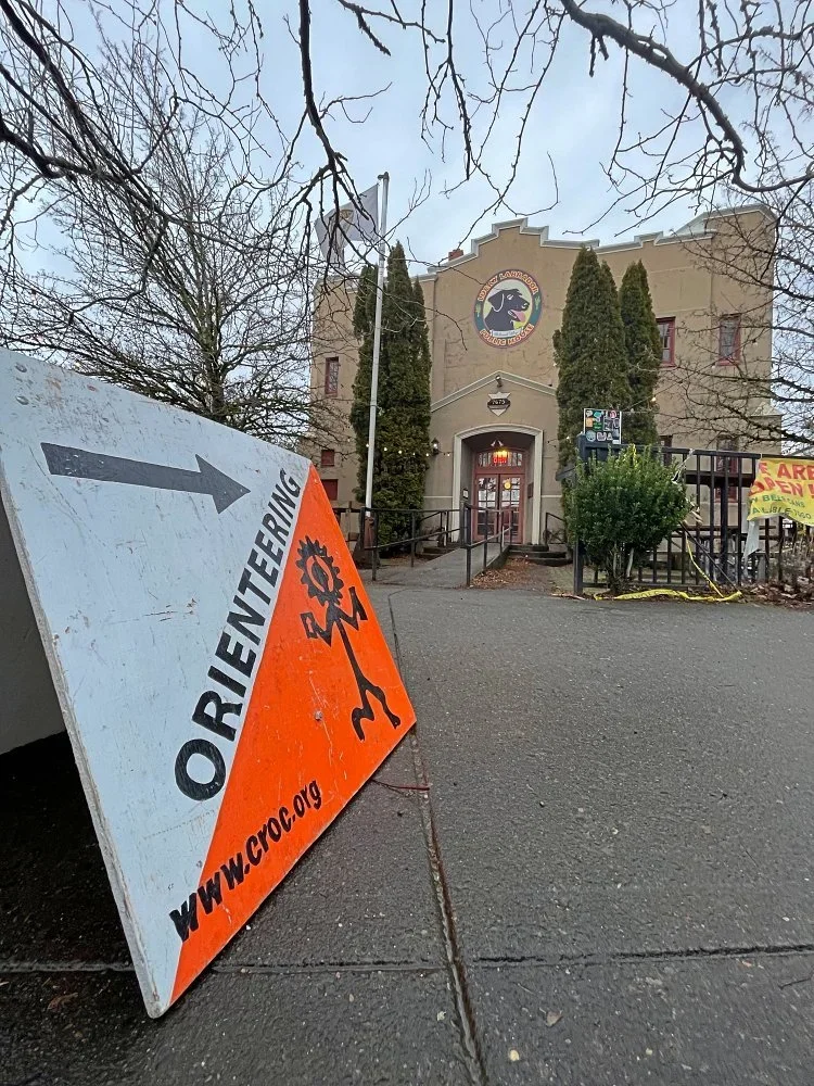
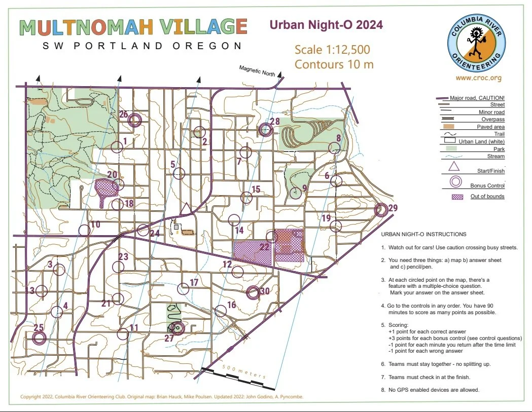
Multnomah Village Night-O
Advance online registration is required for this event.
Quick info
Date: February 28, 2026
Location: Lucky Lab Pub, Multnomah Village, SW Portland 7675 SW Capitol Hwy, Portland, 97219
Times:
4:30 - Check in begins (Lucky Lab upstairs)
4:45 and 5:00 - Beginner Clinics
5:15 - Map Handout & Strategy Planning
6:00 - MASS START
7:30 - Course Closes/Social Hour Begins
Course Options:
Beginners: Score-O format. Find as many checkpoints as you can, in any order, within 90 minutes.
Advanced: Even-Odds Score-O format. Find as many checkpoints as you can, following the Evens-Odds Rule, within 90 minutes.
Cost: $12 individuals, $17 teams, ($5 discount for club members)
Event Director: Helene and Jaime Wren
Event overview
Come out to Multnomah Village for CROC's annual urban night orienteering! Run or stroll the back streets, alleys, and trails of this SW Portland neighborhood on a night-time urban navigation adventure. This urban course is perfect for those new to orienteering. Both individuals and teams are welcome. We will have a mass start together at sunset and then you will have 90 minutes to run your course, finishing in the dark! After the event, stay for social hour! Share your route with others and hang out. We've been doing this event for 15+ years, it's always a lot of fun!
This is a good event to do as a team as well as individually, so feel free to bring a friend. Beginners and families are welcome! Maximum team size is six people.
MapRun - Orienteering using your Smartphone
Using your phone, the MapRun phone app will have the controls/checkpoints for the course. Learn About MapRun
MapRun is a smartphone app that can let you download an orienteering event and run it. To participate, you need to have downloaded the MapRun app (available from Google Play or the App Store) to your GPS-enabled smartphone. For best results, you should use the latest MapRunF version. There is even a MapRunG version intended for Garmin fitness watch users.
Unlike traditional orienteering courses where you find orange and white flags set the day of the event, this course uses permanent objects such as fire hydrants, yard art, and signs. You get a map with about 40 marked checkpoints and with the MapRun app, you will locate checkpoints and the app will log your find.
New for 2026: Advanced Course Option, Evens and Odds!
In addition to the original Score-O format, we are introducing a new scoring format for the 2026 Multnomah Night-O, Evens and Odds! Runners punch even numbered controls first and then odd numbered controls (or vice versa).
Think of it as two separate "blocks" of points. Once you commit to your second block (by punching two in a row of the opposite parity), you can't go back to the first for points!
We also have the traditional Score-O for those who want a simpler option.
More Info
We're starting at dusk, so you’ll have some twilight before it gets fully dark.
Bring headlights and reflective gear. We want everyone to be seen and stay safe!
Be very careful crossing busy streets! Always give cars the right-of-way, they can’t see you.
The finish (at 7:30 on the dot!) is back at the Lucky Lab. After the run, next comes the fun! Join everyone upstairs from 7:30 to 9:00 for social hour. Come and share your routes with others and socialize with CROC. The space is reserved just for us, so no one will judge if you are a little sweaty! Food (Pizza!) and drink will be available for purchase.
Event Rules
Mass start at 6:00 pm sharp. Pub upstairs opens at 4:30, map handout is at 5:15. Please arrive early to check in and plan your route.
You have 90 minutes to find as many checkpoints as you can and return to the finish.
You do NOT have to find all the checkpoints.
The scoring is as follows:
Controls 10-19 are each worth 10 point
Controls 20-29 are each worth 20 points
Controls 30-39 are each worth 30 points
Controls 40-49 are each worth 40 points
Controls 50-59 are each worth 50 points
Beginner Score-O
Plan your route to find as many checkpoints as you can in any order in the 90 minutes. Pay attention to the scoring for each control, some are worth more than others!
New for 2026: Advanced Course Option: Even-Odd Scoring
The runner’s first block is determined by whether two odds or two evens are punched before two of the other (or stated another way, of the first three non-duplicated controls visited, two are even or two are odd).
The flip to the second block is signalled by visiting two controls in the second block in succession. (ie two odds after an initial block of evens or vice versa)
Runners don’t need to visit all evens or all odds and could just visit one block of controls.
Controls of the wrong parity in a block (ie odds visited in an even block and vice versa) do not count towards the points score but can be visited in the correct block for points.
30 points will be deducted for each minute over the time limit (don't be late!)
If you’re on a team, stay together - no splitting up.
No GPS enabled devices (phones or watches ) are allowed for navigation assistance. The MapRun app is allowed.
Only ONE MapRun app per team/group.
Participants under age 18 must be accompanied by a responsible adult.
What to bring
A quality flashlight or headlamp with fresh batteries, one for each person on your team. Please keep your light on at all times during the event to increase your visibility.
Clothing appropriate for the weather. Reflective / high visibility clothing is highly recommended.
A watch/phone to be sure you don't take longer than 90 minutes on the course. (Setting an alarm on your phone for 7:15 PM can be helpful)
A highlighter pen is handy for marking your intended route, hint hint.
New to Orienteering? Welcome!
Our events are open to both members and non-members. Beginners and families are welcome.
We will offer a beginner clinic at 4:45 pm & 5:00 pm at this event, however, please take a close look at the “Event Overview”, and “Event Rules” sections above for all the details.
No compass is needed (but could help if you get turned around!), just decent map reading skills.
If you'd like to get reminders about upcoming events, sign up at our newsletter page. (No more than a couple of emails per month, we promise!)
Thanks for coming out and trying something new, we think you'll like it!
Registration
Advance online registration is required. There is no event day registration.
Registration deadline: February 26th, 6:00pm
Refund policy: full refund if requested more than 48 hours before the start time of the event. Email us to request a refund and we’ll work it out.
Event Cost
$12 base price - individuals
$17 base price, teams of 2 or more. (Maximum team size is six people.)
- Subtract $5 if you’re a member or CROC or other orienteering club (Join CROC)
Results
Results will be posted on the Events & Results page a few days after the event.
Practice/Training
CROC has a permanent training course established in this area. If you try it before the night-O, you may have an unfair advantage, hint hint! See complete details here.
Here’s an example of a map from a previous event.

Ski Orienteering at Teacup Nordic

This event is dependent on favorable weather and snow conditions. Check back here for confirmation before you head up to the mountain. We will try to make any cancellation decision by Thursday, February 19.
Times
Individual starts from 11:00 am to 12:30 pm
Courses close 2:00 pm
Event overview
We are set for ski-orienteering again this year at Teacup Lake. Why not try a little orienteering in the snow? Teacup is always a great place to ski. And even if you ski there regularly ski orienteering gives you a different way of experiencing Teacup Lake. Beginners at orienteering are welcome, as always.
The cabin at Teacup Lake will be our event headquarters.
Sno-park permits are required to park at the trailhead, and participants should also obtain a Teacup Lake trails pass.
All participants must check out at the results download table before leaving the area, even if you do not finish the course or are returning after the course closes.
Contact: Meet director Mike Bruns
Course setter's notes
All controls are on groomed ski trails. Some route choices will include options to take shortcuts between groomed trails using single-tracks that will be marked on the map and will be pre-skied before the event.
All skiers must follow the one-way restrictions on the map and follow any DO NOT ENTER signs posted by Teacup Lake Nordic Club.
Courses
The race format is Score O with individual starts: visit as many controls as you can in 90 minutes from the time you start. Controls have different point value depending on difficulty. Highest score wins, and the finish time is used to break ties.
The game of this type of orienteering event is to maximize your score based on how fast and how far you would like to travel. A smart route choice is usually one that minimizes the distance travelled to reach as many controls as possible. Figuring out which controls to skip is part of the puzzle. Beginner and Intermediate skiers: be aware of steep downhill trail sections. These are marked on the map and they may affect your route selection.
Rules:
Obey One-Way and Do Not Enter directional signs. The one-way trails are also marked on the map
10 point penalty per minute for late finish after 90 minutes.
Ski rentals
If you don't own skis, no worries. There are several local stores that offer Nordic ski rentals including:
Mountain Shop (1205 NE 33rd Ave, Portland, OR 97232)
Registration and other costs
Orienteering SKI-O event fees:
We are hoping to rein in some young skiers so we are making registration FREE for all Youth (17 and under) competing without an adult.
Adult registration fees are $7.00 for individuals and $12.00 for groups of up to 6 participants.
E-sticks* will be available to use for no charge for this event.
* Small electronic devices that allow each orienteer to record their visit to each control
Teacup trail fee: $25 for the day if you are not a Teacup Lake Nordic season pass holder. You can buy onsite or ahead of time at this link: Teacup Nordic
Sno-Park pass: $4-$5 for the day, can buy several places in Sandy and outdoor stores in Portland
Stop at a local merchant to buy a day permit for $4-5 on the way up to the mountain. Shell gas (Sandy), Fred Meyer (Gresham or Sandy), Joe’s Donuts (Sandy), and many others
Map and directions to event
45.32024, -121.6244 - Latitude longitude coordinates (in decimal degrees format) to the event site.
Copy/paste these into Google maps or a phone mapping app to get a map and driving directions.
Driving Directions
From Portland, take US Hwy 26 east towards Mt Hood, and pass through Government Camp
Roughly 2 miles after Government Camp, exit onto OR-35 N/State Route 35 N toward Hood River
The Teacup Nordic Sno-Park is on the right, about 8 miles northeast of this junction.
Driving Directions (alternate, see Travel Tips below)
From Portland, take I-84 east to Hood River. Take exit 64
Travel south on OR-35 about 31 miles
The Teacup Nordic Sno-Park is on the left. Drive past the jersey barrier and enter the Sno-Park from the top (south) end.
NOTE: You must purchase a sno-park permit on the way to the mountain and bring it with you. Sno park permits are are NOT sold at Teacup.
Chains Required
Check road and weather conditions in advance. https://tripcheck.com/
ODOT typically requires chains or traction tires if it is snowing. Bringing chains/traction tires is always a good idea no matter what conditions during the winter. More info at https://www.oregon.gov/odot/mct/pages/chains-and-traction-tires.aspx
Travel Tips
Low snow conditions have prevailed up until now, so there is the possibility of a lot of skiers with pent-up demand trying to get to Mt Hood Meadows on Sunday morning. The winter season traffic delay between Zigzag and Mt Hood Meadows is called “The Govy 500” and can add significant travel time. This may start to appear on Google maps Traffic layer by 8 am if it going to happen. Take the alternate route through Hood River to avoid it.
Parking Tips
The Teacup Nordic Sno-Park can fill to capacity on weekend mornings. On a bluebird day in early season, this can happen as early as 9 am. Here are some options to improve your chances of getting space to park:
Come early, arrive before 9 am
Come late, arrive after 11 am when the first shift is leaving and freeing up spaces
Troll for a space, you’ll eventually get one, and when you do we will still be there to get you on the orienteering course
For the extremely fit and energetic, you can park 2 miles to the north at Pocket Creek Sno-Park and ski the ungroomed but marked trail from there to the Teacup Nordic trail system. This is a 2.5 mile (1 hour) ski with 500 ft climb, For returning to your car, it’s downhill almost all the way. This option works for classic skis and is terrible for skate skis.
Member Training - Plan Ahead: Memory Training
Plan Ahead: Memory Training
February 15, 2026 10:00 am - noon
Sellwood Park in southeast Portland
For CROC members only
To increase your speed in completing a course, there are several little but important things you can practice. One skill is to memorize the map so you don’t have to look at it so often. The course for this exercise gives you a long un-complicated leg, during which you memorize your navigation to the first control and also to the next control. Keep at the front of your mind how the map looks and how the terrain looks, and navigate to the control.
This training is for CROC members only; there is no cost. Register here by February 13 and we’ll send you the exact starting point. For questions and suggestions contact trainer Anndy.
Beaverton Urban-O - POSTPONED
This event has been postponed.
We'll try to reschedule in the spring.
Member Training - Course Design: Intermediate and Advanced Courses
Course Design: Intermediate and Advanced Courses
Monday, January 12, 2026 6:45-8:45 pm
Taborspace in southeast Portland
For CROC members only
If you’ve designed Orange, Brown, and Green courses, come learn from each other about how to make great courses. We also invite new course designers who want to learn from others.
Topics to be covered include How to Begin; Challenges to Designing; the Orange Course Standards; Using Shared Documents; and Making Good Legs. You’ll hear from other course designers and get to practice designing course legs.
We’ll meet at Taborspace in southeast Portland. Bring your laptop with Purple Pen, if possible.
This training is for CROC members only; there is no cost. Register here by January 8 and we’ll send you the location and prep materials. For questions and suggestions contact trainer Anndy.
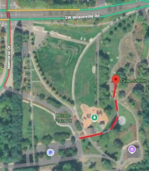
Winter Wander, Memorial Park Wilsonville

Advance online registration is required for this event.
Quick Info
Advanced online registration required, deadline midnight Dec 31.
Location: Memorial Park, Wilsonville
Event Center location: Grove Shelter, see map below
Courses: We’re going to be trying something new for our Memorial Park event based on a fun experience that our course setter had when visiting another club. It’s a variation on a Score-O that allows for different difficulty levels. See below for all the details!
Times: Check-in opens at 10:00. map handout at 11:00ish. Mass start for the advanced course at 11:30. Mass start for beginner/intermediate courses at 11:45.
Everyone welcome, members and nonmembers
Event Director: Josh Kramer
Course Designer: Dan Simon
Event Location
The event center and start / finish will be at the Grove Shelter on the north end of the park near the playground. (Note this is a different area than what we have used in previous years.)
Event Overview
This event will introduce a new, fun course structure for us at CROC. Be sure to read the website event description (below) before completing this registration form.
IMPORTANT: You will be assigned a "MASS start" time based on the course you choose.
ALL Advanced Course participants (Brown, Green, Red, Blue) will start at 11:30am.
ALL Beginner Course participants (White. Yellow, Orange) will start at 11:45am.
11:00-ish AM: All participants gather for final instructions and Map Handout!
*** Due to the Mass start, all participants will be arriving at the event close to the same time.***
There may be a line for check-in and parking could be tight.
Allow plenty of time to be ready for Map handout and your Mass start time!
Bring a pen, pencil or highlighter to help you plan your route on your map.
Beginner clinics will be available at 10:30 & 10:45 AM. Sign-up below.
PLEASE PLAN YOUR ARRIVAL TIME AT THE VENUE ACCORDINGLY!
All courses will use the same controls and the same map with 24 field controls and a special GO control near the start/finish event center. Everyone will get maps before the mass start so you have time to plan your route. Bring something to write with so you can write out your plan or check off controls as you punch!
Wondering which course to do? Here’s some advice from our course designer:
If you are a runner, it is recommended you bias towards a harder course for this event.
If you are concerned about the extra distance, consider how many times you want to go out and back from the start. The distance from the Start to the furthest point of the park is 1km, so your longest loop would be about 2k. See the sample map below that shows one of our standard events at Memorial Park.
CROC thanks our recreation partner Wilsonville Parks.
Event description
We’re going to be trying something new for our Memorial Park event based en event from another club (DVOA). For lack of a better name, this is a Cluster-O, a variation on a Score-O that allows for different difficulty levels. Here’s how it works. There will be 24 field controls for you to collect, and a special GO control near the start/finish event center. All courses will use the same controls and the same map. As a side note, typically the GO control is the last control that you punch before running to the finish. However, in this format, the advanced courses will punch it multiple times. Everyone will punch the GO control before finishing. This event will be using E-Punch.
If you are not doing an advanced course, this will be very similar to a Score-O.
White will punch any 10 of the 24 field controls, then punch the GO control, then the finish.
Yellow will punch any 15 of the 24 field controls, then punch the GO control, then the finish.
Orange will punch all 24 of the field controls, then punch the GO control, then the finish.
For our advanced courses things get more interesting. Hopefully this challenge adds extra distance and a route optimization challenge for our advanced competitors. If you are someone who finds yourself debating between difficulty levels, I would recommend you bias towards the harder course for this event.
Brown will punch clusters of 12 field controls, returning to the GO control after each cluster, for a total of two clusters.
Green will punch clusters of 8 field controls, returning to the GO control after each cluster, for a total of three clusters.
Red will punch clusters of 6 field controls, returning to the GO control after each cluster, for a total of four clusters.
Blue will punch clusters of 4 field controls, returning to the GO control after each cluster, for a total of six clusters.
The clusters are not predetermined; each person can choose whatever order they want to visit the field controls in. All that matters is the GO control is visited at the correct interval.
Those on advanced courses will need to punch all of the 24 field controls to record a successful finish result. If you miss a control your result will be a mispunch.
Example:
Let's say you are running the green course which is three clusters of 8 controls. You get your map which shows controls numbered 31-54, and a highlighted control 60 (GO). From the start, you might grab 31, 32, 33, 34, 35, 36, 37, 38 as your first cluster. You'd then go and punch 60 before going to grab your next 8 controls. The controls don't need to be punched in order! So this time maybe you grab 41, 40, 39, 54, 51, 43, 47, 49 as your second cluster because that seems more efficient before returning to punch 60 a second time. In your third cluster you'd need to punch the controls you have not yet visited, 42, 44, 45, 46, 48, 50, 52, 53 in whatever order you wanted. After grabbing the last field control, you'd punch 60 your third and final time before running to the finish.
FAQ:
What if I punched an extra control before punching GO? Example - If you are running blue, punching clusters of 4, and punch 5 controls before punching the GO control, that 5th control will not count. You will need to visit it again in a different cluster.
What if I missed a control before punching GO? Example - If you are running blue, punching clusters of 4, and only punch 3 controls before punching the GO control, get ready for some extra distance. You can only get, at most, 4 controls between each visit to the GO control. So now you will need to do an extra cluster of 1 to collect all the field controls!
What if I don't realize my error until I download? As this is a new and chaotic format to our club, if you come to download and are missing one or more field controls, you will have two options. You can either accept the MP (missed punch) instead of your time, or you can inform download that you intend to go back out and collect those controls. Informing download is mandatory so we know who is out on the course. From here you can go and collect the controls you missed, obeying the same cluster size rules of your course, before punching GO and the finish a second time. For example, if you somehow missed 5 controls on a blue course, you would need to go and grab 4 of them, punch GO, grab the remaining 1, punch GO again, and then properly finish. Note: if you have an SIAC (#8,000,001 - #8,999,999) the air punch capability will be disabled after you punch finish, so you will need to insert your e-stick into each control to punch.
Times
Beginner clinics 10:30am and 10:45am
Map handout: 11:00ish
Course starts:
Advanced Courses (Brown - Blue) Mass Start at 11:30am
Beginner Courses (White - Orange) Mass Start at 11:45am
Course closure for all courses: 2:30pm
If people arrive after the start they will be allowed to start individually, but we encourage everyone to participate in the one of the group starts.
Everybody must punch in at the finish and download their times even if they do not finish their course, or if they return after the course closes. This is how we make sure everyone returns safely.
New to orienteering? Welcome!
Our events are open to both members and non-members. Beginners, families and dogs are welcome.
Have a look at our “New to O?” webpage, which covers just about every question you may have.
You can compete as an individual or as a team. Maximum team size is six people.
At most events, we offer free beginner clinics (they take about 10 minutes) to teach you everything you need to know. Choose your time slot on the registration page.
If you'd like to get reminders about upcoming events, sign up at our newsletter page. (No more than a couple of emails per month, we promise!)
Thanks for coming out and trying something new, we think you'll like it!
Orienteering map of this location from a previous event

Volunteers
All CROC events are put on by volunteers, and the meet director can almost always use some extra hands. Please keep in mind:
No prior experience is needed for many of the tasks
You can help out AND still run your course of choice
Typical ways to assist are: helping with starts and finishes, checking in folks at registration, and picking up control flags after the course closes. Typical shifts are about one hour long.
If you'd like to help, you can choose a task and time shift when you register online. Thanks!
Results
Results will be posted to the Events & Results page a few days after the event.
Registration and other costs
Refund policy: full refund if requested more than 48 hours before the start time of the event. Email us to request a refund and we’ll work it out.
Event Cost
$17 base price - individuals
$22 base price - groups of 2 or more
- Subtract $5 for membership in CROC or other O-club Become a CROC member
- Subtract $5 if you have your own epunch Buy your own epunch
Map and directions
45.3009, -122.7594
Latitude longitude coordinates of the event site. Copy and paste these into a mapping app on your phone or Google maps to get a map and driving directions to this location.
The map below is to the parking area. From there follow the signs to the Grove Shelter north of the playground.
Member Training: Fun in Foul Weather
Member Training: Fun in Foul Weather
December 13, 2025 10:00 a.m. - noon
Pier Park in North Portland
For CROC members only
This practice is to remember how much fun it is to orienteer, even if it’s raining and cold!
Do you know what to wear, and how to hold a compass with mittens on?
Which shoes work best in the mud?
How do you keep your map from disintegrating in the rain?
But most importantly: you can have fun with your orienteering colleagues!
There’s a mass start at 10:00 a.m. - experience the chaos of many running off while you’re trying to find north on your compass. The course is ~3.0 kilometers through an urban park with low hills, some forest, and a popular disc golf course.
We’ll treat you to cider; your cookies/crackers/cheese are optional.
This training is for CROC members only; there is no cost. Register here by December 11 and we’ll send you the exact starting point. For questions and suggestions contact trainer Anndy.


CROC Board Meeting
CROC holds quarterly board meetings. All members may attend.
Meeting dates are generally scheduled for: first Monday of December, March and June, and the second Monday of September, from 7:00 pm to 9:00 pm.
The meeting location may vary. Meetings may be online or in-person.
Please go to About > Contact and email us to find out where the next meeting will be, and to confirm the actual date.
Turkey-O at Catlin Gabel

Thanksgiving-O at Catlin Gabel
Join us and get re-energized after Thanksgiving! The Thanksgiving-O will be on our newly mapped (thanks, Ken Wenzel!) Catlin Gabel campus and neighboring woods and parkland.
Quick info
Advanced online registration required, deadline end of day November 26th (the night BEFORE Thanksgiving!).
Courses: Three courses, point-to-point orienteering format, but the controls will be closer together to test your quick decision making!
TImes: Check-in opens at 9:30. Start your course between 10:00 am and 12:00 pm
Everyone welcome, members and nonmembers
Event director: Ken Wenzel
Event Overview
Catlin Gabel is a local school with an extensive campus. Ken Wenzel mapped the campus this year and also added neighboring woods and parkland to create a fun event to help you get re-energized after that big Thanksgiving feast!
We use an electronic scoring and timing system known as e-punch. Each entry or team needs to have an e-punch stick. If you don't have your own e-punch stick, the rental cost is included in your registration fee. Using e-punch is easy. You can learn how at the event, or read about e-punch here.
CROC thanks Catlin Gabel for permission and support for the event!
Turkey-O Courses
Chick: Short course 1.4 km, 14 controls
Trot: Longer course 2.8 km, 23 controls
Gobble: Short + Long course to make sure you burn off all those turkey calories! 4.2 km, 37 controls!
New to orienteering? Welcome!
Our events are open to both members and non-members. Beginners and families are welcome.
Have a look at our “New to O?” webpage, which covers just about every question you may have.
At most events, we offer free beginner clinics (they take about 10 minutes) to teach you everything you need to know. These are typically at half-hour intervals; choose your time slot on the registration page.
If you'd like to get reminders about upcoming events, sign up at our newsletter page. (No more than a couple of emails per month, we promise!)
Thanks for coming out and trying something new, we think you'll like it!
Start Windows
For this event, we’re using assigned 30 minute start windows between 10 AM and 12 PM. This spreads participants over the entire two hour start window instead of a big rush at the beginning, and increases space between competitors running the same course.
Please choose your start window during registration. The earlier you register, the better chance you have of a preferred window. If you arrive early for your start window, you may be asked to wait. If you’re late, no worries, we’ll allow you to start when we have an opening. It’s a guideline, not a firm rule.
Times
Beginner clinics: 10:00 am and 10:30 am. Choose your preferred time when you register.
Course starts: between 10:00 am and 12:00 pm
All courses close: 3:00 pm (controls will be picked up)
(All teams must check out through the course finish area before leaving, even if the team does not finish the course or returns after the course closes.)
Registration and other costs
Event Cost
$17 base price - individuals
$22 base price - groups of 2 - 6
- Subtract $5 if you’re a member or CROC or other O-club (Join CROC)
- Subtract $5 if you have your own e-punch (Buy your own epunch)
Livelox: GPS tracking and route reviewing tool
CROC uses Livelox, which is an interactive web based tool that enables you to see your exact route/track on the orienteering map, and compare them with other competitors.
Volunteers
All CROC events are put on by volunteers, and the meet director can almost always use some extra hands. Please keep in mind:
No prior experience is needed for many of the tasks
You can help out AND still run your course of choice
Typical ways to assist are: helping with starts and finishes, handing out maps, and picking up control flags after the course closes. Typical shifts are one hour.
If you'd like to help, you can choose a task and time shift when you register online. Thanks!
Results
Results are posted to the Events & Results web page a day or two after the event.
Event location
Latitude longitude coordinates of the event: 45.5101, -122.7658. Copy/paste these coordinates into Google maps or your smartphone mapping app to get a map and driving directions to the event.
Catlin Gabel school is east of St. Vincent’s Hospital on Barnes Road.
Look for the orange and white CROC sandwich board signs when you get close.
CROC Annual Member Appreciation Party
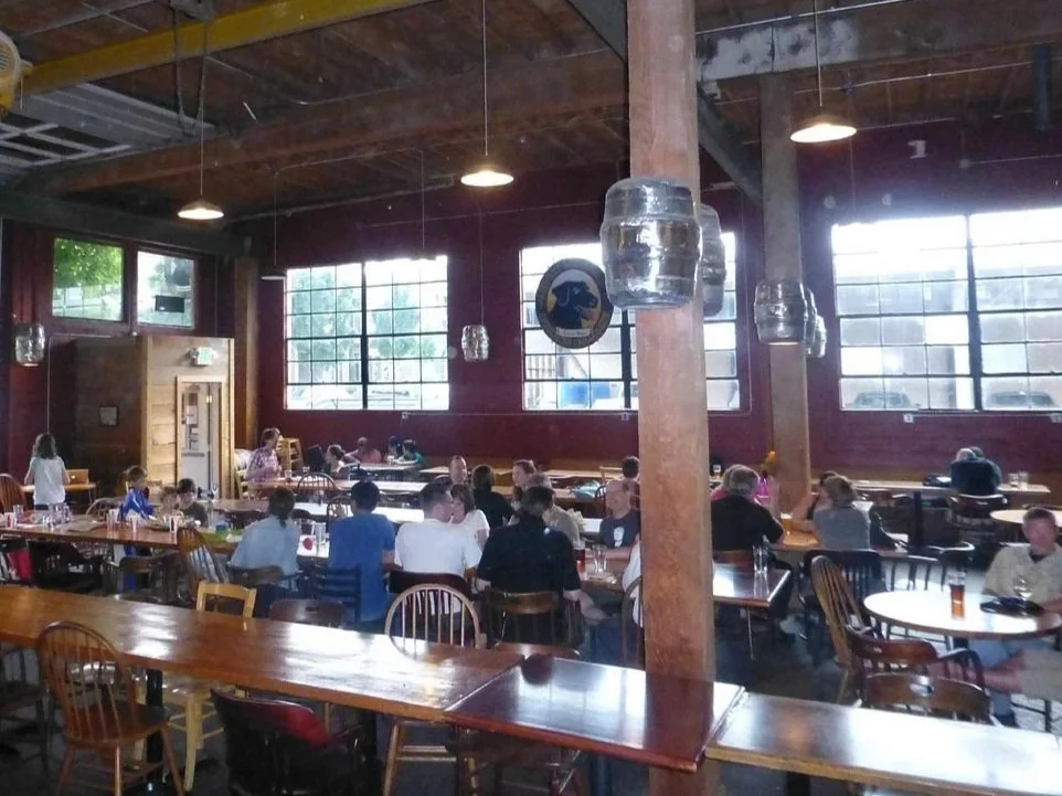
November 16th Member Appreciation Party and Annual General Meeting
At the Quimby Lucky Lab in NW Portland, CROC recognizes all of our great members and volunteers for making another fantastic O-year! Join us for a free score-O event, pizza, salad, and (no host) beverages.
The Annual General Meeting will give an update about the state of the club, the slate of nominees for the upcoming CROC Board elections and plans for next year.
As part of the Annual End of Year CROC festivities, we're having a casual urban score-O (just for fun, no results) on the 2023 Kings Heights map. Stop off at the Lucky Lab to grab a map, try your hand at the short score-O course, then come back for free salad and pizza, yummy beverages, and sharing tales with your fellow CROCers. We’ll be using the MapRun app on your phone this year. Find all the info you need about MapRun below.
Help us and the Lucky lab get ready for the party!
Highlights
Hear about the state of the club, a summary of the great year we had in 2025 and nominees for the 2026 board.
Look at maps from major events from around the country.
Review the preliminary 2026 event plans and provide feedback, new meet directors and course setters are welcome!
Did we mention free pizza and salad?
Times
Score-O: start from the Lucky Lab anytime from from 3:30pm to 4:30 pm
Party: 5:00 to 7:00 pm at the Lucky Lab Quimby
There is a pay parking lot at 20th and Raleigh or you can’t find street parking. The restaurant does not have a parking lot. Paid street parking in Portland is managed with the Parking Kitty app.
Score-O Details
Map handout from 3:30pm to 4:30pm
The start location is in the party room at the Quimby Lucky Lab, come on in and get your map!
Depending on weather, you might want to bring a change of clothes and shoes for the party which immediately follows the sprint
Then, join us at the Lucky Lab for food, celebration and our annual meeting!
MapRun - Orienteering using your Smartphone
An exciting new way to enjoy orienteering has arrived in the last couple years. It is now possible to go orienteering as an activity you can do using your smartphone and GPS technology.
MapRun is a smartphone app that can let you download an orienteering event and run it. To participate, you need a Smartphone and have downloaded the MapRun app (available from Google Play or the App Store) to your GPS-enabled smartphone. For best results, you should use the latest MapRunF version. There is even a MapRunG version intended for Garmin fitness watch users.
Unlike traditional orienteering courses where you find orange and white flags set the day of the event, this course uses permanent objects such as fire hydrants, yard art, and signs. You get a map with about 20 marked checkpoints and with the MapRun app, you will locate each point and the app will log your find. While the MapRun app is preferred, there will be an optional paper and pencil option with multiple choice questions for those that prefer.
Have questions? Contact Marsha Holliday
Lacamas Park
LACAMAS PARK
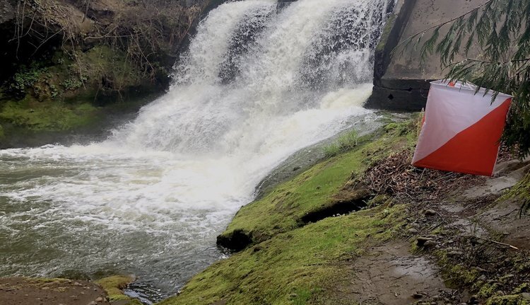
Advance online registration is required for this event.
Quick info
Advanced online registration required, deadline end of day October 15.
Courses: Five different courses for all skill levels. Classic point-to-point orienteering format.
TImes: Check-in opens at 10:30. Start your course anytime between 11:00 am and 1:00 pm
This is an addition to our 2025 Classic Series competition! Take the best 4 of 6! races throughout the season and see how you compare to others in your category! More information on the 2025 Classic Series page.
Everyone welcome, members and nonmembers
Event director: Bjorn Freeman-Benson
Event Overview
Lacamas Park is a large wooded area near Camas, WA. The park is hilly, with a complex network of canyons and spurs. Cliffs and rock outcrops are abundant.
There is an extensive trail network. Open rocky areas can showcase wildflowers in certain seasons; however most of the vegetation is lush, and trail running skills will come in handy. Route choices for all courses are primarily on trail.
Note that there is poison oak in the park. Long pants and/or gaiters are recommended for the advanced courses.
We use an electronic scoring and timing system known as e-punch. Each entry or team needs to have an e-punch stick. If you don't have your own e-punch stick, the rental cost is included in your registration fee. Using e-punch is easy. You can learn how at the event, or read about e-punch here.
CROC thanks our land management partner Clark County.
Courses - Map scale is 1:5000 for all courses
White: Beginner (1.9 km, 70m elevation, 13 controls, on-trail and near-trail navigation)
Yellow: Beginner / Intermediate (2.6 km, 100m elevation, 12 controls, on-trail and near-trail navigation)
Orange: Intermediate (3.8 km, 110m elevation, 14 controls, mostly on or near-trail with some off-trail navigation)
Brown: Short Advanced (3.5 km, 110m elevation, 13 controls, off-trail and near-trail navigation)
Green: Long Advanced (4.4 km, 160m elevation, 18 controls, off-trail and near-trail navigation)
Map and Course Notes:
Lacamas Park has been completely remapped this year by Rex Winterbottom of terraloco to obtain correct contour lines and trails. The vegetation mapping has also been redone. Note that not every portion of this densely vegetated terrain has had detailed field work, but every effort is being made to ensure accuracy along course routes.
There is much less fully runnable terrain here than at some of our other venues. The White and Yellow courses will keep you on trail most of the way. The orange course will include a lot of on-trail navigation with short off-trail excursions. You can expect the green course to provide opportunities for off-trail routes and navigation through areas of “walk” and “slow running”.
Per the IOF standard, the darkest green represents “fight” (running reduced to less than 20% of normal speed). The next lighter shade of green is “walk”, then “slow running” and finally white represents “easily runnable”. The new map shows darker green than the previous map, based on the mappers application of the standard and his mapping practices. Another difference in the map is the use of the “stony ground” symbol (multiple black dots distributed randomly). This can be easily confused with the boulder symbol, which is twice the diameter of the “stony ground” symbol.
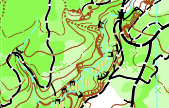
Vegetation shades of green
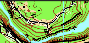
Stony Ground
New to orienteering? Welcome!
Our events are open to both members and non-members. Beginners and families are welcome.
Have a look at our “New to O?” webpage, which covers just about every question you may have.
At most events, we offer free beginner clinics (they take about 10 minutes) to teach you everything you need to know. These are typically at half-hour intervals; choose your time slot on the registration page.
If you'd like to get reminders about upcoming events, sign up at our newsletter page. (No more than a couple of emails per month, we promise!)
Thanks for coming out and trying something new, we think you'll like it!
Start Windows
For this event, we’re using assigned 30 minute start windows between 11 AM and 1 PM. This spreads participants over the entire two hour start window instead of a big rush at the beginning, and increases space between competitors running the same course.
Please choose your start window during registration. The earlier you register, the better chance you have of a preferred window. If you arrive early for your start window, you may be asked to wait. If you’re late, no worries, we’ll allow you to start when we have an opening. It’s a guideline, not a firm rule.
Times
Beginner clinics: 11:00 am and 11:30 am. Choose your preferred time when you register.
Course starts: between 11:00 am and 1:00 pm
All courses close: 3:00 pm (controls will be picked up)
(All teams must check out through the course finish area before leaving, even if the team does not finish the course or returns after the course closes.)
Registration and other costs
Event Cost
$17 base price - individuals
$22 base price - groups of 2 or more
- Subtract $5 if you’re a member or CROC or other O-club (Join CROC)
- Subtract $5 if you have your own e-punch (Buy your own epunch)
Livelox: GPS tracking and route reviewing tool
CROC uses Livelox, which is an interactive web based tool that enables you to see your exact route/track on the orienteering map, and compare them with other competitors.
Volunteers
All CROC events are put on by volunteers, and the meet director can almost always use some extra hands. Please keep in mind:
No prior experience is needed for many of the tasks
You can help out AND still run your course of choice
Typical ways to assist are: helping with starts and finishes, handing out maps, and picking up control flags after the course closes. Typical shifts are one hour.
If you'd like to help, you can choose a task and time shift when you register online. Thanks!
Results
Results are posted to the Events & Results web page a day or two after the event.
Event location
Latitude longitude coordinates of the event: 45.6055, -122.4058. Copy/paste these coordinates into Google maps or your smartphone mapping app to get a map and driving directions to the event.
The park is north of Camas, WA; on the east side of Washington SR 500/SE Everett Rd.
The start is next to the lake across the street from the labeled overflow parking lot.
Please park in the labeled overflow parking lot (not in the much smaller, and in the wrong place, main parking lot). The labeled overflow parking lot is reached by driving over the bridge between Round Lake and Lacamas Lake, turning right on 35th Ave, then left into the large gravel lot.
Look for the orange and white CROC sandwich board signs when you get close.
Restrooms are south across the pedestrian bridge.
Member Training: Control Descriptions in the Field
Member Training: Control Descriptions in the Field
Sunday, October 12, 2025 10:00 a.m. - noon
Westmoreland Park in Southeast Portland
For CROC members only
Becoming comfortable with the pictographic language of control descriptions is one of the skills that can help you zero in on orienteering course controls. To get more familiar with the control description sheet, you can look up the meaning of all the symbols, but seeing the symbols come to life in the field is even better.
To help you internalize control description symbols, this training has been set up as a series of puzzles to solve, using Westmoreland Park as the game board. Maps and puzzle sheets will be provided.
Dress for whatever weather is expected on Sunday, October 12, 10:00 a.m. until noon. Like Crossword, Wordle, Flagle, and your other favorite game, expect this training to be more cerebral than aerobic.
This training is for CROC members only; there is no cost. Register here by October 10 and we’ll send you the exact starting point. For questions and suggestions contact trainer Virginia Church or training coordinator Anndy Wiselogle.
Champoeg State Park Classic
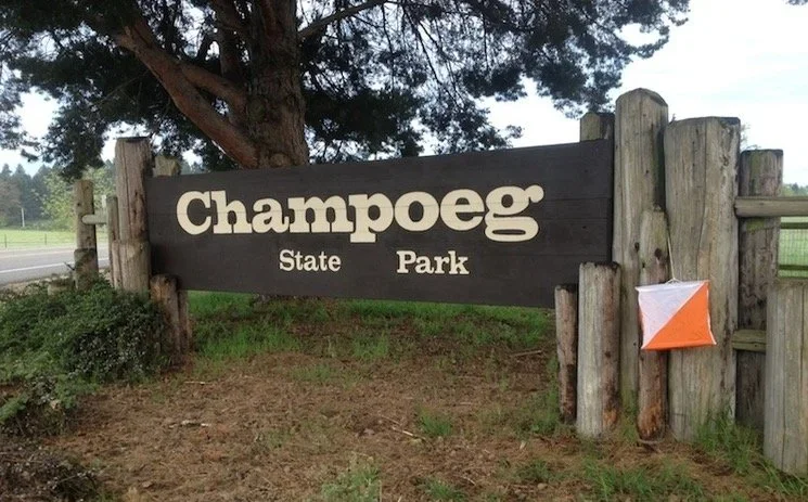
Advance online registration is required for this event
Quick info
Registration closes end of day WEDNESDAY, September 24th. Please note that registration is closing one day earlier than for past events.
Courses: Five different courses for all skill levels.
Times: Check-in opens at 10:30. Start your course between 11:00 am and 1:00 pm. All courses close at 3 pm.
Intermediate Member Training: Offered before the meet on the topic of “Control Symbols”). See Member Training - Control Description Symbols for more information.
This is part of our 2025 Classic Series competition! Take the best 4 of 5 races throughout the season and see how you compare to others in your category! More information on the 2025 Classic Series page.
Everyone welcome, members, nonmembers, families, and youth groups.
Courses set by: Alex Myachin and Becky Bruns.
Event directors: Mike Holliday and Sarah Vitak
Event Overview
On the banks of the Willamette River, Champoeg State Park is large and mostly flat. An interesting variety of terrain should make for some fun orienteering! We will use a new start location at the Pioneer Memorial Pavilion to change it up from previous years.
We use an electronic scoring and timing system known as “e-punch”. Each entry or team needs to have an e-punch stick. If you don't have your own e-punch stick, the rental cost is included in your registration fee. Using e-punch is easy. You can learn how at the event, or read about e-punch here. For this event, AIR+ is enabled for optional contactless control punching with your Sportident SIAC card.
CROC thanks our land management partner Oregon State Parks.
Participants should be aware that there is poison oak in the park, and in some areas, it has invaded the grass. While the Park has undertaken measures to manage it and the courses will be designed to avoid it, it is recommended that participants wear full lower body covering.
Courses
Preliminary Course Distances (see color codes for course difficulty descriptions)
White: Beginner 2.0 km, 12 controls, 5m climb
Yellow: Beginner / Intermediate 2.9 km, 13 controls, 10m climb
Orange: Intermediate about 4 km
Brown: Advanced Short about 4 km
Green: Advanced Medium about 5 km
New to Orienteering? Welcome!
Our events are open to both members and non-members. Beginners, families and dogs are welcome.
Have a look at our “New to O?” webpage, which covers just about every question you may have.
At most events, we offer free beginner clinics (they take about 10 minutes) to teach you everything you need to know. These are typically at half-hour intervals; choose your time slot on the registration page.
If you'd like to get reminders about upcoming events, sign up at our newsletter page. (No more than a couple of emails per month, we promise!)
Thanks for coming out and trying something new, we think you'll like it!
Start Windows
For this event, we’re using assigned 30 minute start windows between 11 AM and 1 PM. This spreads participants over the entire two hour start window instead of a big rush at the beginning, and increases space between competitors running the same course.
Please choose your start window during registration. The earlier you register, the better chance you have of a preferred window. If you arrive early for your start window, you may be asked to wait. If you’re late, no worries, we’ll allow you to start when we have an opening. It’s a guideline, not a firm rule.
Times
Beginner clinics: 11:00 am and 11:30 am. Choose your preferred time when you register.
Course starts: between 11:00 am - 1 pm
All courses close: 3:00 pm (controls will be picked up). Everybody must punch in at the finish and proceed to the download station even if they do not finish their course. This is how we make sure that everyone returns safely.
Registration and other costs
Park Fee: Oregon State Parks charges $10 for day use, $30 for a 12 month pass and $50 for a 24 month pass. The day pass fee may be paid at either the welcome center (one mile after entering the park) or at the "iron ranger" fee box in each parking lot (exact change required.)
Event Cost
$17 base price - individuals
$22 base price - groups of 2 or more
- Subtract $5 if you’re a member or CROC or other O-club (Join CROC)
- Subtract $5 if you have your own e-punch or if you buy one during registration. (Buy your own epunch)
Purchase an E-Punch stick!
At this event we are offering a limited number of Epunch sticks for purchase (three left). We made a bulk purchase and are passing the discounted price to you! These are Sportident SI Card 9 that sell individually for $50, but our discounted price is $39. These are NOT SI-AIR enabled.
When you have your own E-punch stick, you save $5 at every event!
Order when you register and pick up when you check in at the event.
Livelox: GPS tracking and route reviewing tool
CROC uses Livelox, which is an interactive web based tool that enables you to see your exact route/track on the orienteering map, and compare them with other competitors.
Volunteers
All CROC events are put on by volunteers, and the meet director can almost always use some extra hands. Please keep in mind:
No prior experience is needed for many of the tasks
You can help out AND still run your course of choice
Typical ways to assist are: helping with starts and finishes, handing out maps, and picking up control flags after the course closes. Typical shifts are one hour. If you'd like to help, you can choose a task and time shift when you register online. Thanks!
Results
Results are posted to the Events & Results web page a day or two after the event.
Driving directions and location
Latitude longitude coordinates of the event: 45.25532, -122.90483. (Parking at Riverside Day Use area):
From Interstate 5, take the Donald exit (Exit 278).
Follow the signs to Champoeg Park:
Drive west on Ehlen Road. Go about 3.6 miles.
Turn right on Case Road. Go about 1.4 miles.
Turn left on Champoeg Road. Go about 0.9 miles.
Turn right into the park at the entrance. Follow the orienteering signs to the event parking at Riverside Day Use Parking Lot.
Walk to the event center at the Pioneer Memorial Building
Member Training - Control Description Symbols
Control Description Symbols
September 27, 2025 10:00 - 11:00 a.m.
Champoeg State Park in St. Paul, Oregon
For CROC members only
Just what are those funny symbols, and what do I do with them? Learn the system of control descriptions and how they help you locate controls in an orienteering meet. We’ll meet together to learn the symbols and how they’re organized. After the workshop, you can apply your knowledge on the orienteering course. A special invitation goes to all who want to be course designers.
This training is for CROC members only; there is no cost. Register here by September 25 and we’ll send you the exact starting point. For questions and suggestions contact trainer Anndy.

CROC Board Meeting
CROC holds quarterly board meetings. All members may attend.
Meeting dates are generally scheduled for: first Monday of December, March and June, and the second Monday of September, from 7:00 pm to 9:00 pm.
The meeting location may vary. Meetings may be online or in-person.
Please go to About > Contact and email us to find out where the next meeting will be, and to confirm the actual date.